

Committed to the First Amendment and OUR Freedom of Speech since 2008


Across North Carolina: Volume XVII


Publisher's note: Please be aware that we have created a new fixture at the foot of this post, describing the location of some of North Carolina's most memorable scenic points of interest, is our interactive map that we developed to do exactly what we want it to do ... for now.
Why am I going back and installing these interactive maps? Simply, folks like to use them because our newer posts are getting more views faster than the older posts did. Providing yet another 'leading edge' product that works is a good enough reason for me.
This is the seventeenth of a new series of images from across North Carolina from my travels, and from the long intervals that I have spent with my camera making a record of where I have been. Upon examination of these random images, I concluded that best format would be the one page arrangement, where I cut the images to 1280 pixels wide, arrayed in a wide viewed 'fancybox' series, where there is a title of explanation, and maybe a bit more, but mainly, the photo should speak rather than my words. In fact, I plan to put my words on hold for a bit here, which will be to the fine relief of a great many.
Each series will be random and varied; however, most will center from here in eastern North Carolina, which is closer to my home in northeastern North Carolina, in the county of Beaufort, and the county seat of Washington, my home. From this perspective, we will reach out beyond the myriad waters: fresh and calm, brackish and moving, salty with powerful waves, and get to see North Carolina, where we may know it a little better, if only through images.
This random display of images of North Carolina, made by the Tar Heel traveler, may have been revealed earlier in BCN, and when I can remember a relative series, I shall link to it; however know that this series of ongoing themes will remain that there is no theme. In this random projection of unrelated images, the series will seek its relevance, its beauty and its strength of purpose.
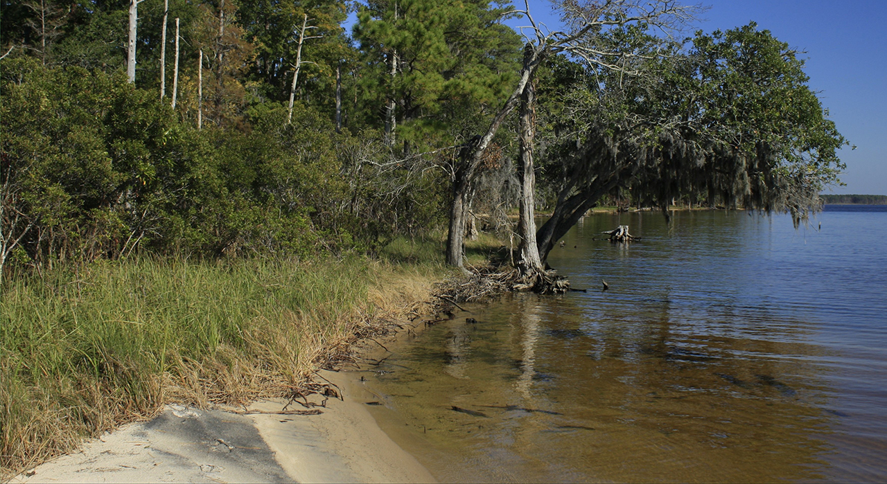
We begin in Beaufort County where the ragged shores of the Pamlico River at Goose Creek State Park are the order of the day: Above. And then we settle in for another walk along the waterfront of Washington, North Carolina: Below. photos by Stan Deatherage Click images to expand.

We leave Beaufort County for Craven County, and then Carteret County, where we visit these waterfront communities in images made by a sometimes certain camera of mine.
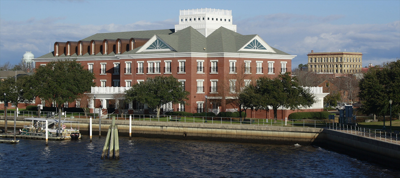
In Craven County, we visit the waterfront of New Bern, NC, where the hotels of the city meets the watercraft that are bountiful in number here on the Trent River: Above and below. photos by Stan Deatherage Click images to expand.
We leave Beaufort County for Craven County, and then Carteret County, where we visit these waterfront communities in images made by a sometimes certain camera of mine.
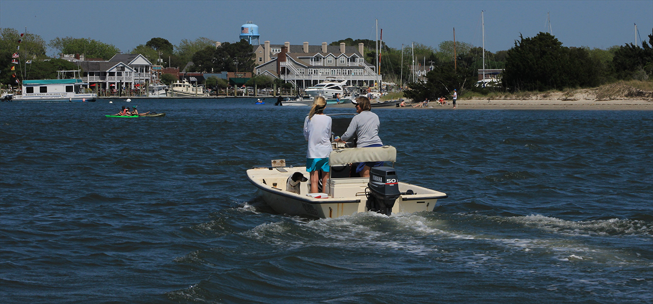
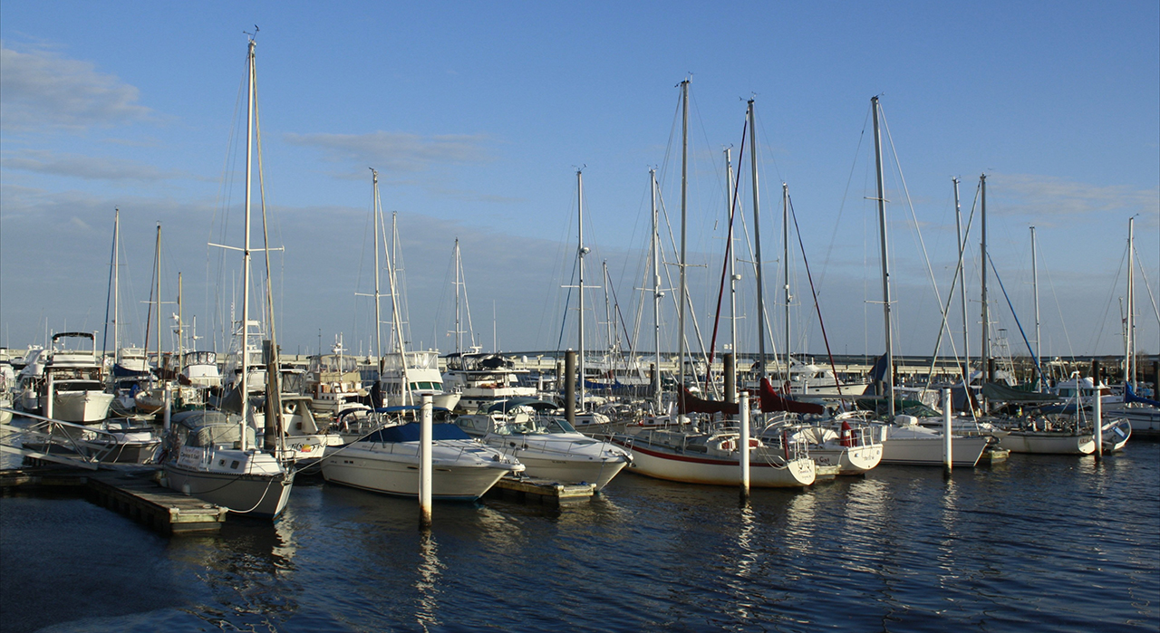
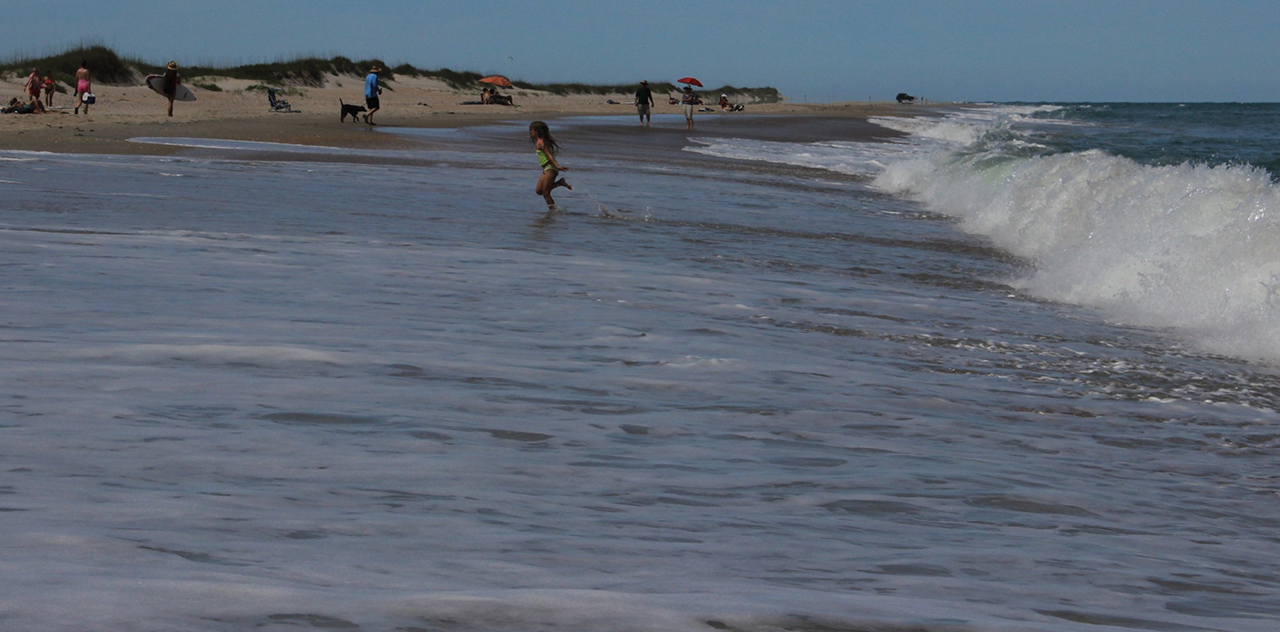
In Carteret County, we navigate to the waterfront of a bustling Beaufort, NC, where the watercraft are both large and small: Above. Just a few miles east a young child finds the waves crashing on Core Banks a might too rough: Below. photos by Stan Deatherage Click images to expand.
As we leave the warm summer waters of the southern tip of the central Outer Banks, we make our way to New Hanover County and the the seaport of Wilmington, North Carolina - the Old North State's largest and most important port.
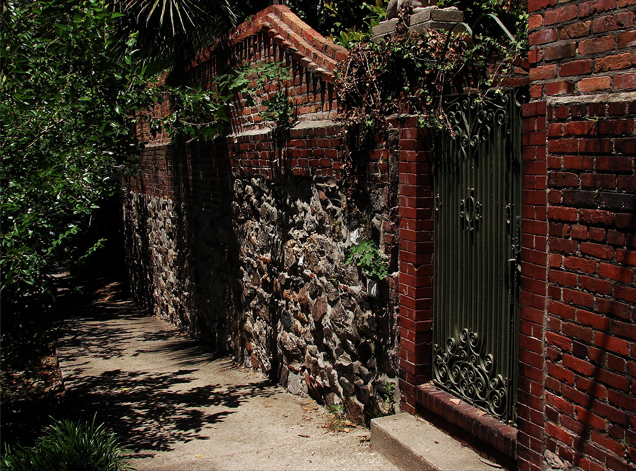
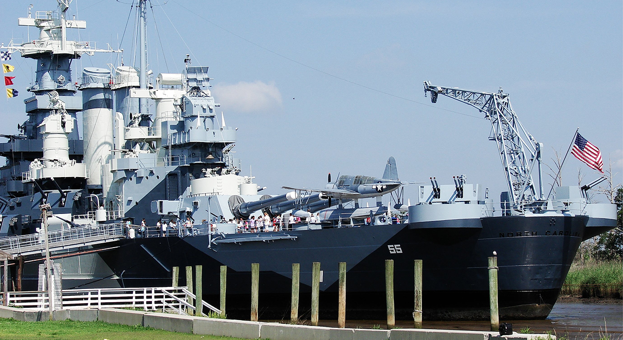
In Wilmington, along historic North 3rd Street, this old wall still stands like a symbolic bastion to the old Antebellum South, which is the best of Old Wilmington in this downtown area: Above. While in downtown Wilmington, along its historic waterfront, we need only face south to look across the Cape Fear River to view an equal part of America's history - the USS North Carolina, a.k.a. The Showboat: Below. photos by Stan Deatherage Click images to expand.
Leaving Wilmington proper, we head down the New Hanover peninsula, on its northern shore of the Cape Fear River to its culmination - Fort Fisher. Fort Fisher and this peninsula, the Cape Fear River and even Wilmington were embroiled here, in the winter of 1865, in one of the most fierce battles to gain control of the Cape Fear ports, predominately Wilmington.
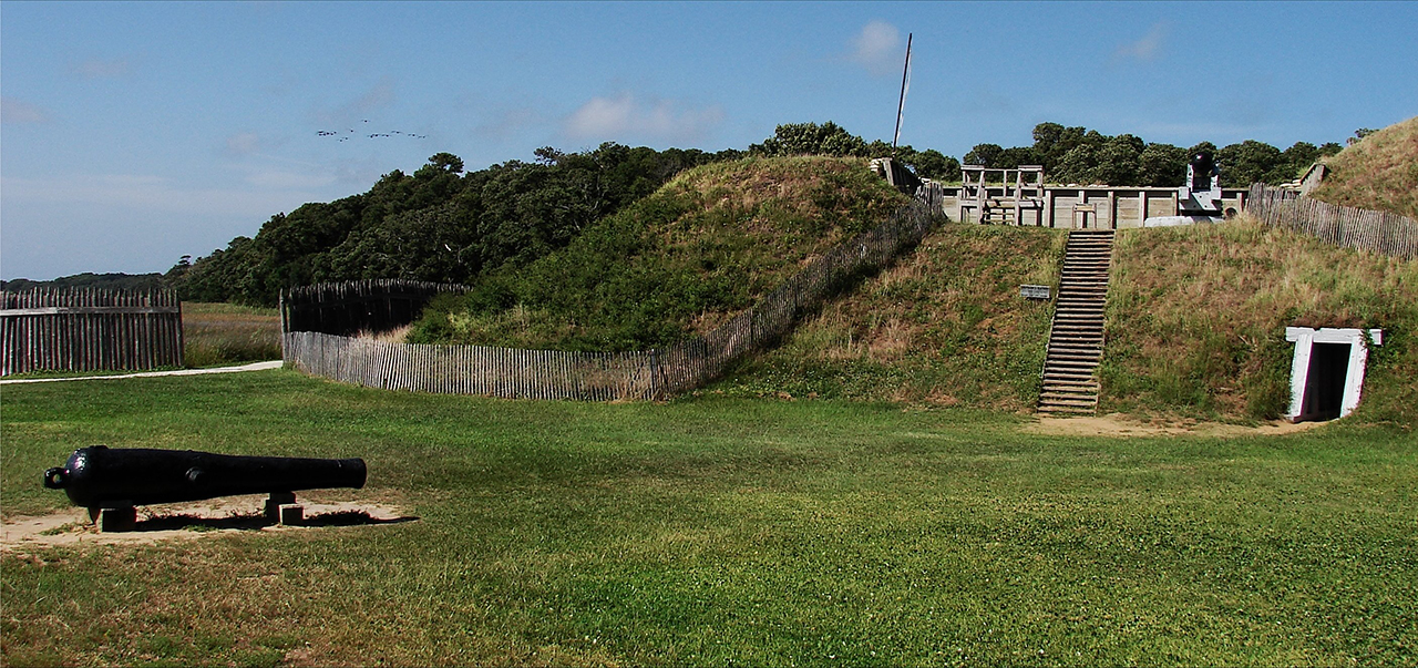
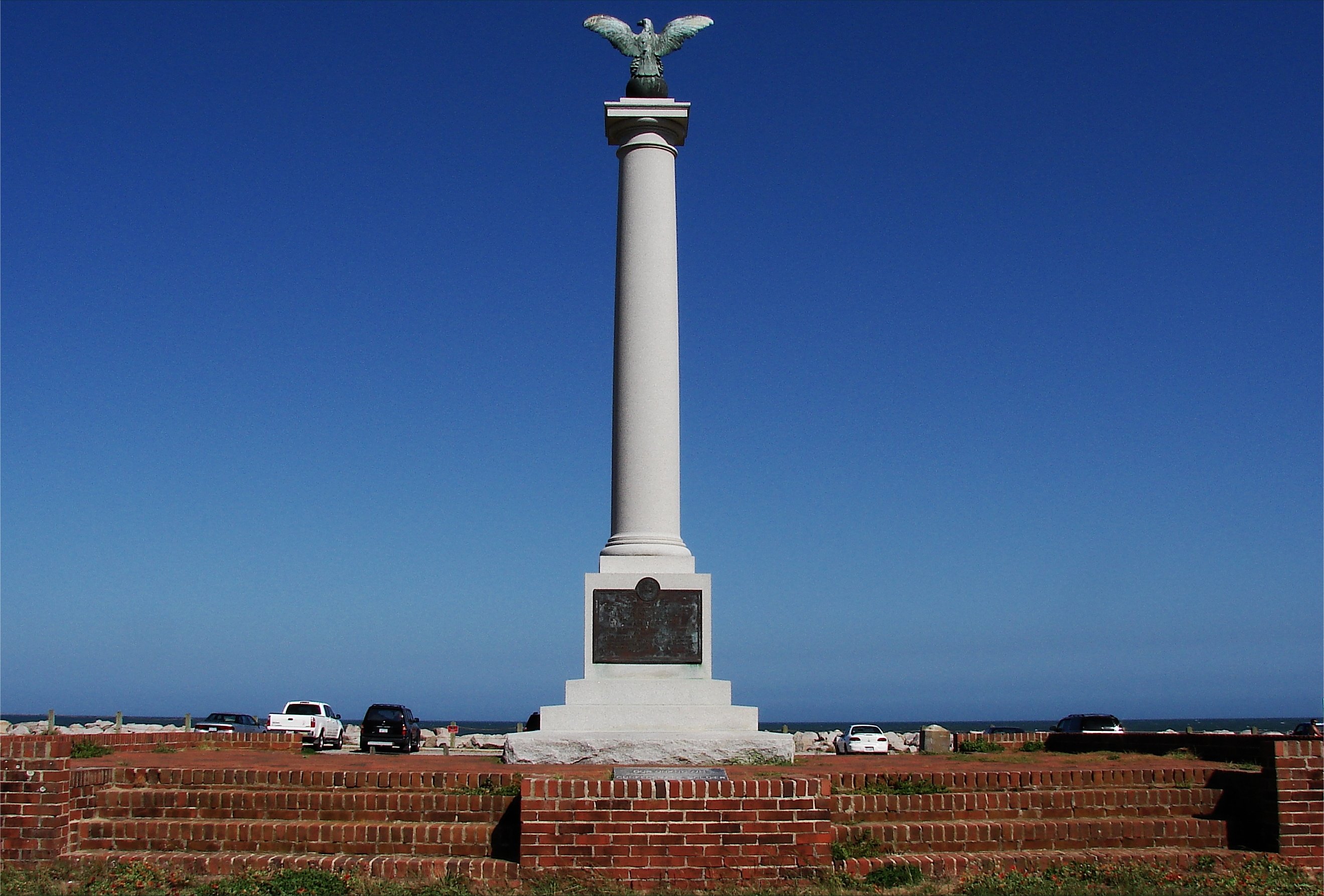
Historic Fort Fisher, where the earthen walls of its redoubts still stand to the wild weather of the Atlantic's assault, like it did during the Civil War, keeping the South's last remaining port viable as a beginning point of the supply chain feeding the Army of Northern Virginia: Above. The memorial for the those that fought this perilous battle for control of the Cape Fear stand here facing east along the last of this peninsula: Below. photos by Stan Deatherage Click images to expand.
And then back home ...
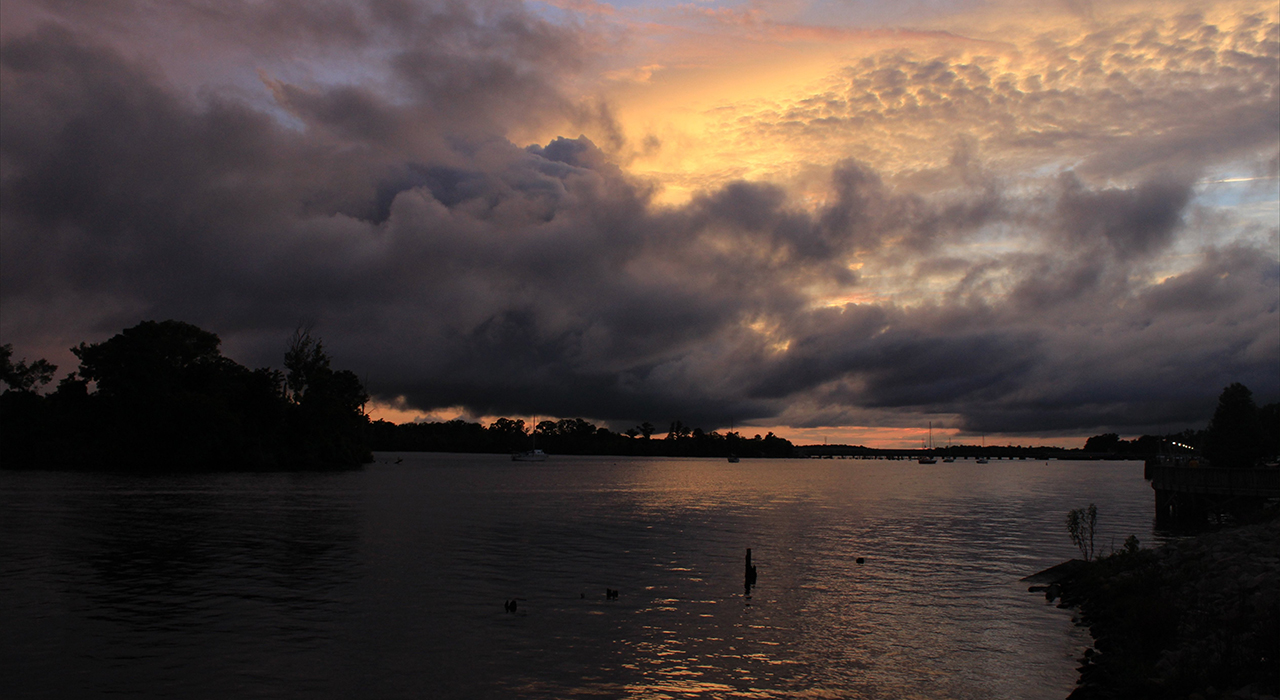
Back in Washington, NC, we watch the sunset on the Pamlico River: Above. photos by Stan Deatherage Click image to expand.
We'll do another one of these as the time becomes ready and appropriate. At your leisure, please follow this link to the growing list of this pictorial series - "Across North Carolina".
Below is our new interactive map that will show where all the pictures were made, and if you wish, you can get the distances and directions to these vistas. Also, you can interact with the map by placing your address in the "Enter an Address or Place & Click Find" field, and then click find to get best directions and mileage between your address and the chosen subject site. More features to follow.
Go Back
Why am I going back and installing these interactive maps? Simply, folks like to use them because our newer posts are getting more views faster than the older posts did. Providing yet another 'leading edge' product that works is a good enough reason for me.
This is the seventeenth of a new series of images from across North Carolina from my travels, and from the long intervals that I have spent with my camera making a record of where I have been. Upon examination of these random images, I concluded that best format would be the one page arrangement, where I cut the images to 1280 pixels wide, arrayed in a wide viewed 'fancybox' series, where there is a title of explanation, and maybe a bit more, but mainly, the photo should speak rather than my words. In fact, I plan to put my words on hold for a bit here, which will be to the fine relief of a great many.
Each series will be random and varied; however, most will center from here in eastern North Carolina, which is closer to my home in northeastern North Carolina, in the county of Beaufort, and the county seat of Washington, my home. From this perspective, we will reach out beyond the myriad waters: fresh and calm, brackish and moving, salty with powerful waves, and get to see North Carolina, where we may know it a little better, if only through images.
This random display of images of North Carolina, made by the Tar Heel traveler, may have been revealed earlier in BCN, and when I can remember a relative series, I shall link to it; however know that this series of ongoing themes will remain that there is no theme. In this random projection of unrelated images, the series will seek its relevance, its beauty and its strength of purpose.
The Seventeenth Pictorial Trek from Here to There and Back Again
We leave Beaufort County for Craven County, and then Carteret County, where we visit these waterfront communities in images made by a sometimes certain camera of mine.
We leave Beaufort County for Craven County, and then Carteret County, where we visit these waterfront communities in images made by a sometimes certain camera of mine.
As we leave the warm summer waters of the southern tip of the central Outer Banks, we make our way to New Hanover County and the the seaport of Wilmington, North Carolina - the Old North State's largest and most important port.
Interested in a very inexpensive vacation for yourself? Then click here.
Leaving Wilmington proper, we head down the New Hanover peninsula, on its northern shore of the Cape Fear River to its culmination - Fort Fisher. Fort Fisher and this peninsula, the Cape Fear River and even Wilmington were embroiled here, in the winter of 1865, in one of the most fierce battles to gain control of the Cape Fear ports, predominately Wilmington.
And then back home ...
We'll do another one of these as the time becomes ready and appropriate. At your leisure, please follow this link to the growing list of this pictorial series - "Across North Carolina".
Loading Google Map...Please Wait...
| Enter an Address or Place & Click Find | ||
Locations; Click to View

| Revisiting the site of the movie Deliverance | Across North Carolina, Body & Soul, Travel | Teachers who made a difference - Palmer Marsh Oysters and bomb shelter |


Home
Contact
About
Service Rates
Privacy Policy
Follow on Facebook
Subscribe to Newsletters
Rss Feed
Keywords
Eastern NC Now & ENC NOW © Copyright 1998-2024 All Rights Reserved.
