Press Release:
Good Morning Everyone,
This morning's update from the National Weather Service (NWS) included a slight increase in forecasted wind conditions as well as detailed flood inundation levels for Eastern NC. (Note: Beaufort County was not included in this morning's Coastal Flood Advisory). Detailed forecast changes for our area have been
underlined below.
Elevated Winds
- N & NE winds are forecasted to increase overnight, becoming sustained between 15 and 20 mph with gust of 20 to 25 by sunrise. These wind conditions are expected to continue through sunset Friday. However, while the winds will lay down overnight Friday, they will once again increase for a brief period between 11am and 5pm Saturday.
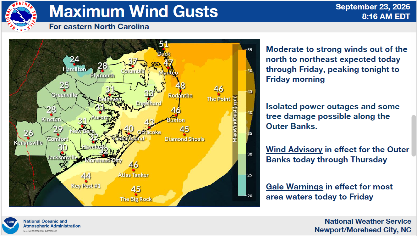
- We will likely experience our strongest wind gust between 11am and 6pm Thursday afternoon.
Wednesday & Thursday Hourly Wind Graphic
 Friday & Saturday Hourly Wind Graphic
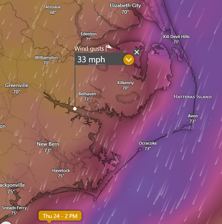
 Peak Wind Gust Graphic - 2pm Thursday
Coastal Flooding
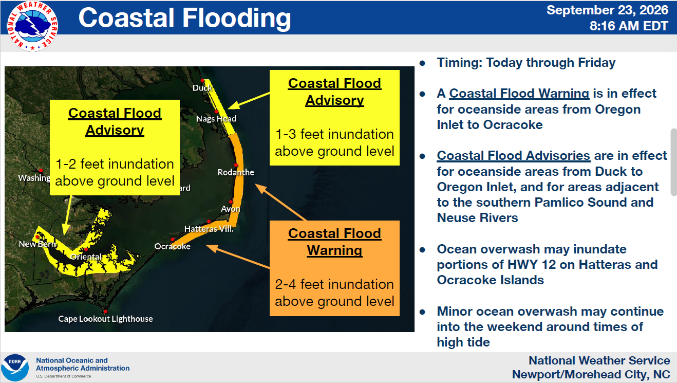
- The long duration of elevated N & NE winds will likely cause minor flooding along areas that are vulnerable to N and NE wind directions. (Especially for the southern shorelines / waterways of Chocowinity Bay, Blounts Creek, Aurora / South Creek, etc.)
NWS Coastal Flooding Graphic
Rain
- This will primarily be a long duration wind event for our area, with most of this system's moisture remaining offshore. However, we will likely experience brief periods of scattered light rain today and tomorrow.
Wednesday & Thursday Hourly Rainfall Graphic

Please see the email below and attached briefing from the National Weather Service for more information.
We will continue to monitor this system and provide updates as forecast details change.
As always, thank you all for what you do to keep our county informed, prepared, and safe!
Chris Newkirk
Director
Beaufort County Emergency Services
121 W 3rd St.
Washington, NC 27889
Office: (252)946-0079
Cell: (252) 378-5352
Good Morning,
Attached is an updated full-briefing for a coastal low that will impact ENC and the nearby marine areas through the end of the week. We are planning to send updated briefings each morning by 10:00 am.
What has changed:
- Forecast remains consistent
- Confidence is high for coastal and marine impacts
- The wind forecast has slightly increased, wave forecast remains similar.
The next briefing will be sent by 10:00 am Thursday, September 24, 2026
If you have any questions or need anything else, please let us know!
NWS_Morehead_City_Briefing_5_Coastal_Low_September_23_26_2026.pdf
Regards,
NWS Newport/Morehead City
NOAA - National Weather Service
Newport/Morehead City, NC Weather Forecast Office
533 Roberts Rd
Newport, NC 28570