Across North Carolina: Volume XIX | Eastern NC Now
This is the nineteenth of a less new series of images from across North Carolina from my travels, and from the long intervals that I have spent with my camera making a record of where I have been.
Where do you stand on the Transgender Issue now that the issue has gotten to the overt point of the open celebration of this lifestyle choice, dictated by certain direct and explicit actions.
91.07% I do not approve of behavior that has within its expressed tenants policies that harm children.
8.04% I do support the Trans Community in all its many facets because diversity is at a premium in today's society.
0.89% What is a "Children's Drag Queen Story Hour?"
Publisher's note: Please be aware that we have created a new fixture at the foot of this post, describing the location of some of North Carolina's most memorable scenic points of interest, is our interactive map that we developed to do exactly what we want it to do ... for now.
Why am I going back and installing these interactive maps? Simply, folks like to use them because our newer posts are getting more views faster than the older posts did. Providing yet another 'leading edge' product that works is a good enough reason for me.
This is the nineteenth of a new series of images from across North Carolina from my travels, and from the long intervals that I have spent with my camera making a record of where I have been. Upon examination of these random images, I concluded that best format would be the one page arrangement, where I cut the images to 1280 pixels wide, arrayed in a wide viewed 'fancybox' series, where there is a title of explanation, and maybe a bit more, but mainly, the photo should speak rather than my words. In fact, I plan to put my words on hold for a bit here, which will be to the fine relief of a great many.
Each series will be random and varied; however, most will center from here in eastern North Carolina, which is closer to my home in northeastern North Carolina, in the county of Beaufort, and the county seat of Washington, my home. From this perspective, we will reach out beyond the myriad waters: fresh and calm, brackish and moving, salty with powerful waves, and get to see North Carolina, where we may know it a little better, if only through images.
This random display of images of North Carolina, made by the Tar Heel traveler, may have been revealed earlier in BCN, and when I can remember a relative series, I shall link to it; however know that this series of ongoing themes will remain that there is no theme. In this random projection of unrelated images, the series will seek its relevance, its beauty and its strength of purpose.
The Nineteenth Pictorial Trek from Here to There and Back Again
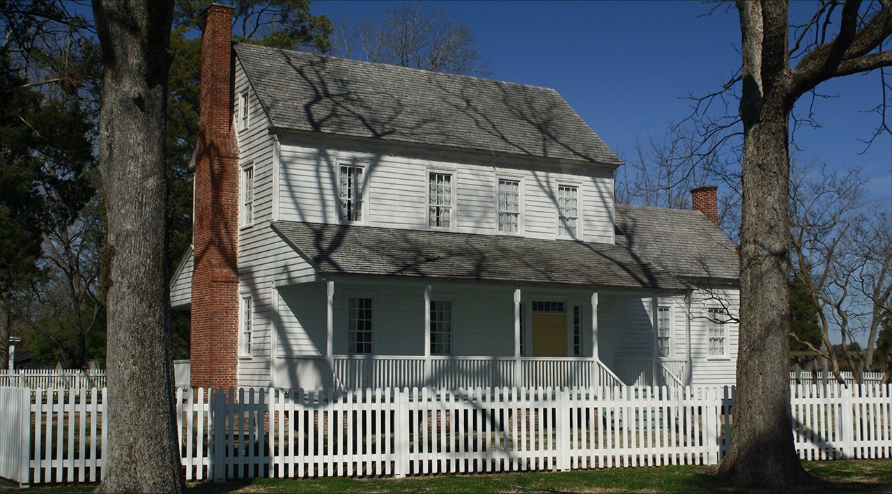
As per usual, we begin in Beaufort County in Bath, North Carolina, the oldest town in the state.
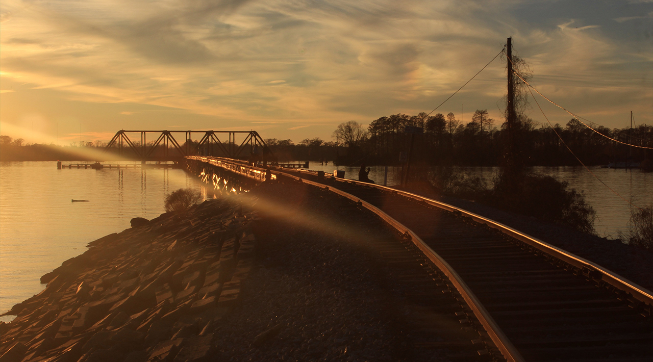
The southern front of the Bonner House, which possesses probably the most prime waterfront view in eastern North Carolina - looking south down historic Bath Creek: Above. The last rays of a winter sun keeping a faint light on the Trestle crossing the Pamlico River, here in Washington, NC: Below.photos by Stan DeatherageClick images to expand.
Leaving Beaufort County and heading north and east to North Carolina's northern Outer Banks, we stop by Washington County, specifically the northern lake Phelps area for a respite.
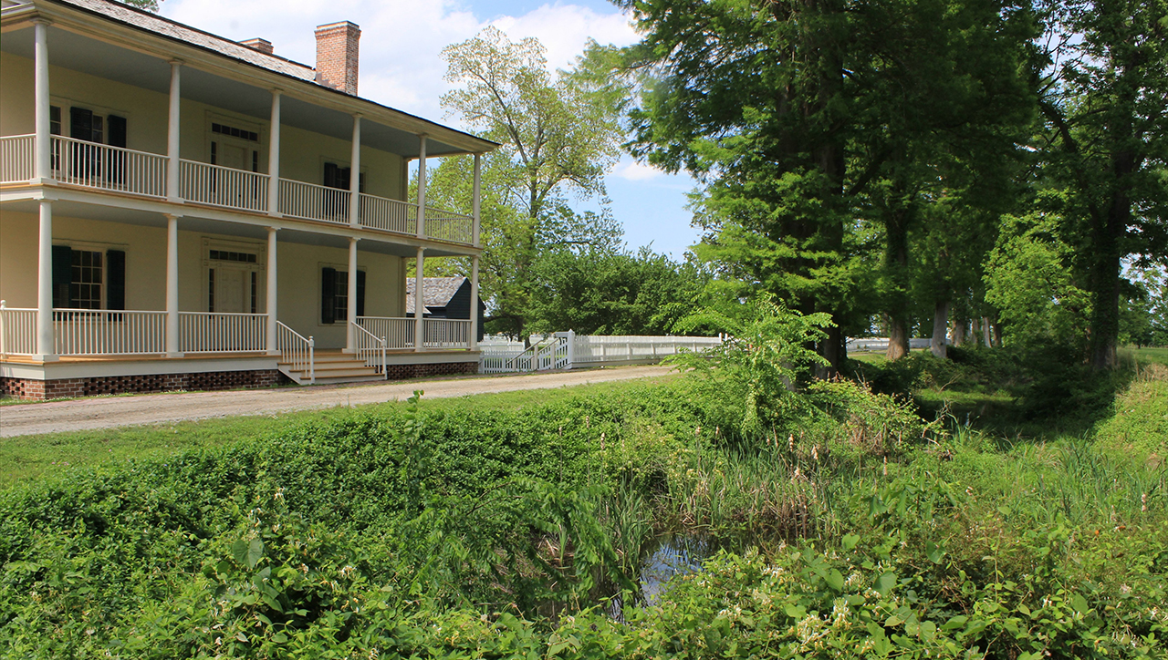
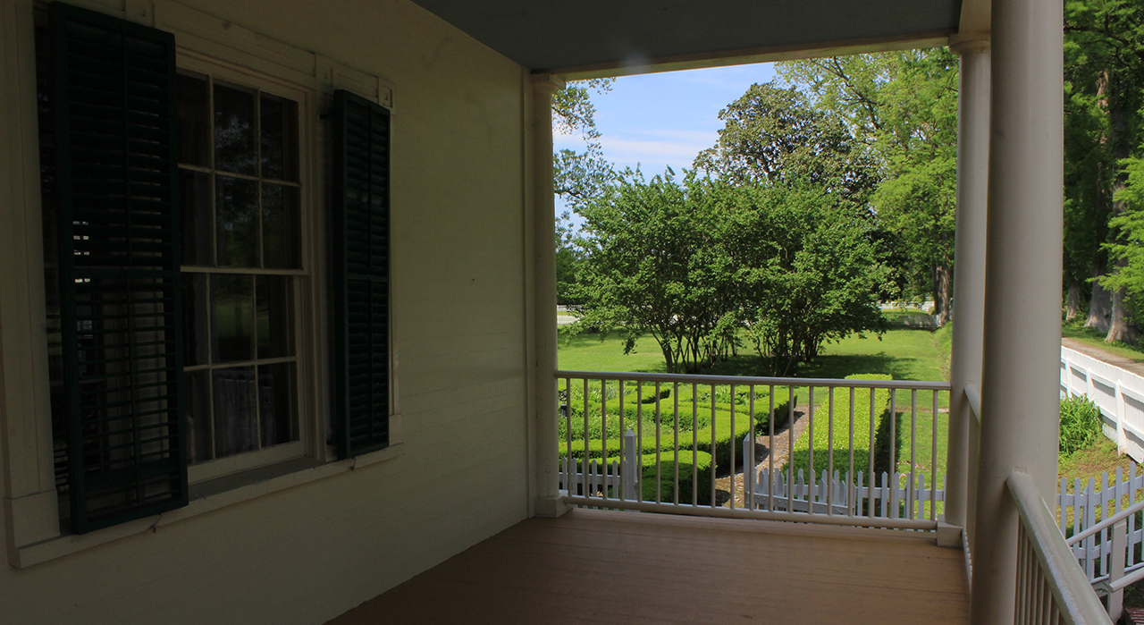
Here at Somerset Plantation, in the southeastern corner of Washington County, we get a glimpse of the eastern front of the Somerset manor house; standing firm on the west bank of the beginning of the remnants of a canal that was dug out by slaves in the 18th century, which did connect with the Scuppernong River, and then the rest of the World by water: Above. From the porch as seen from the previous picture, facing east, one can look in the same direction that freight was sent on barges and other boats toward the Scuppernong River: Below.photos by Stan DeatherageClick images to expand.
As we move east to Roanoke Island, and then Nags Head, there is more to see on this sojourn.
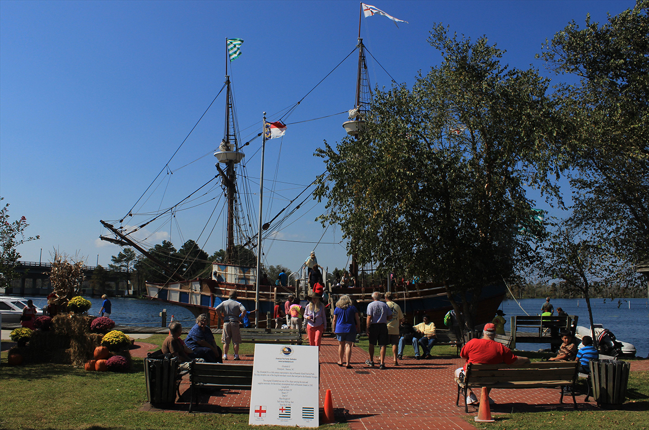
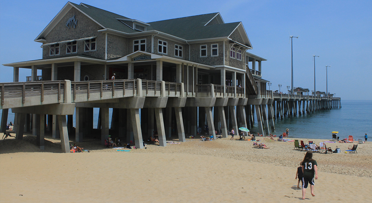
Docked along the waterfront of the Scuppernong River, in Columbia, North Carolina in Tyrell County, the Elizabeth II proves that stores from the Somerset Plantation, just a few miles away by that hand-dug canal, did connect that plantation with the World: Above. One county over in Dare County, we make our way to Jennette's Pier in Nags Head on a warm Spring afternoon: Below.photos by Stan DeatherageClick images to expand.
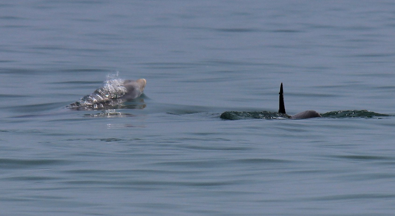
We stay here on this long ribbon of sand that runs from the Virgina border more than 60 miles south to the Oregon inlet connecting the Atlantic Ocean with the Pamlico Sound.
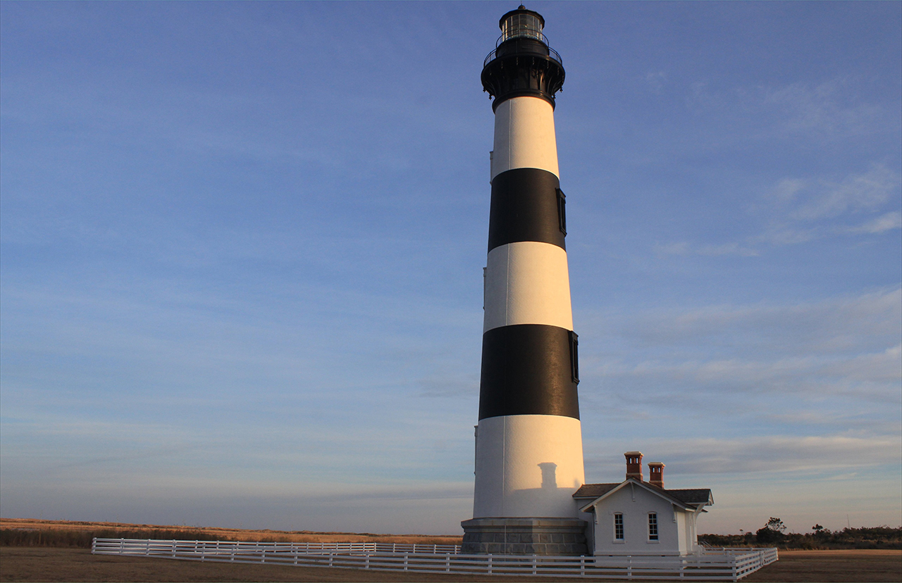
Not far off shore, actually within telephoto distance, playful dolphins frolic and feed when the smaller fishes come closer to shore: Above. Within sight distance of the Oregon Inlet is the Bodie Island Light Station standing tall in the afternoon glow of the lowered sun: Below.photos by Stan DeatherageClick images to expand.
Steaming west to higher ground, we make our way to the capital of North Carolina.
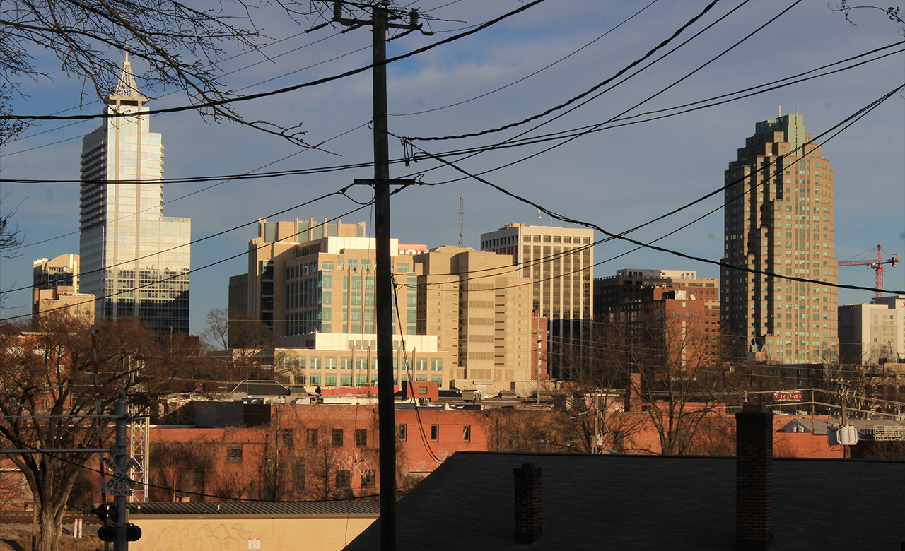
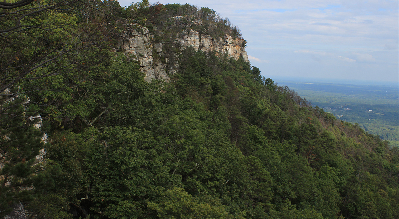
Here, we examine the backside (western front) of the growing Raleigh skyline, from above the rooftops of Boylan Heights: Above. It was a short stop in Raleigh and then on to "Mount Pilot", I mean Pilot Mountain State Park, where here we have a view of the promontory, the knob: Below.photos by Stan DeatherageClick images to expand.
Once we leave the expansive state park of North Carolina's most eastern mountains, in the diminutive Sauratown Mountain chain (mostly in Surry County), we head west and south to Watauga County, just west of the Blue Ridge.
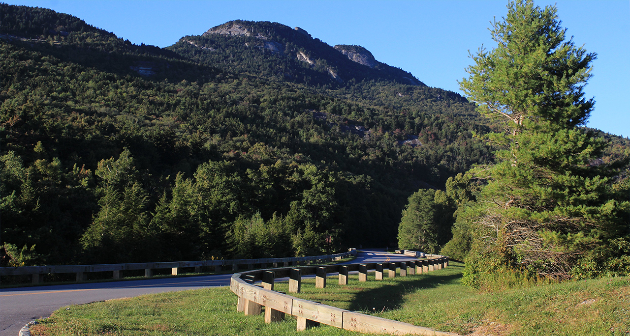
Here at the manor house of the Moses Cone Memorial park, we see the see shining bright light upon its white boards: Above. Another rocky outcrop, other than Pilot Mountain's knob, is the southeast face of Grandfather Mountain as seen from the Blue Ridge Parkway. This peak is 3,500 feet higher above sea level than the apex of the knob of Pilot Mountain: Below.photos by Stan DeatherageClick images to expand.
And then back home ...
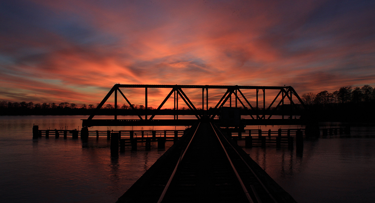
Back in Washington, NC, we watch the sunset over the Pamlico River from the trestle fording that river at Washington: Above. photos by Stan DeatherageClick image to expand.
We'll do another one of these as the time becomes ready and appropriate. At your leisure, please follow this link to the growing list of this pictorial series - "Across North Carolina".
Below is our new interactive map that will show where all the pictures were made, and if you wish, you can get the distances and directions to these vistas. Also, you can interact with the map by placing your address in the "Enter an Address or Place & Click Find" field, and then click find to get best directions and mileage between your address and the chosen subject site. More features to follow.