This is the tenth of a new series of images from across North Carolina from my travels, and from the long intervals that I have spent with my camera making a record of where I have been.
Where do you stand on the Transgender Issue now that the issue has gotten to the overt point of the open celebration of this lifestyle choice, dictated by certain direct and explicit actions.
91.07% I do not approve of behavior that has within its expressed tenants policies that harm children.
8.04% I do support the Trans Community in all its many facets because diversity is at a premium in today's society.
0.89% What is a "Children's Drag Queen Story Hour?"
Publisher's note: Please be aware that we have created a new fixture at the foot of this post, describing the location of some of North Carolina's most memorable scenic points of interest, is our interactive map that we developed to do exactly what we want it to do ... for now.
Why am I going back and installing these interactive maps? Simply, folks like to use them because our newer posts are getting more views faster than the older posts did. Providing yet another 'leading edge' product that works is a good enough reason for me.
This is the tenth of a new series of images from across North Carolina from my travels, and from the long intervals that I have spent with my camera making a record of where I have been. Upon examination of these random images, I concluded that best format would be the one page arrangement, where I cut the images to 1280 pixels wide, arrayed in a wide viewed 'fancybox' series, where there is a title of explanation, and maybe a bit more, but mainly, the photo should speak rather than my words. In fact, I plan to put my words on hold for a bit here, which will be to the fine relief of a great many.
Each series will be random and varied; however, most will center from here in eastern North Carolina, which is closer to my home in northeastern North Carolina, in the county of Beaufort, and the county seat of Washington, my home. From this perspective, we will reach out beyond the myriad waters: fresh and calm, brackish and moving, salty with powerful waves, and get to see North Carolina, where we may know it a little better, if only through images.
This random display of images of North Carolina, made by the Tar Heel traveler, may have been revealed earlier in BCN, and when I can remember a relative series, I shall link to it; however know that this series of ongoing themes will remain that there is no theme. In this random projection of unrelated images, the series will seek its relevance, its beauty and its strength of purpose.
The Tenth Pictorial Trek from Here to There and Back Again
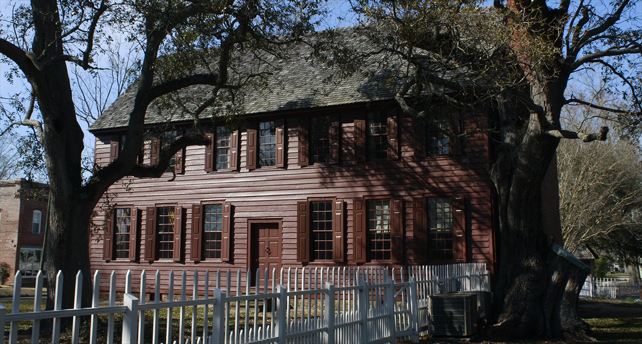
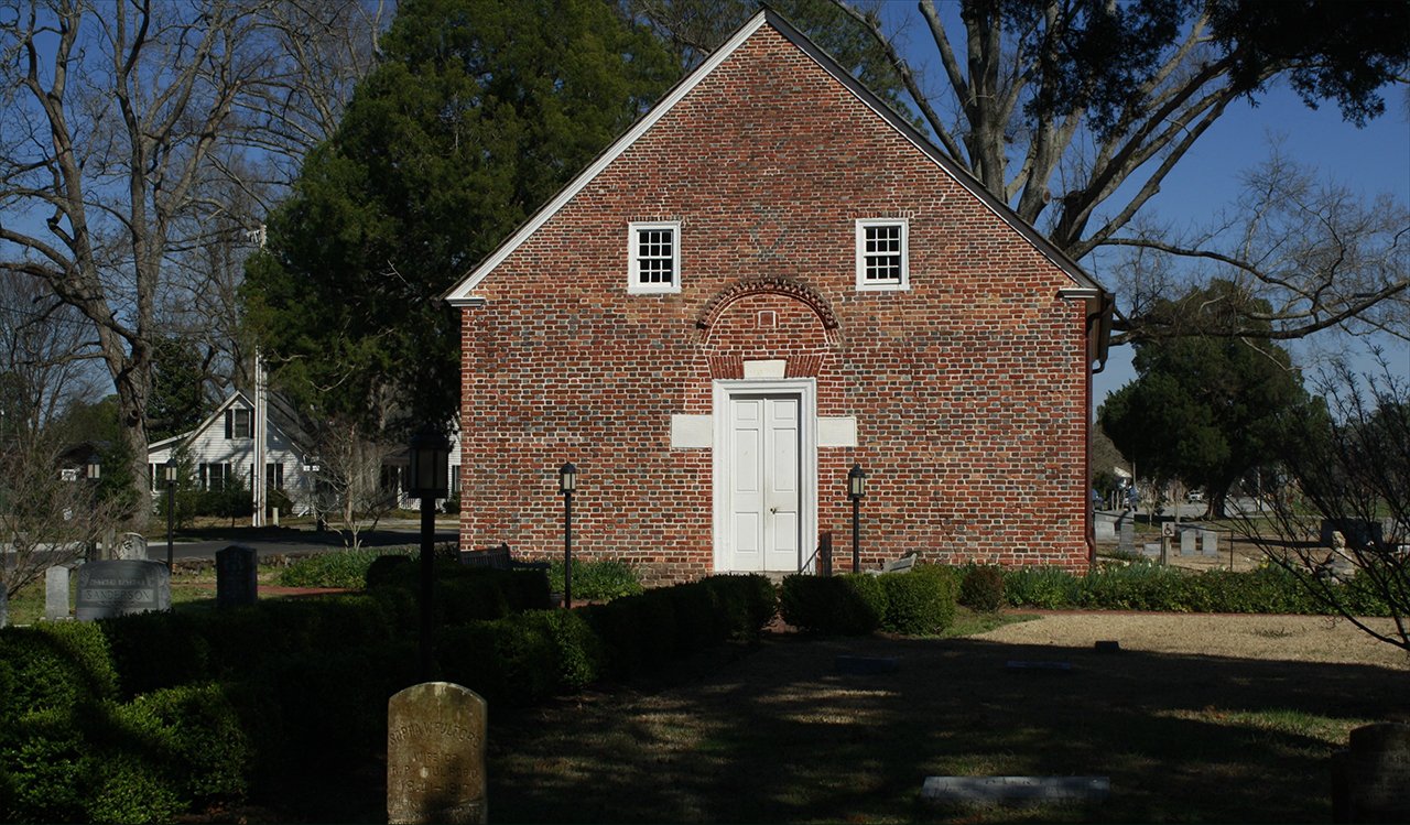
We begin in Beaufort County, the town of Bath, North Carolina, and we view the Palmer-Marsh house, which was built in the early / mid 18th century: Above. St. Thomas Episcopal Church in bath is the oldest church in North Carolina: Below.photos by Stan DeatherageClick images to expand.
In this edition of "Across North Carolina", we will not trek across the state of North Carolina from east to west and back again, but we will stay in eastern North Carolina from north to south, and back again here in Beaufort County.
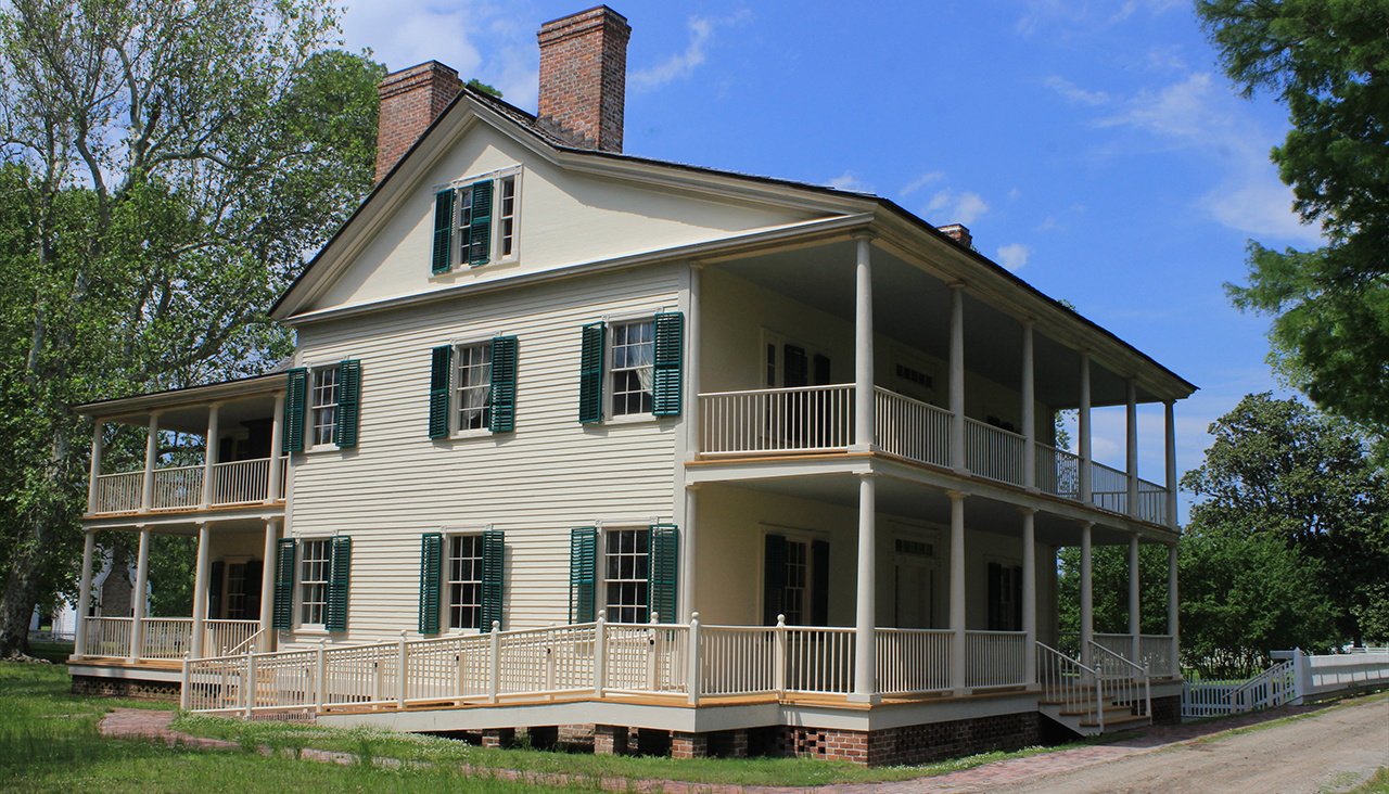
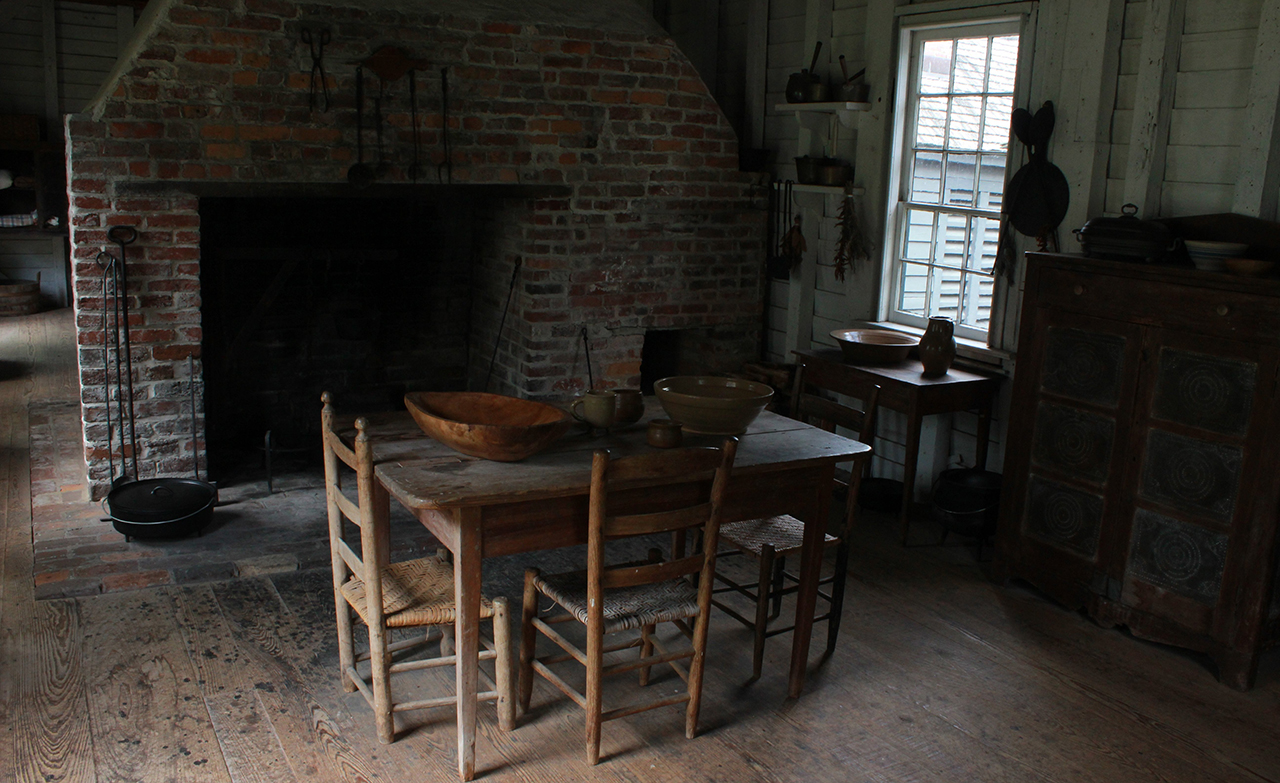
This view of Somerset Plantation House is from the canal area that was dug by slaves more than 200 years ago that at some point intersected with the Scuppernong River, which empties into the Albemarle Sound: Above. This interior of the detached kitchen is preserved to show how large meals were prepaed for the family and their guests at the plantation House: Below.photos by Stan DeatherageClick images to expand.
Eastern North Carolina, from north to south, here Downeast, is a most unique stretch of ground where real people live, and have lived, and now we move to the Outer Banks, where some of the most unique folks in North Carolina still inhabit.
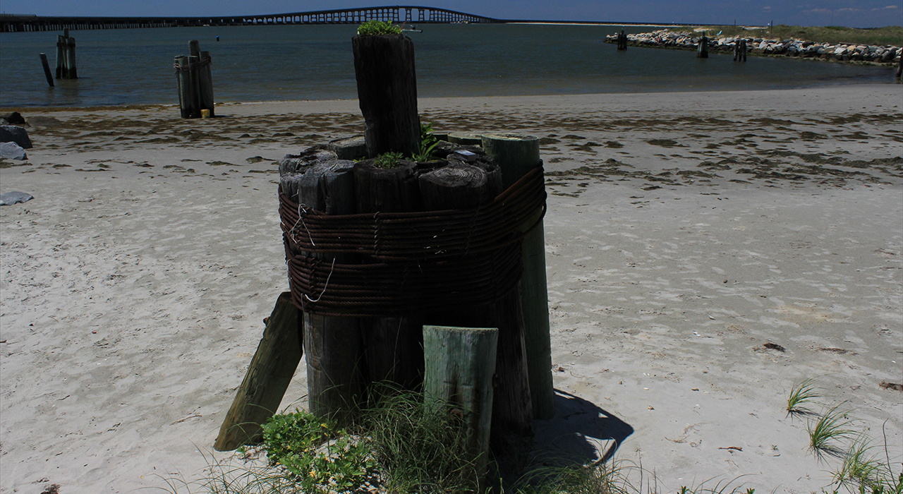
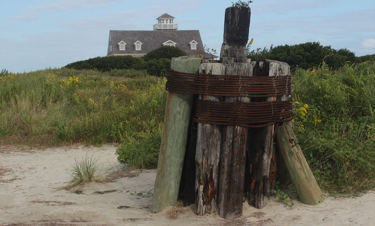
The Oregon Inlet, here forded by the expansive Herbert C. Bonner Bridge, here in the background, is the first inlet south from the Virginia line, to separate the long strip of land known as the Outer Banks: Above. Here at low tide, one can fully observe the mooring posts that populate the southern shores of the Oregon Inlet, and in the background, the roof of the Oregon Inlet Life-Saving Station: Below. photos by Stan DeatherageClick images to expand.
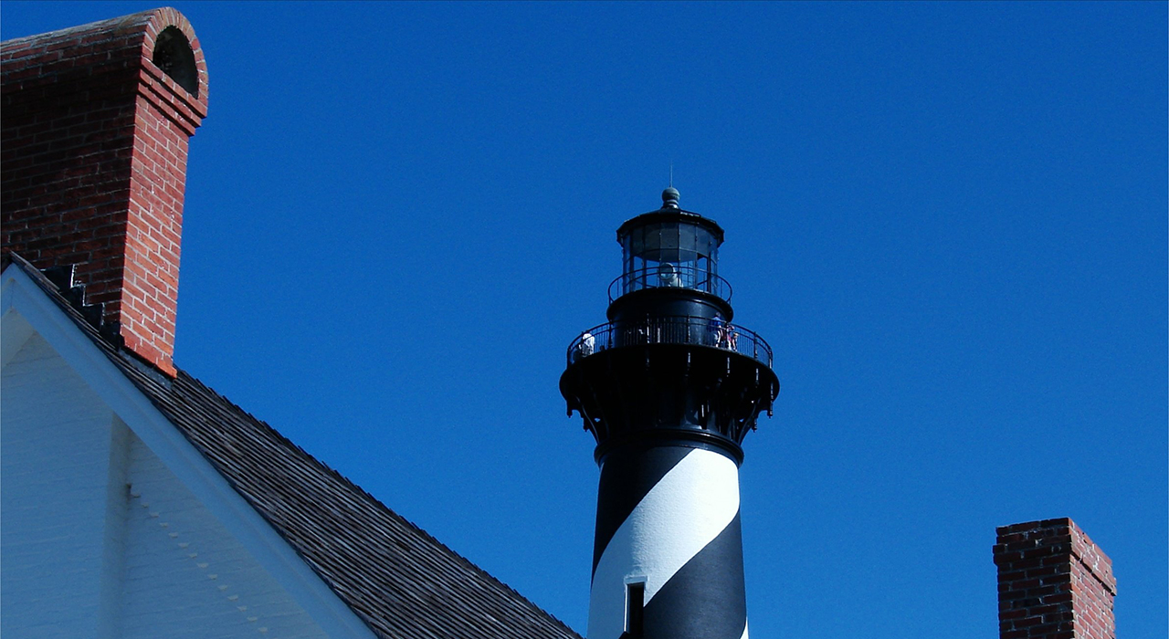
From Oregon Inlet, we head due south along the storied U.S. Hwy. 12 to the Cape Hatteras Light Station, which is within the expansive Cape Hatteras National Seashore, where we make a firm observation as to just how tenuous sustainability exists for humans at this most eastern point of North Carolina.
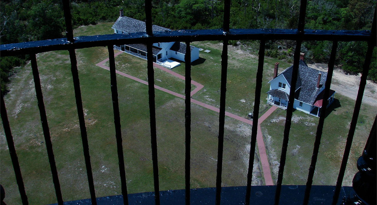
The apex of the Cape Hatteras Lighthouse, here viewed above the roof of the Light Station quarters: Above. Here we view the topside of the Light Station buildings from the top of tallest Lighthouse in the United States: Below.photos by Stan DeatherageClick images to expand.
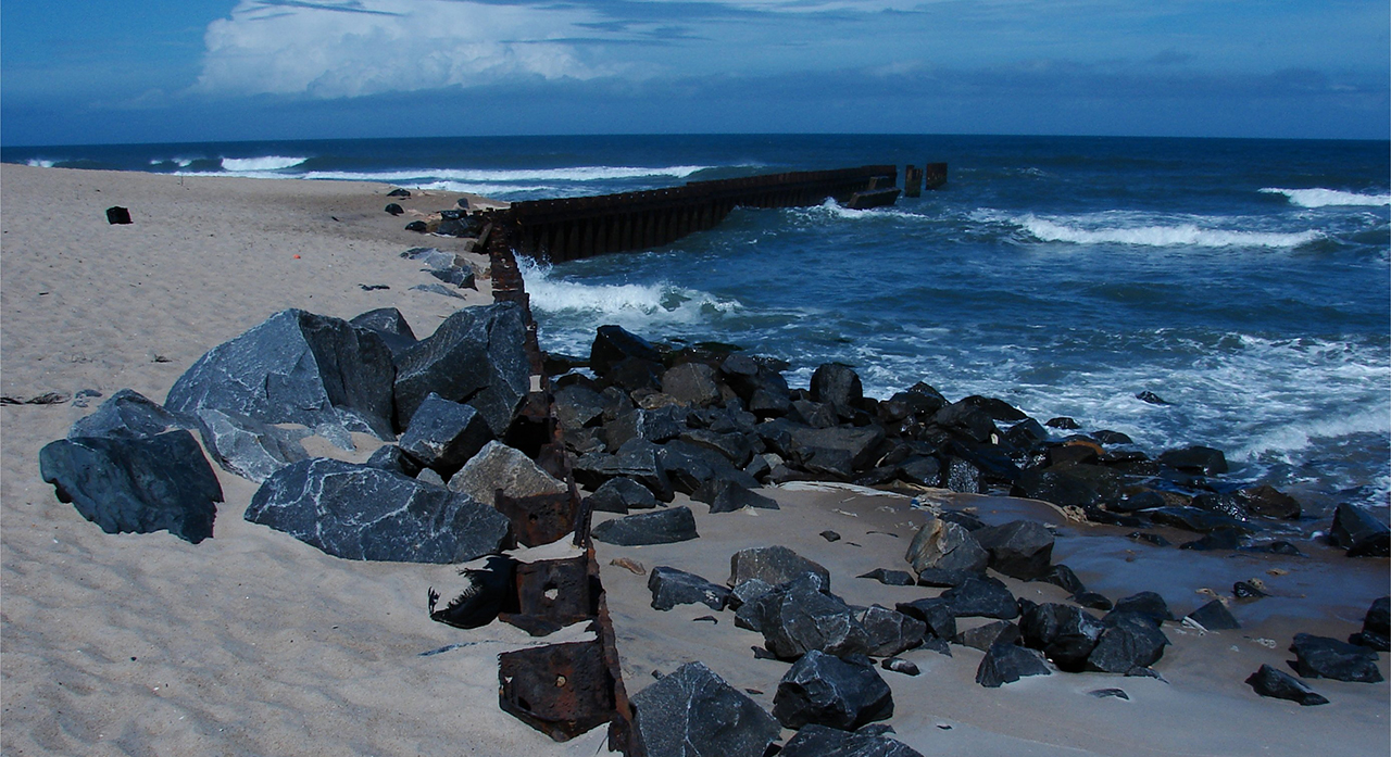
Cape Hatteras is a precarious point in North Carolina, where storms as regular as a nor'easter can create a severe loss of shoreline, hence rip-rap and jetties are a big part of sustaining the shoreline on, and along the Cape.
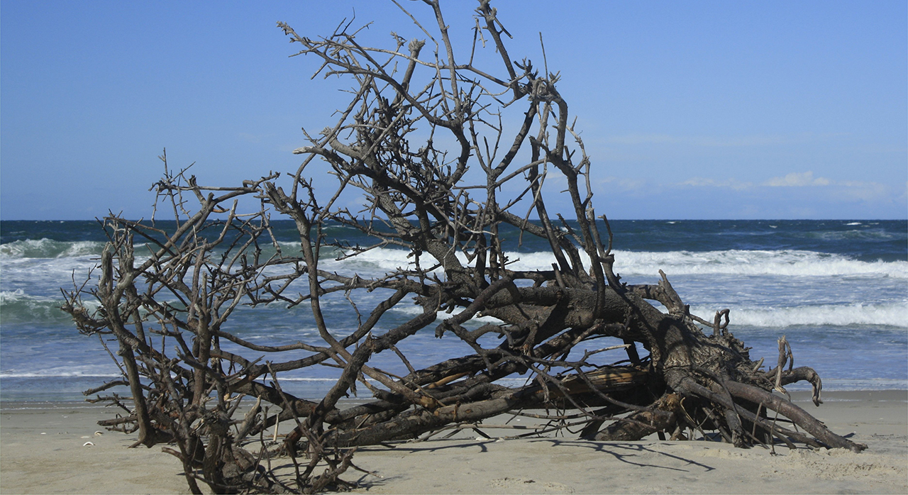
The aforementioned rip-rap and jetty: Above. Along the wide undeveloped, and very natural beaches of The National Seashore in North Carolina's Outer Banks about anything can, and will turn up, washed ashore: Below. photos by Stan DeatherageClick images to expand.
Further south along North Carolina's national treasure of profound proportions, the Cape Lookout National Seashore, is one of the most beautiful locations in the eastern United States.
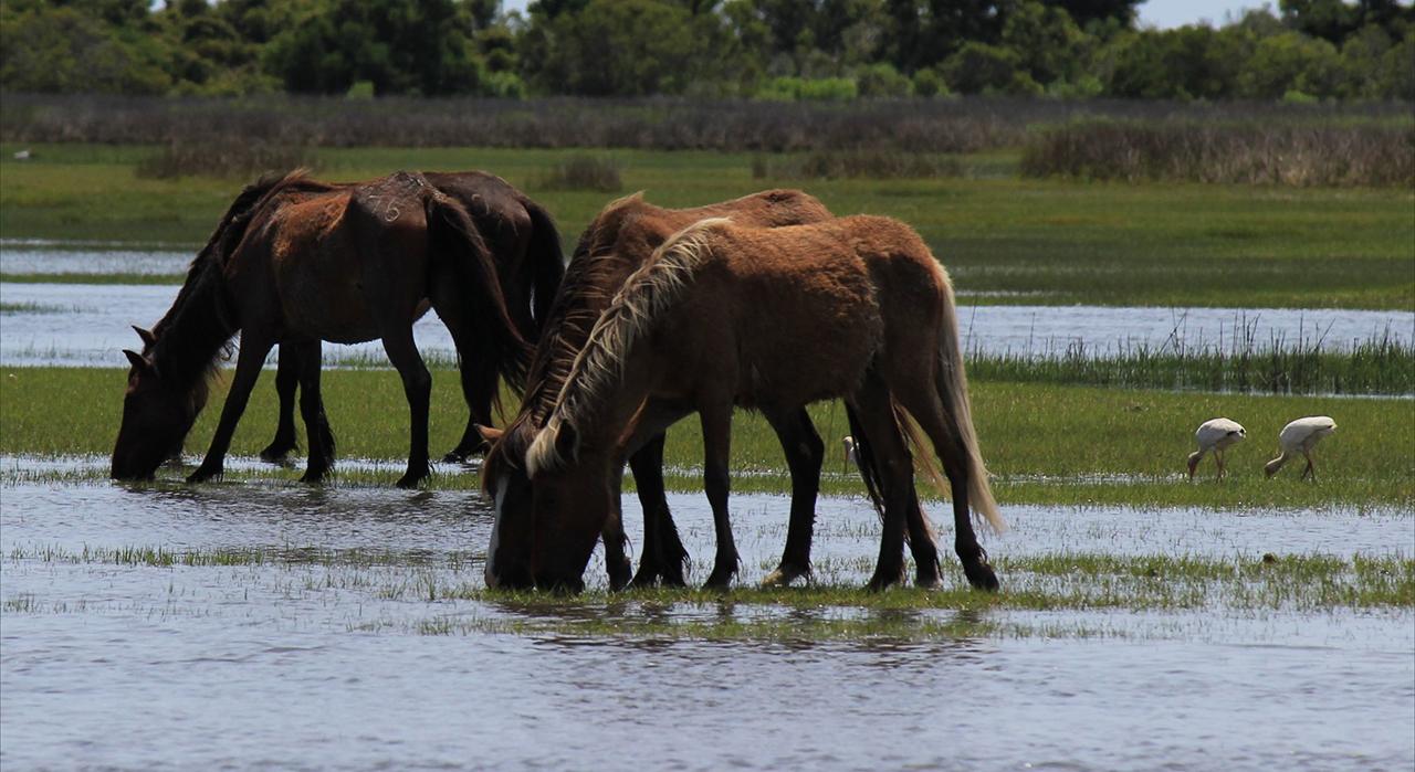
Along the wide beach of Cape Lookout National Seashore, we see the tire tracks of the local vehicles that are secluded on this long island with no roads and no bridges leading off its shores. In the background is the Cape Lookout Light Station: Above. The wild horses of Shackleford Banks are a rare attraction along the way upon the waters of Back Sound to Core Banks, where Cape Lookout makes its unique geographic statement: Below.photos by Stan DeatherageClick images to expand.
And then back home ...
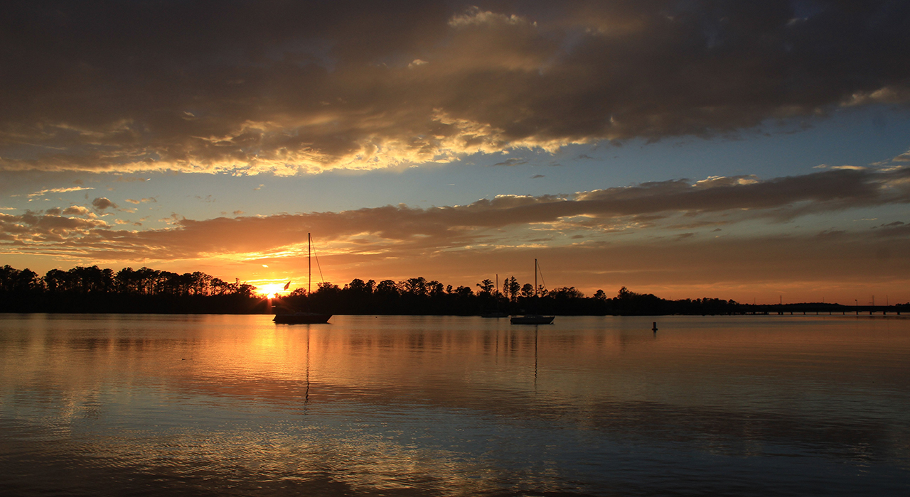
Where I always finish with a sunset image over the Pamlico River in Washington, NC: Above. photo by Stan DeatherageClick image to expand.
We'll do another one of these as the time becomes ready and appropriate. At your leisure, please follow this link to the growing list of this pictorial series - "Across North Carolina".
Below is our new interactive map that will show where all the pictures were made, and if you wish, you can get the distances and directions to these vistas. Also, you can interact with the map by placing your address in the "Enter an Address or Place & Click Find" field, and then click find to get best directions and mileage between your address and the chosen subject site. More features to follow.