As it grows colder, and as we step gingerly into winter, I recall one of the hottest days of the summer, when I explored the counties of Pender, New Hanover, and Brunswick. I traveled through this sector of the Old North State on my way to Myrtle Beach in the late July, 2010.
Traveling south on this very hot day, with the thermostat approaching 102 degrees, I took some time to inspect the grounds of Poplar Grove, just inside the the most southeastern boundary of Pender County. Poplar Grove, is an antebellum home built in 1850, which is reminiscent of the Georgian architecture of that period. Poplar Grove is near Scotts Hill on Hwy 17 South.
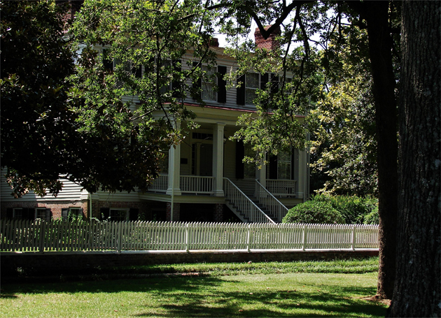
The front of the Poplar Grove main house, with it sweeping front porch, from the grounds: Above. And the rear with its two porches, and multiple access points from the south lawn: Below.


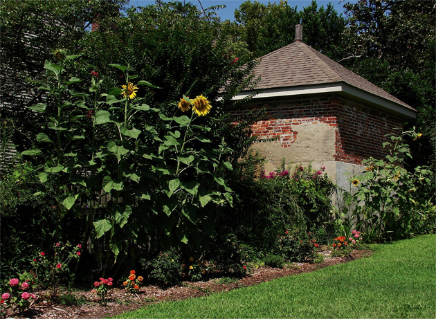
The north entry point with it s semi-covered walk-way: Above. And behind the main house the masonry structure, which was surely a kitchen in its day, surrounded by a plethora of sunflowers: Below.
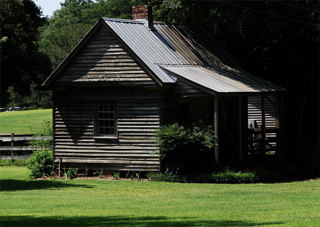
The probable slaves' quarters on the east grounds of Polar Grove is still in period condition: Above. Just east of Poplar Grove in the Scotts Hill community is the waterfront, with its many public access points, leading out to Rich Inlet. Here across the estuary enveloping Butlers Creek is the oceanside development of Figure Eight Island in northeastern New Hanover County: Below.


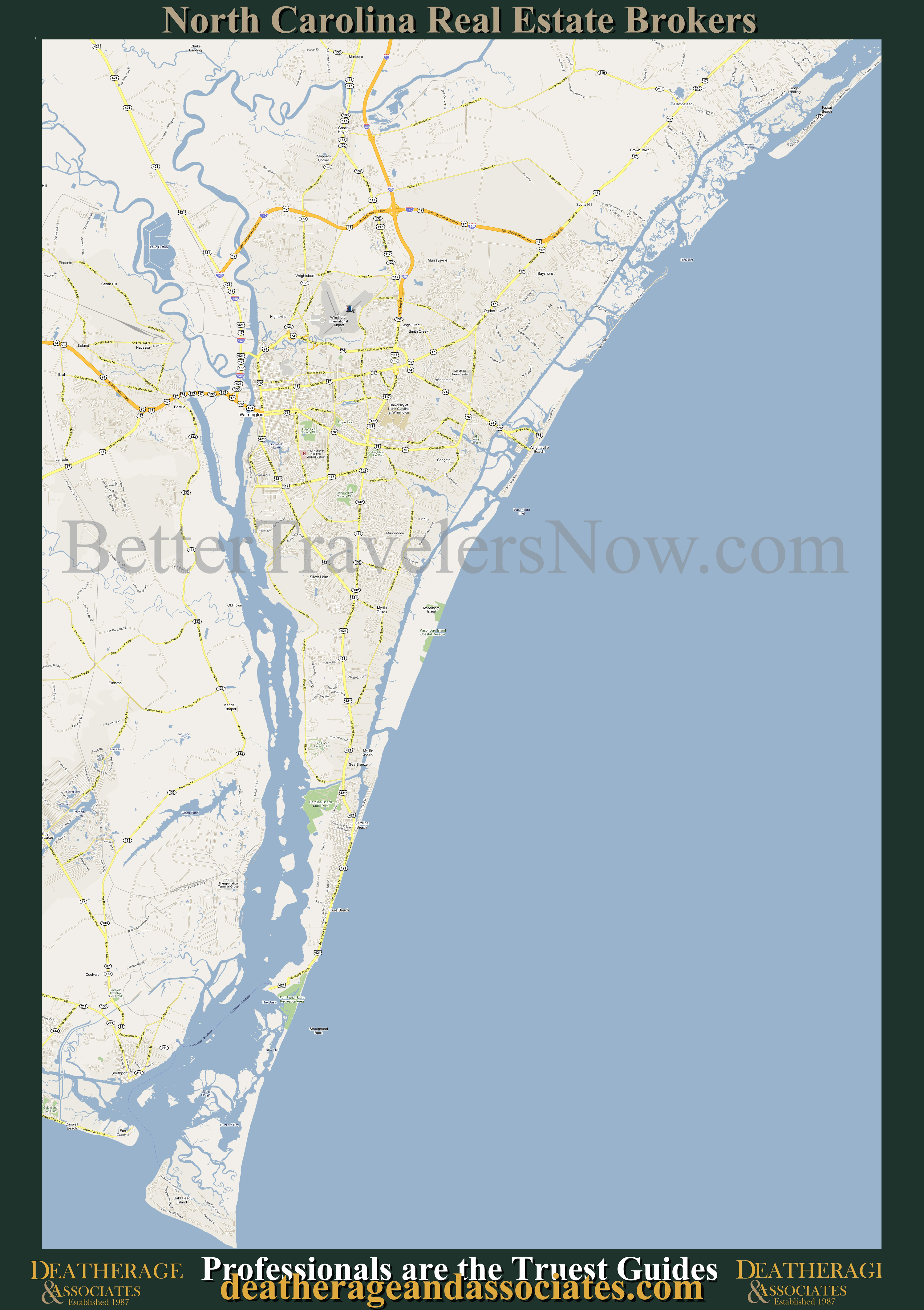
Location map of Wilmington signals that we are moving into this old Southern city and we want you to get a good look on how to find your way around the jewel upon the Cape Fear.
Click here for a larger look at a bigger map of the area.
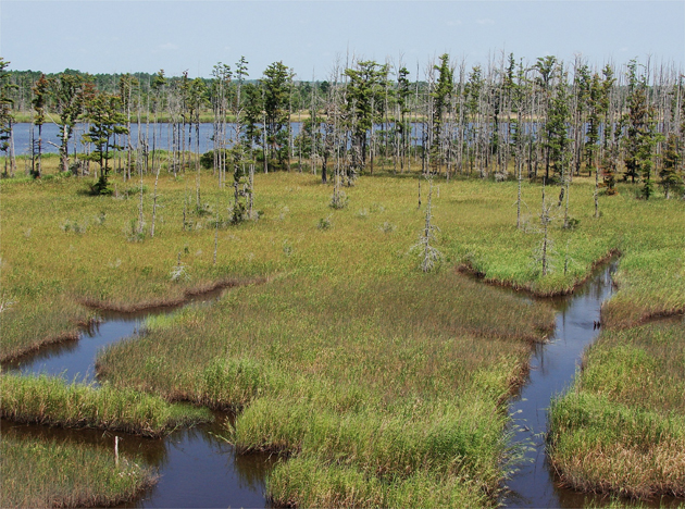
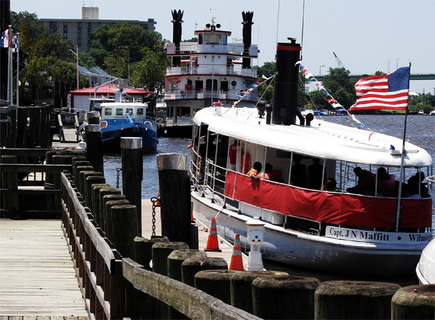
From the bridge fording US Interstate 140 over Northeast Cape Fear River, we look southwest over the low marsh adjoining this prong of the storied Cape Fear River: Above. The upper Cape Fear River along Wilmington's historic waterfront is a bustling intersection of strolling folks and docked watercraft: Below.


In a deep dug canal perpendicular to the relatively deep Cape Fear River, across from its northern shore whereupon the colonial port of Wilmington, North Carolina rises from its banks, is moored the USS North Carolina, one of two North Carolina class battleships, also know as "The Showboat:" Above. Across from the floating gunship, moored perpendicular to the Cape Fear's southern shore, is Wilmington's downtown waterfront walkway where the numerous pleasure craft are docked that ferry the natives and tourists alike upon the strong currents of North Carolina's deepest river: Below.

The brick pavers along the wide streets leading to Cape Fear River bring the people to the water's edge, where folks may find peace, tranquility: Above and below.