Press Release:
Good Afternoon Everyone,
Our office continues to monitor the potential for severe storms and periods of heavy rain between Wednesday and Saturday. Today's forecast updates shifted some of the early precipitation north and west of our area, which resulted in minor changes to the timing of our expected rainfall, and overall rainfall totals. These changes have been
underlined below.
Rain
- A persistent rain is expected to move into our area around noon tomorrow and continue through late Saturday / early Sunday morning.
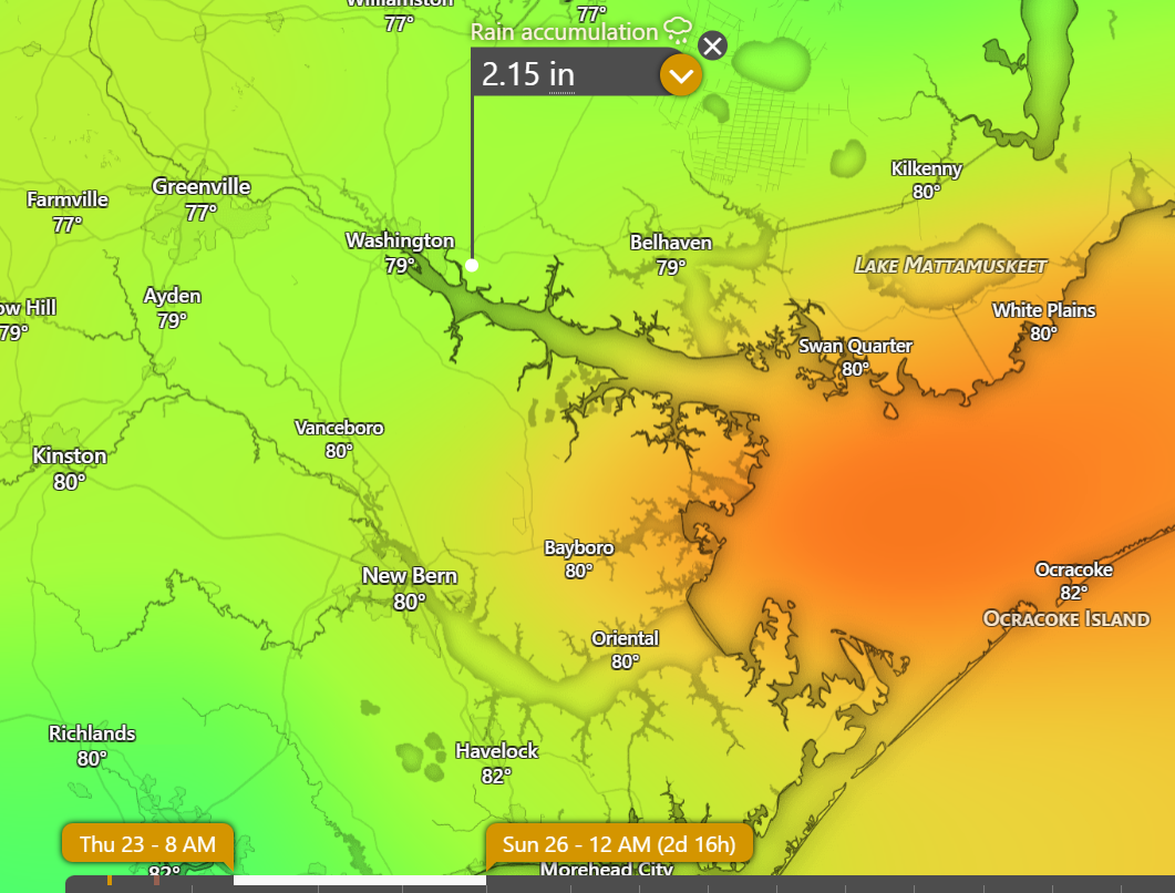
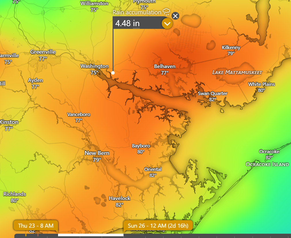
- Beaufort Co. is expected to receive 2 to 5 inches of rain during this time. (Locally higher amounts will be largely dependent on the formation and track of heavier rain bands / thunderstorms.)
- Our heaviest rains are currently forecasted to occur between 7pm Thursday and sunrise Friday.
Hourly Rainfall Graphic: 8am Thursday - 8am Saturday
 GFS Rainfall Totals: 8am Thursday - Midnight Saturday
 EURO Rainfall Totals: 8am Thursday - Midnight Saturday
 Severe Thunderstorms
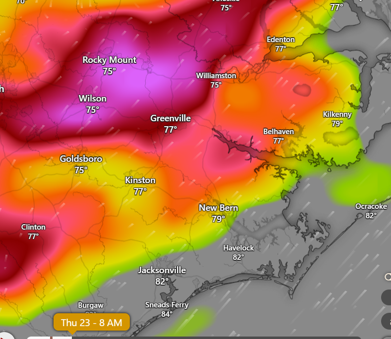
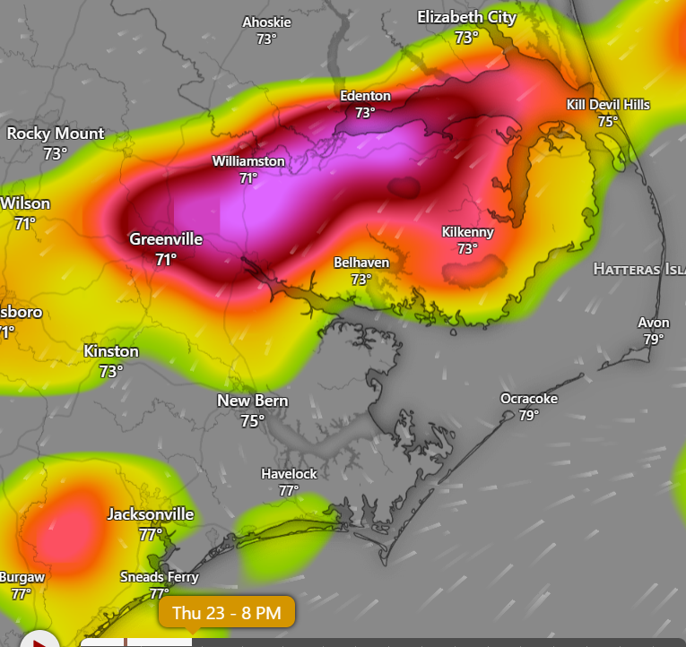
- This system will have the potential to produce severe thunderstorms, capable of heavy rains that could cause localized flash flooding. Our greatest chance for threats for severe weather includes:
- Thursday morning between 7am and 10am.
- 8pm Thursday afternoon through noon Friday.
8am Thursday - Thunderstorm Probability Graphic
 8pm Thursday - Thunderstorm Probability Graphic
 4am Friday - Thunderstorm Probability Graphic
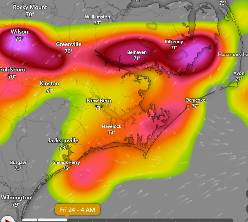 4am Friday - Thunderstorm Probability Graphic
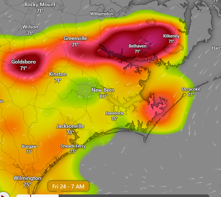
Please see the email below and attached briefing from the National Weather Services (NWS) for additional information
We encourage everyone to continue to monitor trusted sources for additional information.
We also ask that everyone take a moment to ensure that you, your family, friends, and neighbors have a means of being alerted to any watches and / or warnings that may be issued. (weather radio, weather apps with push notifications, etc.)
As always, thank you all for what you do to keep Beaufort County informed, prepared and safe.
Chris Newkirk
Director
Beaufort County Emergency Services
121 W 3rd St.
Washington, NC 27889
Office: (252)946-0079
Cell: (252) 378-5352
Good afternoon,
No significant changes since the last update. A Flood Watch continues for most of eastern NC.
Key Messages
- Isolated strong to severe thunderstorms with damaging wind gusts will be possible this evening.
- The main threat will be the potential for heavy rain and flash flooding early Thursday morning into Thursday evening. A Flood Watch continues for most of eastern NC. Widespread rainfall amounts 3-5 inches expected, with locally higher amounts possible.
- Localized flood threat could continue Friday into the weekend with already saturated soils.
NWS_MHX_Briefing_2_Flood_Svr_Threat_July_22_23_2026.pdf
Regards,
NWS Newport/Morehead City