Press Release:
Good Evening Everyone,
Our office is monitoring the potential for severe storms and periods of heavy rain between Wednesday and Saturday. Please see below for Beaufort County's forecast details.
High Winds
- S & SW winds will continue to increase overnight, becoming sustained between 10 and 15 mph with frequent gust of 20 to 30 mph by 10pm tonight. Our winds are expected to remain elevated through by 10pm Thursday.
- Our highest winds are expected between 10pm tonight and 3pm tomorrow.
Wind Graphic: 8pm Tuesday - 8pm Thursday
 Rain
Rain
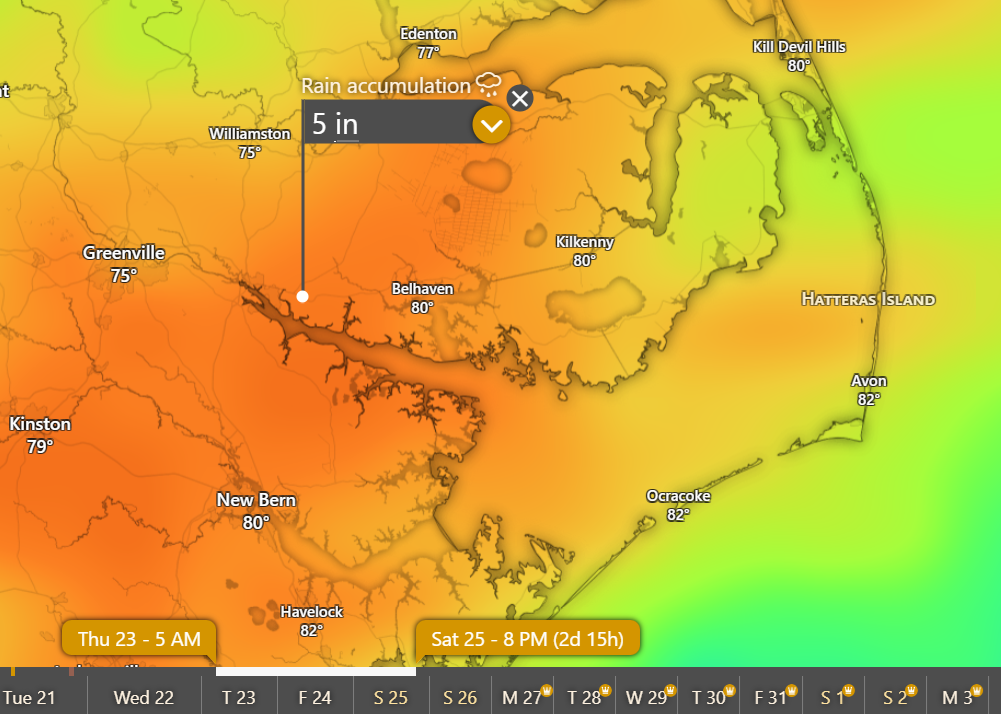
- A persistent rain is expected to move into our area around sunrise Thursday morning and continue through 8pm Saturday, with 3 to 5 inches expected for most areas during this time.
- Our heaviest rains are currently forecasted to occur during the following time periods. Please note: These periods of heavy rain will have the potential to produce localized flash flooding.
- Between 3pm Thursday afternoon and 3am Friday morning.
- Between 3pm and sunset Friday afternoon.
Hourly Rainfall Graphic: 2am Thursday - Midnight Friday
 Rainfall Totals: 5am Thursday - 8pm Saturday
 Severe Thunderstorms
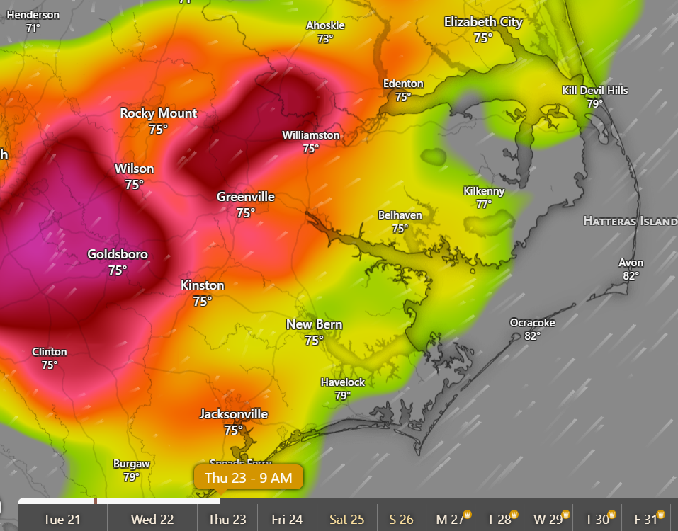
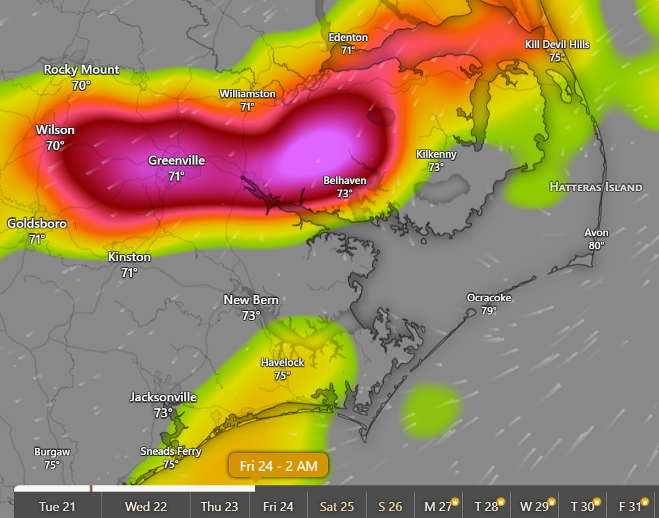
- While there is a potential for scattered severe thunderstorms possible for tomorrow afternoon, our greatest threats will occur as follows.
- Between 5am and 10am Thursday morning.
- Between 5pm Thursday and 3am Friday
9am Thursday - Thunderstorm Probability Graphic
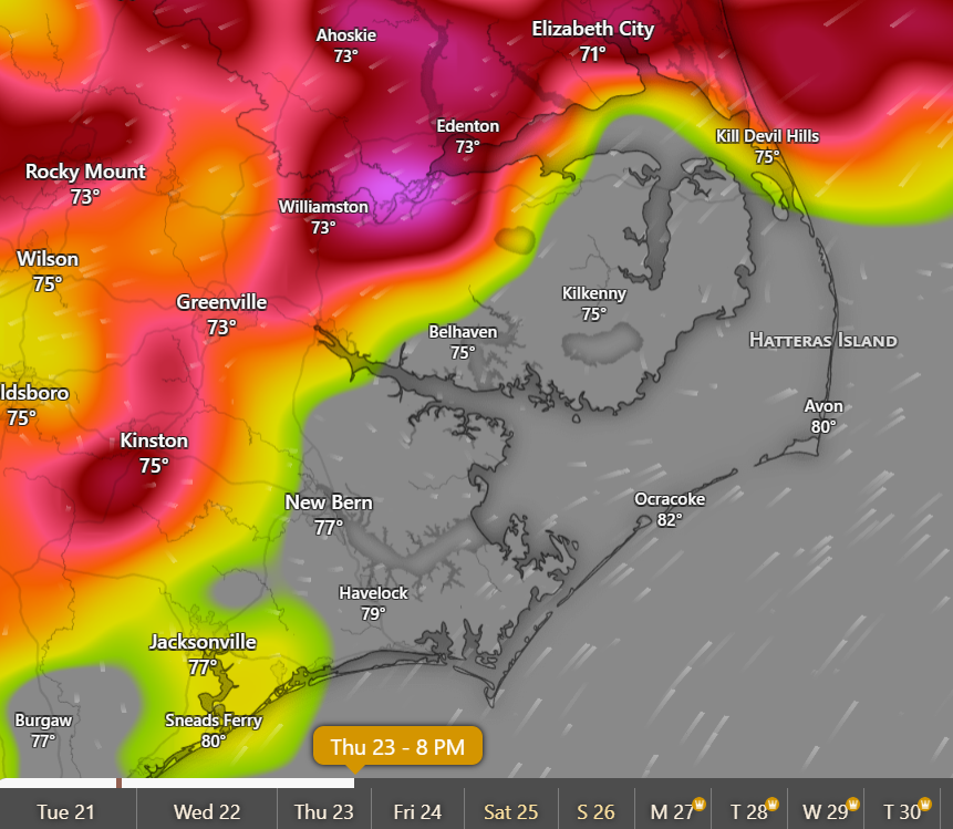 2am Friday - Thunderstorm Probability Graphic
Please see the email below and attached briefing from the National Weather Service (NWS) for additional information. We will continue to pass along information as we receive it.
Please take time tomorrow to secure any outdoor items that are vulnerable to high winds and move items out of low lying areas that are susceptible to flash flooding. We also encourage everyone to take a moment tomorrow to ensure that outdoor pets and livestock are protected from this approaching weather.
As always, thank you all for what you do to keep Beaufort County informed, prepared and safe.
Chris Newkirk
Director
Beaufort County Emergency Services
121 W 3rd St.
Washington, NC 27889
Office: (252)946-0079
Cell: (252) 378-5352
Good afternoon,
Key Messages
- Isolated strong to severe thunderstorms with damaging wind gusts will be possible Wednesday afternoon and evening.
- The main threat will be the potential for heavy rain and flash flooding early Thursday morning into Thursday evening.
- Localized flood threat could continue Friday into the weekend with already saturated soils.
Our next briefing will be sent Wednesday afternoon. If you have questions or concerns, please let us know.
Regards,
NWS Newport/Morehead City