The Keeper of the Mouth of the Savannah River is Tybee Island ...
And it has been since 1736. In that year, British General James Oglethorpe understood the imperative need to mark the entrance of the river, so he ordered a lighthouse constructed at its mouth on Tybee Island. General Oglethorpe considered the defense of the river also a priority, and therefore, he had a small fort constructed to insure the control of the Savannah River for his British Citizens upriver.
Tybee Island would later be wrested from British control in the American Revolution. In 1779, French Admiral D'Estaing used the Island as a staging area for the Siege of Savannah, which was unsuccessful. During the War of 1812, the Tybee Island Lighthouse was used as a signal tower to warn the American defenders of Savannah.
Since that first lighthouse ordered constructed by General Oglethorpe, there have been three more constructive processes - two in the same location, using the same foundation. The fourth lighthouse, constructed after The War Between the States, still stands today.

The Tybee Island Light Station was originally built from masonry and wood, but after the structural technological advances of, say, the last 270 years, the renovated upper portion of the light station is now constructed of masonry and steel frame. The U.S. Coast Guard has maintained the lighthouse since 1948, beginning when the last keeper, George Jackson died. In 1987, with renovations needed and the historical imperative to preserve that integrity, the Coast Guard enjoined a partnership agreement, by lease, with the City of Tybee Island and the Tybee Island Historical Society. The latter parties to their agreement maintain the structure and the continuing renovations to the entire light station, while the Coast Guard continues to maintain the light in its Aid to Navigation System in this sector along the Atlantic Shore. The preservation of history is served and the aids to navigation is continued - a model deal for all.
 Click to enlarge a much larger map of the Savannah, Tybee Island and Hilton Head Island area.
The U.S. Coast Guard's concern for good aids to navigation, as evidenced in their continued maintenance of the Tybee Island Light Station, is well founded. The Port of Savannah is one of the busiest in the South, and from Norfolk, Virginia to Jacksonville, Florida, there is no busier port. The port provides significant economic development in the Savannah region.


Just a couple, or three nautical miles from the mouth of the Savannah and the shore of Tybee Island is Fort Pulaski National Monument on Cockspur Island. Construction was begun in earnest in early 1830 on the great Fort, which has a perfect vantage on all ship traffic entering the mouth of the
Savannah River. Fort Paulaski was named for the brave Polish Calvary Officer, who was held great esteem by General George Washington, and aided in the attack on the British held City of Savannah on October 9, 1979. In that valiant, but unsuccessful strike against British forces, Brigadier General Casimir Pulaski was mortally wounded and was buried at sea near the mouth of the Savannah River.

Lieutenant Robert E. Lee's first station was the construction of Fort Pulaski. An outstanding civil engineering student at West Point, the young engineer was well qualified to design and coordinate the construction of this large and well fortified fort that would, in time, aim its guns at the mouth of the Savannah River. The young lieutenant would eventually return to Fort Pulaski, after spending more than a year on Cockspur Island, as General Robert E. Lee in command of The Army of Northern Virginia, to take possession of the fort for the South.
The fort would stay in the hands of the South until surrendered by Colonel Olmstead to the Federal troops on April 11, 1862 after a few days of bombardment from the big and plentiful Union mortars and rifled canon entrenched on Tybee Island less than a mile southeast of its mote abutted, masonry walls.


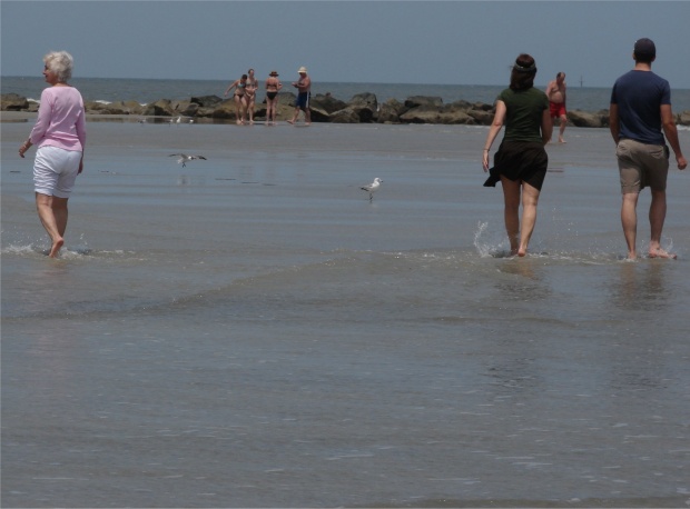
After witnessing the physical history of Tybee Island, one would be remise in not visiting the relatively calm waters of the Atlantic shore of this famed island. I leave you with a few pictures of this natural splendor, and until we have the opportunity to discuss other locales on your or my travel horizons, I bid that you enjoy safe and happy travels.
 Northern end of Tybee Island: above. Southern end of Tybee Island: below. photos by Stan Deatherage
This article provided courtesy of our sister site:
Better Travelers Now