Publisher's note: We believe the subject of history makes people (i.e., American people) smarter, so in our quest to educate others, we will provide excerpts from the North Carolina History Project, an online publication of the John Locke Foundation. This sixtieth installment, by Jonathan Martin, was originally posted in the North Carolina History Project.
Pender County was once part of New Hanover County, it was annexed from the coastal county in 1875 and named for the area native, William D. Pender, the youngest Confederate general who died in 1863 at the Battle of Gettysburg. Burgaw Indians once lived in the present county, and English, Welsh, and German immigrants moved into the Pender area in the seventeenth century. The county seat, Burgaw, was named after the original inhabitants. The town was incorporated in 1875. Other towns and communities within Pender County include the beach areas of Topsail Beach, Surf City, Penderlea, Rocky Point, Hampstead, and Scotts Hill.
A coastal county, Pender has several prominent natural characteristics. The important Cape Fear River meanders through the county, and some lesser known creeks - Colvins, Beasley's, and Rock Fish - are found in Pender County. In addition, Topsail Island and Roan Island, are important tourist attractions within the region.
In February of 1776, North Carolina Patriots battled several hundred Tories at Moore's Creek Bridge---the first Revolutionary War battle on North Carolina soil. Later dubbed the "Lexington and Concord of the South," the Battle of Moore's Creek Bridge became a substantial Patriot victory, mainly due to the leadership of the Colonels James Moore, Alexander Lillington, and Richard Caswell.
The lead-up of the Battle of Moore's Creek Bridge began when Royal Governor Josiah Martin ordered General Donald MacDonald and Lt. Colonel Donald McLeod to capture Brunswick Town. As British forces made their way to Wilmington, Patriot forces gathered at a small bridge, high above the Moore's Creek and proving a prime defensive position for the militiamen. McLeod led his troops through the swamp of Moore's Creek, and on the early morning hours of February 27 the British ground forces made their way on the bridge only to be met by an extreme amount of Patriot musket fire. After only three minutes of fighting the battle was over, and the Patriots had claimed victory.
Historians admit that the Battle of Moore's Creek Bridge led to the end of British royal government in North Carolina. In addition, the victory aroused delegates to meet at Halifax on April 12, 1776, to discuss North Carolina's support of Independence, and the battle allowed the Patriots to hold to the South at the early outset of the Revolutionary War. Presently, the Moore's Creek Bridge has been reconstructed in Pender County and a park commemorates the early Revolutionary War victory in North Carolina.
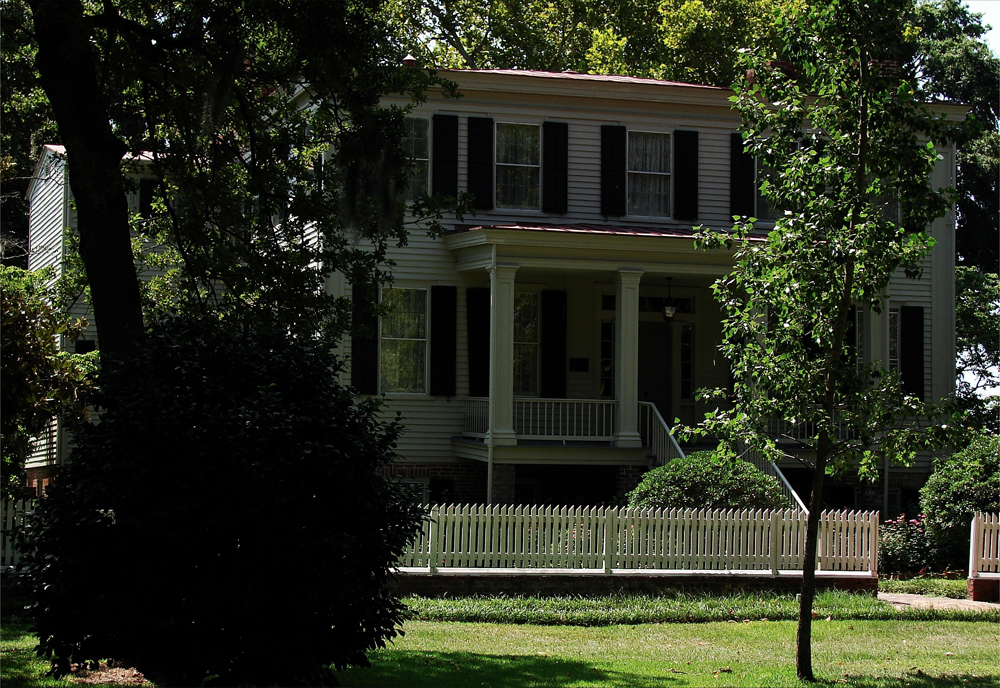
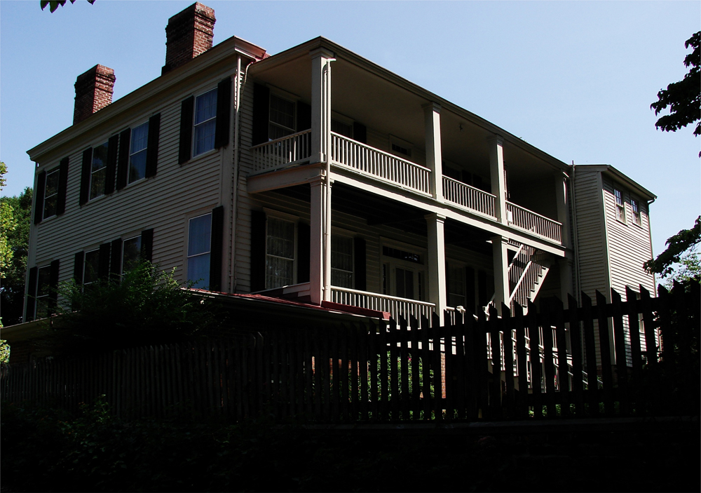
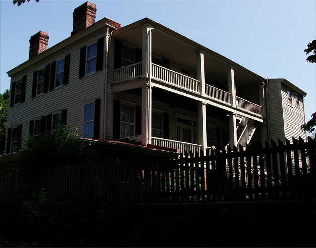
 The front view of the main house in the Poplar Grove plantation in southeast Pender County: Above. The rear view of that same main house: Below. photos by Stan Deatherage Click the picture to expand to as much as 1000 pixels wide within most expanded images, and then push the arrows embedded in the center edge of the play-box to access the gallery, and slide new images into viewing within the center of the screen.
Several structures in Pender County have a degree of historic value to the region. One building, the Sloop Point Plantation, the most enduring house in North Carolina, continues to stand in the county. Built in the year 1726, the Sloop Point Plantation was named for the numerous sloops that arrived at the port near the plantation from the Caribbean and England in the early eighteenth century. John Baptista Ashe had received the original grant for the land the Sloop Point Plantation rests on, and the plantation focused on saltworks. Plantation workers collected water from surrounding salt waterways, and allowed the water to evaporate in large iron pans. After the water evaporated, brine would collect in the iron pans. Salt, a crucial mainstay for early colonists, was needed to preserve meats and other perishable food items, and during the Civil War, salt sold for over $60.00 per bushel. The Sloop Point Plantation thrived during its salt production days, and in 1989 the original plantation home was remolded in Pender County.
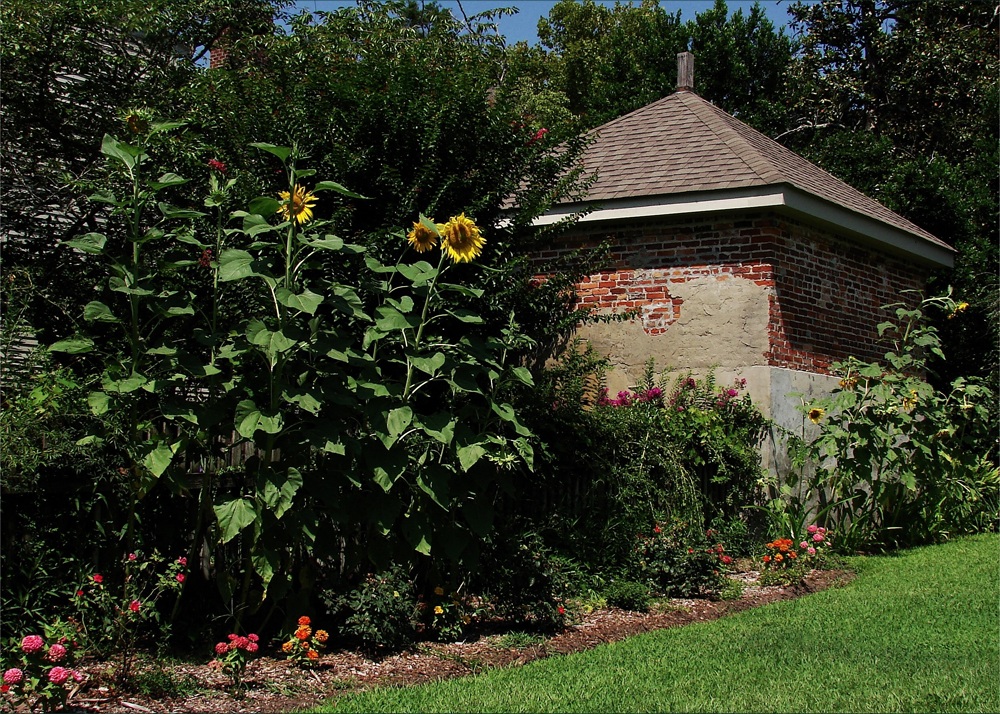
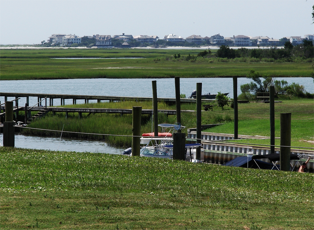
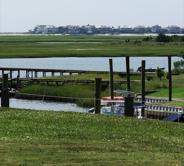
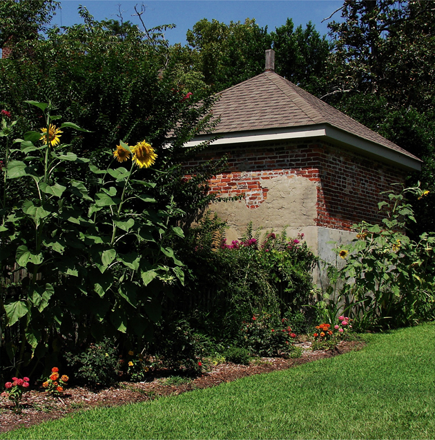 Poplar Grove, in the Scotts Hill community, has many ancillary structures, including this one that resemble an old smoke house: Above. The Scotts Hill community extends all the way down to the water, as we stand here and gaze, across the salt marsh and Rich Inlet, upon the beach community of Figure Eight Island in the northeastern sector of New Hanover County: Below. photos by Stan Deatherage Click the picture to expand to as much as 1000 pixels wide within most expanded images, and then push the arrows embedded in the center edge of the play-box to access the gallery, and slide new images into viewing within the center of the screen.
In addition to the Sloop Point Plantation, the Penderlea Homesteads were once operated by Hugh MacRae in the County of Pender. MacRae had originally created farms and ethnic communities in the southeastern section of North Carolina, and these farming colonies appealed to numerous foreign immigrants, particularly the Dutch. One of the more flourishing homesteads became known as Castle Hayne where foreign farmers settled and grew crops such as gladioli, daffodils, and irises beginning in the early 1900s. When the Great Depression hit North Carolina, MacRae, along with directors from the North Carolina State College, Princeton, and Harvard, devised a plan to create "the best planned rural community in the world" known as the Penderlea Homesteads in the 1930s (Powell, p. 876). However, differences on the operation of the Homesteads eventually led MacRae to resign, and the federal government took control of the community under the New Deal. By the time of World War II many of the original homesteaders had left the area, but many of the homes and structures of the Penderlea Homestead continue to stand in Pender County.
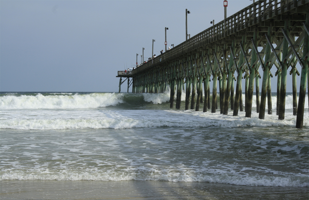
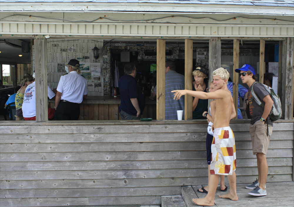
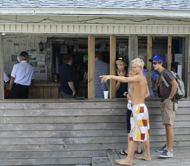
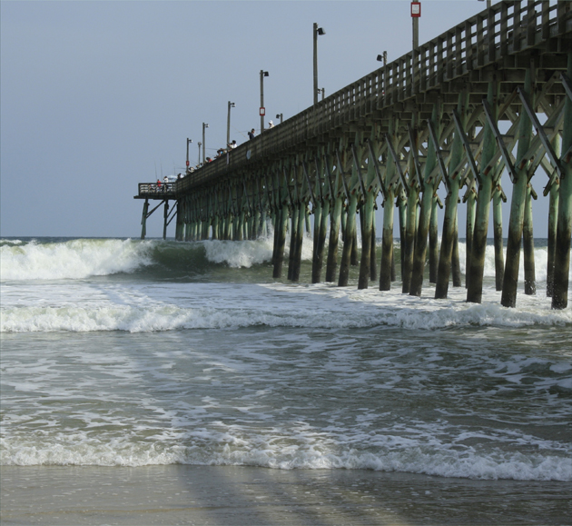 Keeping with the water / travel and tourism theme, there is Surf City, located near the middle of Pender County, and closer to Onslow County to the north. Here we look toward the large fishing pier in Surf City's center as it is battered by an unusually strong surf: Above. The high waves of this strong surf did offer an outstanding day as these little "surfer dudes" get a kick out of watching their friends tackle the 6 to 8 feet high waves: Below. photos by Stan Deatherage Click the picture to expand to as much as 1000 pixels wide within most expanded images, and then push the arrows embedded in the center edge of the play-box to access the gallery, and slide new images into viewing within the center of the screen.
After the conclusion of the World War II, two areas on the North Carolina coast were selected for test regions for U.S. Navy rockets and ramjet engines. Beginning in the early 1940s, the Kellet Corporation and the John Hopkins University Applied Physics Laboratory tested rockets and missiles all across Topsail Island in Pender County. Kellet and John Hopkins were contracted by the Navy to furbish a high-profile missile capable of decimating an air target which over twenty miles away, and after nearly two years, experimenters had launched over two hundred rockets. In 1948, the experiment was moved to New Mexico and Cape Canaveral, and the results from the Topsail Island tests provided a solid backdrop for future jet aircraft experiments and rocket technology in the development of the United States NASA program.
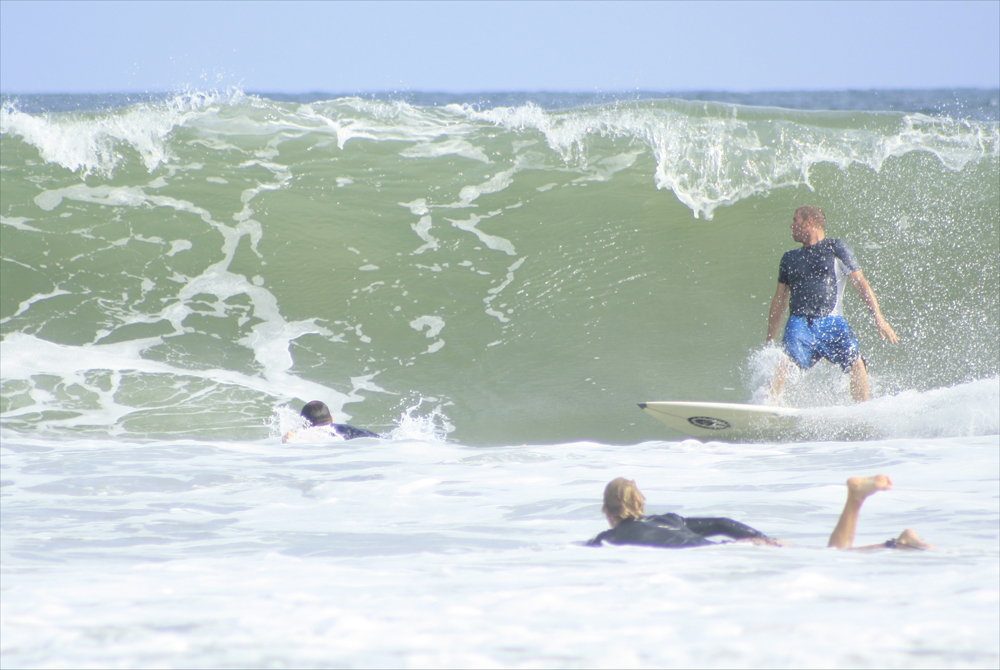
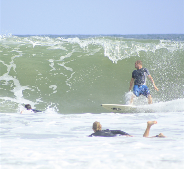 Here along the beach in Surf City, the sunbathers and curious onlookers are treated to an outstanding display of high waves and well balance surfers having a blast in the tall, forceful waves: Above. Notice the the kid getting low to ride the waning curl; this is the same "surfer dude" pointing in the picture above: Below. photos by Stan Deatherage Click the picture to expand to as much as 1000 pixels wide within most expanded images, and then push the arrows embedded in the center edge of the play-box to access the gallery, and slide new images into viewing within the center of the screen.

Pender County's economy centers on farming and manufacturing. Some agriculture products of the county include blueberries, strawberries, tobacco, soybeans, and livestock. In addition to these crops, the unique Venus flytrap plant thrives naturally in Pender County. Factories in Pender County fabricate clothes and pressure sensitive labels.
Sources:
"Pender County; Penderlea Homesteads; Rocketry Experiments; Sloop Point Plantation; Battle of Moore's Creek Bridge." William S. Powell, ed. Encyclopedia of North Carolina (University of North Carolina Press: Chapel Hill, NC 2006).
"Missile Tests." North Carolina Highway Historical Marker Program website. A Division of the North Carolina Department of Cultural Resources. (accessed December 23, 2011).
"History of Pender County." Pender County government website. http://www.pendercountync.gov/Visiting/History.aspx, (accessed December 23, 2011).