This is the eleventh of a new series of images from across North Carolina from my travels, and from the long intervals that I have spent with my camera making a record of where I have been.
Where do you stand on the Transgender Issue now that the issue has gotten to the overt point of the open celebration of this lifestyle choice, dictated by certain direct and explicit actions.
91.07% I do not approve of behavior that has within its expressed tenants policies that harm children.
8.04% I do support the Trans Community in all its many facets because diversity is at a premium in today's society.
0.89% What is a "Children's Drag Queen Story Hour?"
Publisher's note: Please be aware that we have created a new fixture at the foot of this post, describing the location of some of North Carolina's most memorable scenic points of interest, is our interactive map that we developed to do exactly what we want it to do ... for now.
Why am I going back and installing these interactive maps? Simply, folks like to use them because our newer posts are getting more views faster than the older posts did. Providing yet another 'leading edge' product that works is a good enough reason for me.
This is the eleventh of a new series of images from across North Carolina from my travels, and from the long intervals that I have spent with my camera making a record of where I have been. Upon examination of these random images, I concluded that best format would be the one page arrangement, where I cut the images to 1280 pixels wide, arrayed in a wide viewed 'fancybox' series, where there is a title of explanation, and maybe a bit more, but mainly, the photo should speak rather than my words. In fact, I plan to put my words on hold for a bit here, which will be to the fine relief of a great many.
Each series will be random and varied; however, most will center from here in eastern North Carolina, which is closer to my home in northeastern North Carolina, in the county of Beaufort, and the county seat of Washington, my home. From this perspective, we will reach out beyond the myriad waters: fresh and calm, brackish and moving, salty with powerful waves, and get to see North Carolina, where we may know it a little better, if only through images.
This random display of images of North Carolina, made by the Tar Heel traveler, may have been revealed earlier in BCN, and when I can remember a relative series, I shall link to it; however know that this series of ongoing themes will remain that there is no theme. In this random projection of unrelated images, the series will seek its relevance, its beauty and its strength of purpose.
The Eleventh Pictorial Trek from Here to There and Back Again
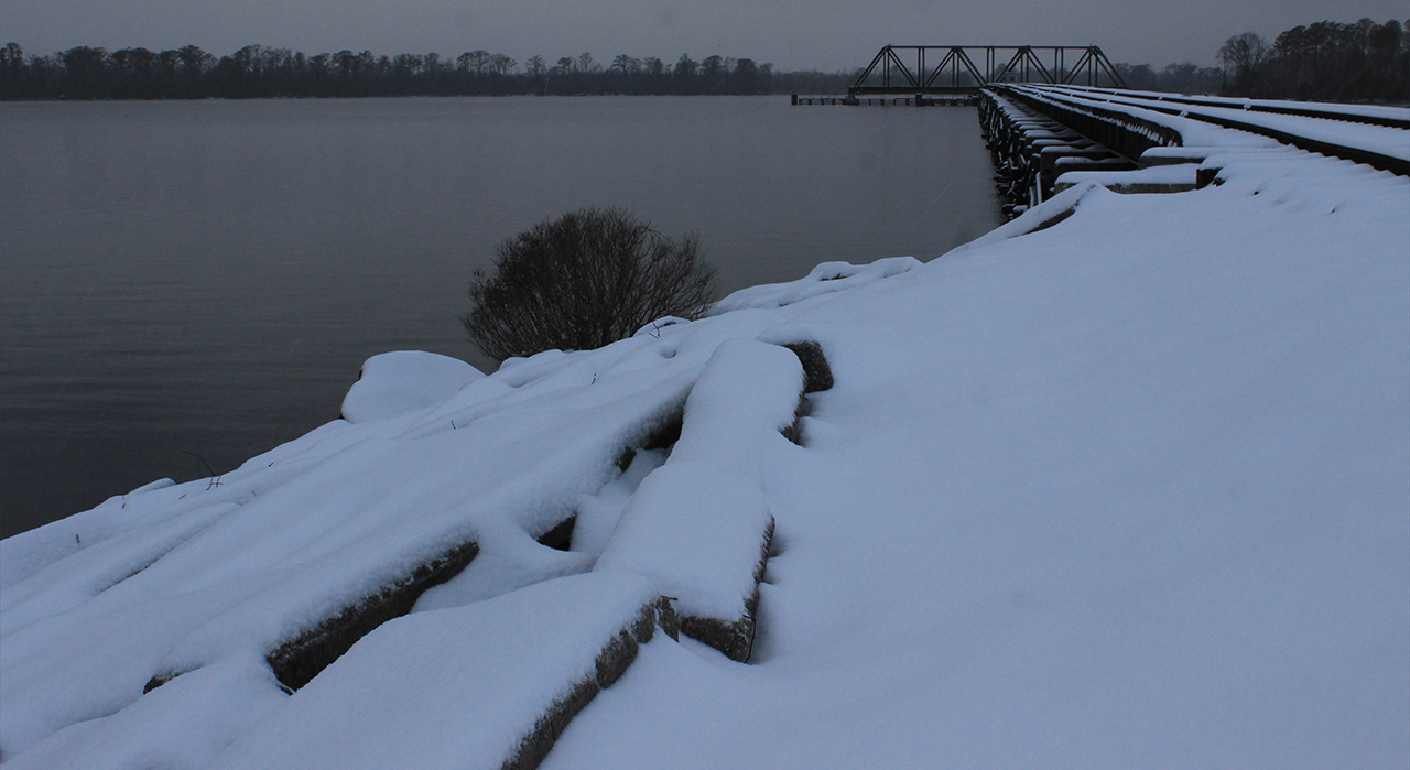
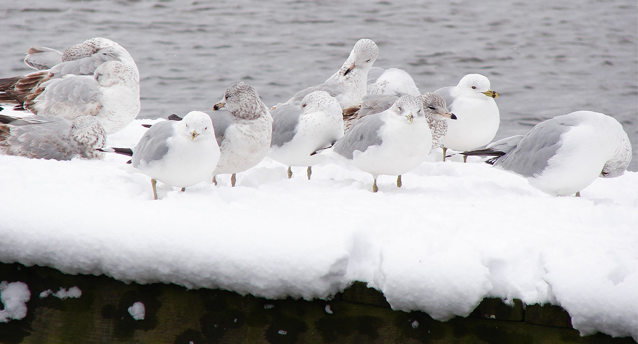
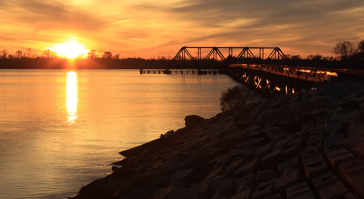
We begin in Beaufort County, on a cold wintry day, lots of wind, snow and sleet as the sun, lost behind a thick bank of clouds, is sinking. That is a very good time to take a walk out on the trestle: Above. Just about 3/4 of a mile up the Pamlico River, the local sea gulls are feeling it quite a good deal: Below.photos by Stan DeatherageClick images to expand.
We leave Beaufort County, and head south to Carteret County and then along the Cape Fear River.
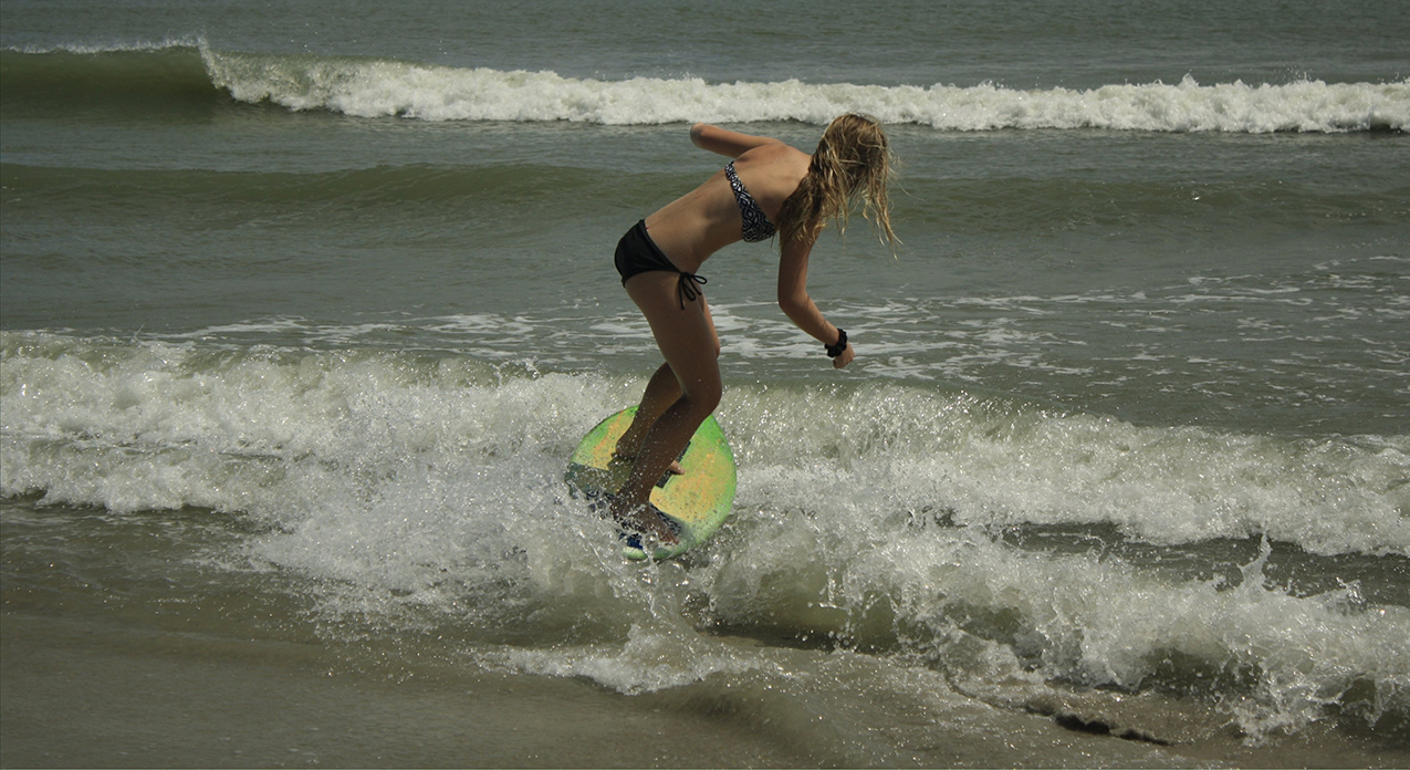
Here at Atlantic Beach, we discover that skim boarding is like surfing in reverse: Above. Here in Morehead City, the sun slips out from behind the clouds for an interesting vision above the Bouge Sound: Below.photos by Stan DeatherageClick images to expand.
Eastern North Carolina, from north to south, here Downeast, is a most unique stretch of ground where real people live, and have lived, and now we make our way to Wilmington, NC, in New Hanover County, to catch a glimpse of how folks live by analyzing their surroundings.
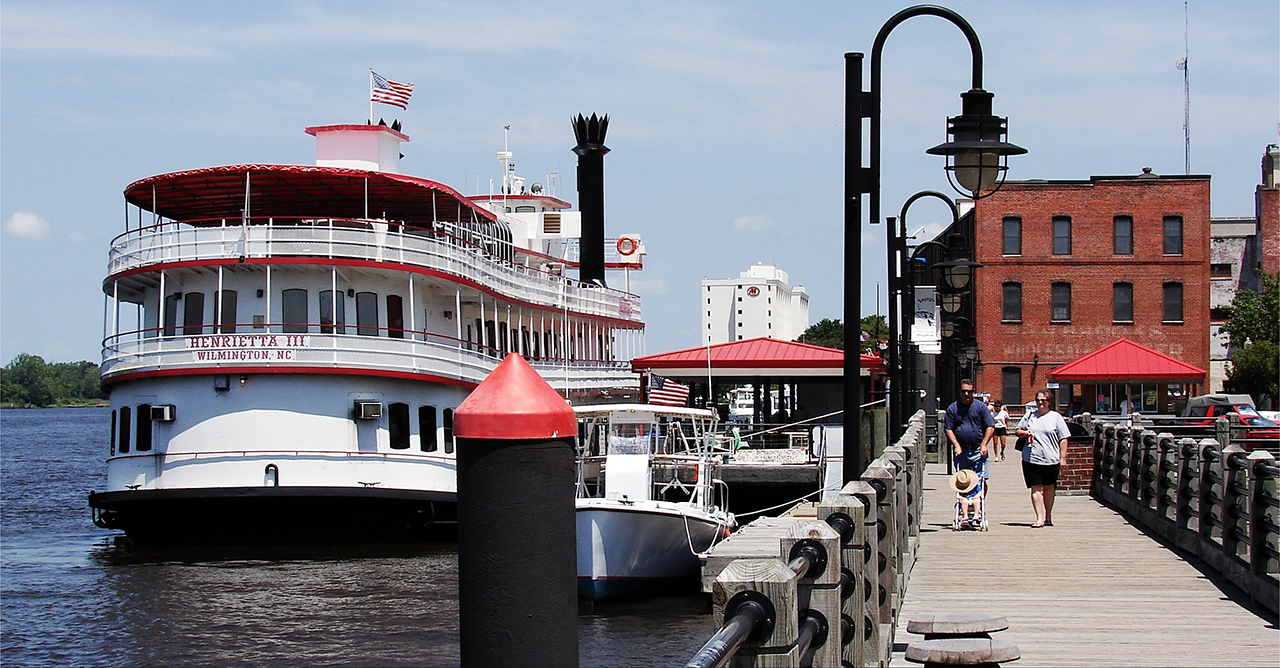
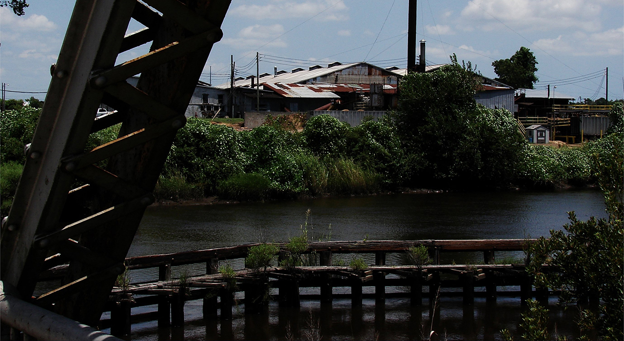
A gentle stroll along Wilmington's storied waterfront: Above. And not more than a couple of miles away, we view a rustic sawmill along a small creek feeding the Cape Fear River: Below. photos by Stan DeatherageClick images to expand.
In the New Hanover County / Brunswick County area, the Cape Fear River has long been the most essential component that worked to forge, by its rushing waters, a rich history that continues unto today.
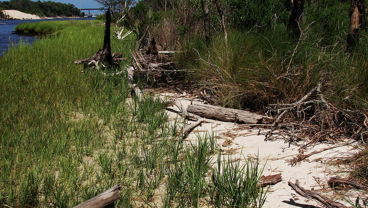
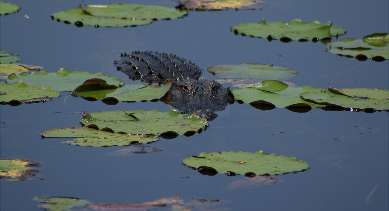
Between the Inland Waterway and the Cape Fear River is the Carolina Beach State Park, with fabulous facilities, that is wonderful for many activities, especially a fine walk along the shoreline: Above. On the other hand, be careful strolling around Orton Pond just a few miles from the southern shore of the Cape Fear River in Brunswick County: Below.photos by Stan DeatherageClick images to expand.
Before we head west to Buncombe County, we take a few precious moments to rest our traveling shoes in the Cape Fear Riverside town of Southport.
The quiet peace of one of the few streets in downtown Southport: Above. The neighbors bidding good Saturday morning to one another in Asheville, NC, some great distance from the Southeastern shore: Below. photos by Stan DeatherageClick images to expand.
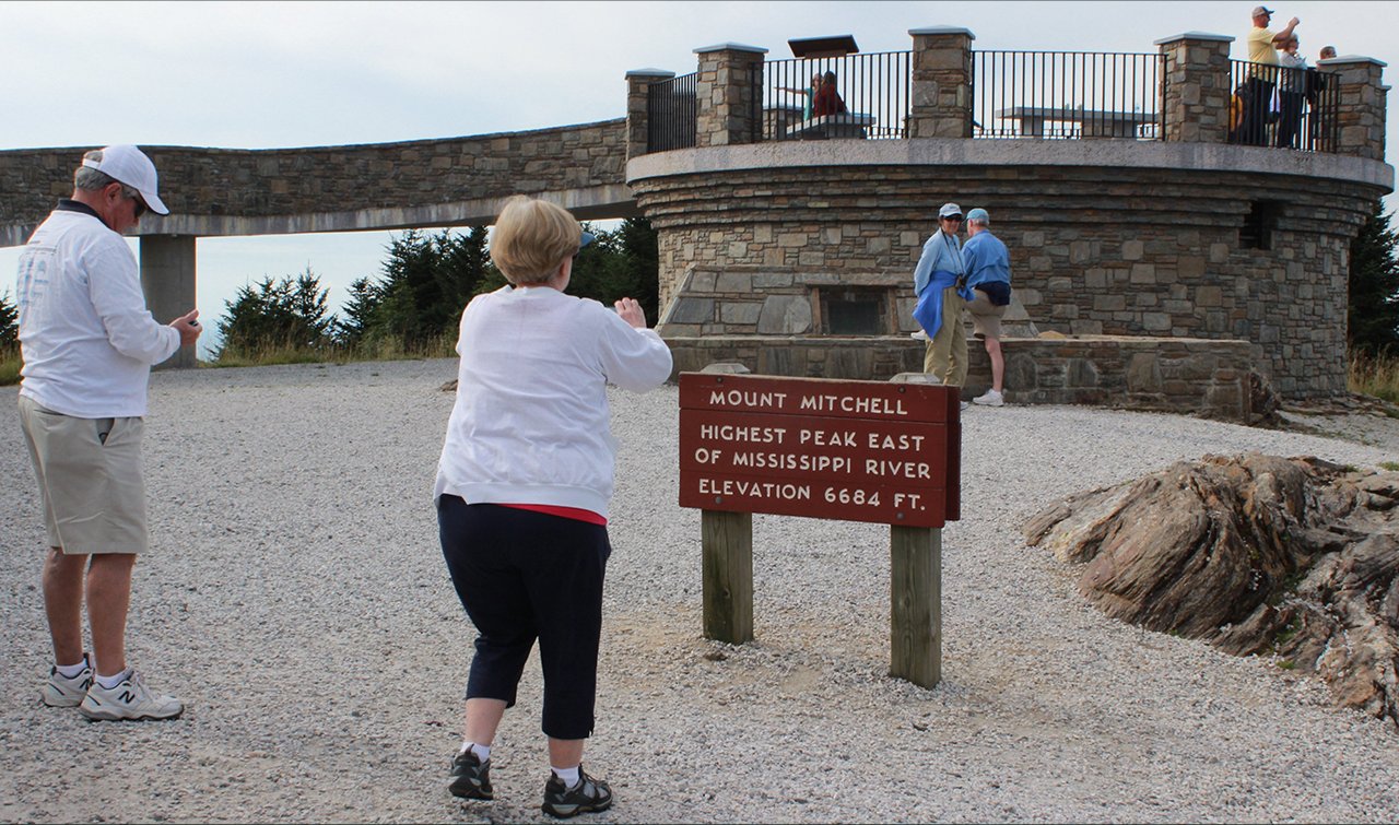
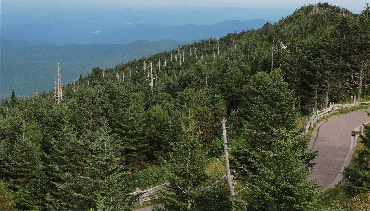
If one ventures far west to Asheville: How could you pass up the opportunity to head north up the winding Blue Ridge Parkway to Mt. Mitchell?
Yes mam, you are standing at the highest point above the earth for over thousands of miles. So take a picture for the memories preserved: Above. It is a sweeping view and a worthwhile trek to these dizzying heights: Below.photos by Stan DeatherageClick images to expand.
And then back home ...
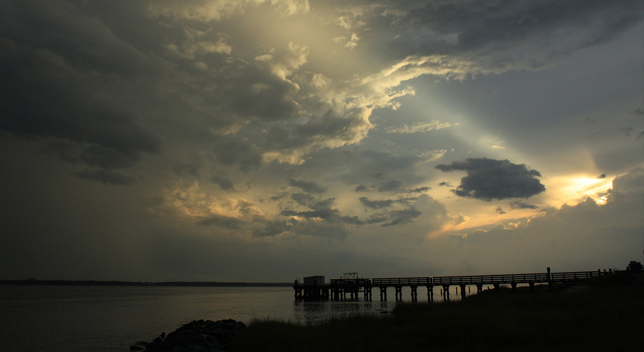
I always finish, where we began, with a sunset image over the Pamlico River, this time another winter shot on a cold wintry day, minus the snow and sleet in Washington, NC: Above. photo by Stan DeatherageClick image to expand.
We'll do another one of these as the time becomes ready and appropriate. At your leisure, please follow this link to the growing list of this pictorial series - "Across North Carolina".
Below is our new interactive map that will show where all the pictures were made, and if you wish, you can get the distances and directions to these vistas. Also, you can interact with the map by placing your address in the "Enter an Address or Place & Click Find" field, and then click find to get best directions and mileage between your address and the chosen subject site. More features to follow.