This is the twentieth of a less new series of images from across North Carolina from my travels, and from the long intervals that I have spent with my camera making a record of where I have been.
Where do you stand on the Transgender Issue now that the issue has gotten to the overt point of the open celebration of this lifestyle choice, dictated by certain direct and explicit actions.
91.07% I do not approve of behavior that has within its expressed tenants policies that harm children.
8.04% I do support the Trans Community in all its many facets because diversity is at a premium in today's society.
0.89% What is a "Children's Drag Queen Story Hour?"
Publisher's note: Please be aware that we have created a new fixture at the foot of this post, describing the location of some of North Carolina's most memorable scenic points of interest, is our interactive map that we developed to do exactly what we want it to do ... for now.
Why am I going back and installing these interactive maps? Simply, folks like to use them because our newer posts are getting more views faster than the older posts did. Providing yet another 'leading edge' product that works is a good enough reason for me.
This is the twentieth of a new series of images from across North Carolina from my travels, and from the long intervals that I have spent with my camera making a record of where I have been. Upon examination of these random images, I concluded that best format would be the one page arrangement, where I cut the images to 1280 pixels wide, arrayed in a wide viewed 'fancybox' series, where there is a title of explanation, and maybe a bit more, but mainly, the photo should speak rather than my words. In fact, I plan to put my words on hold for a bit here, which will be to the fine relief of a great many.
Each series will be random and varied; however, most will center from here in eastern North Carolina, which is closer to my home in northeastern North Carolina, in the county of Beaufort, and the county seat of Washington, my home. From this perspective, we will reach out beyond the myriad waters: fresh and calm, brackish and moving, salty with powerful waves, and get to see North Carolina, where we may know it a little better, if only through images.
This random display of images of North Carolina, made by the Tar Heel traveler, may have been revealed earlier in BCN, and when I can remember a relative series, I shall link to it; however know that this series of ongoing themes will remain that there is no theme. In this random projection of unrelated images, the series will seek its relevance, its beauty and its strength of purpose.
The Twentieth Pictorial Trek from Here to There and Back Again
We begin along Washington's waterfront, where the sun sets over the Pamlico River: Above. Along that same waterfront, a sun soaked flower full of nectar is a wonderful feeding point for bees: Below.photos by Stan DeatherageClick images to expand.
Our travels turn south to Carteret County, where 'water, water is everywhere'.
Along the banks of Bouge Sound, in Morehead City, we watch the sun stretch the clouds to make a brief but powerful appearance: Above. Nearly 50 miles offshore, at Big Rock, we notice: An unusual abundance of traffic, and that the waters are routinely rough as the opposing Gulf Stream and the Labrador currents skim one another as one heads south and the other conveys north, with a rich palate of blue in many different shades everywhere: Below.photos by Stan DeatherageClick images to expand.
From these deep blue seas, we head north and east:
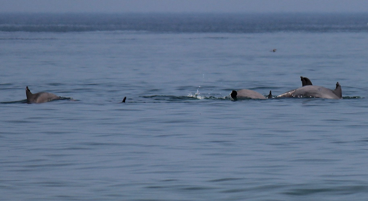
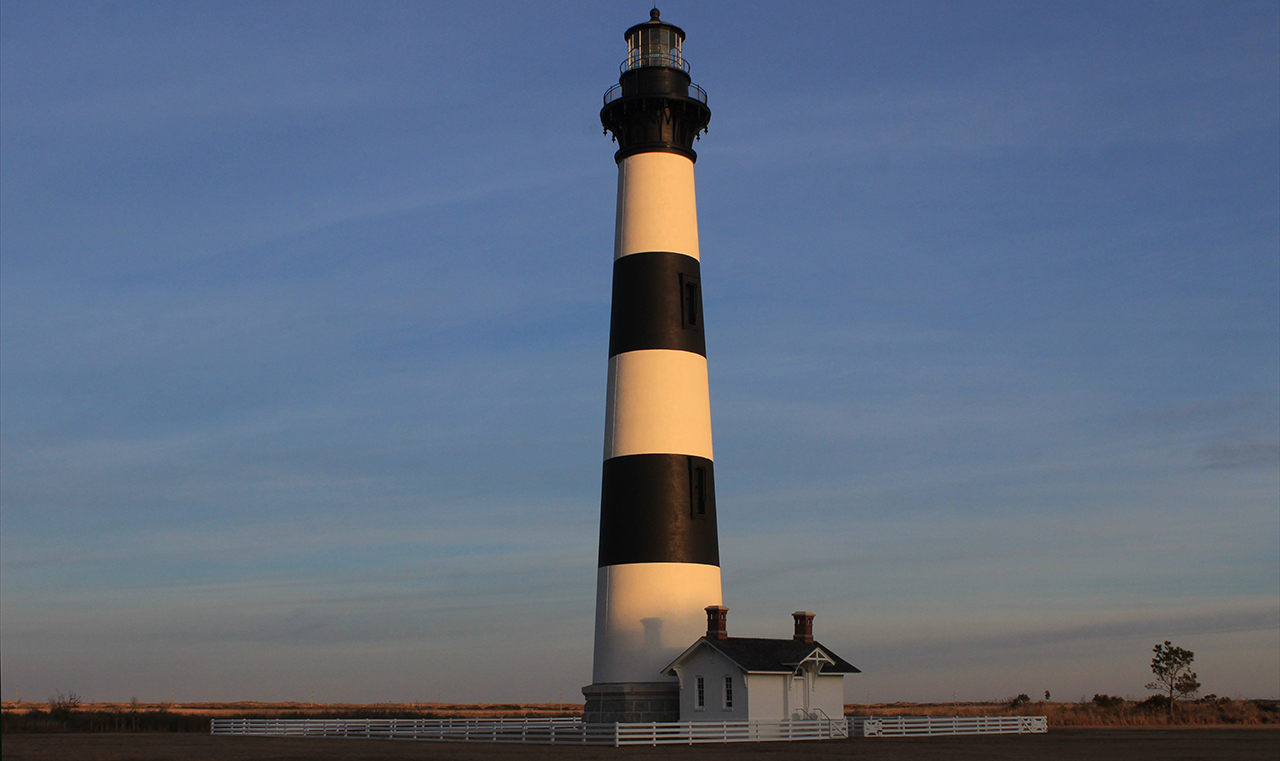
to find a school of bottle-nose dolphins just off the beach in Nags Head: Above. And, we witness the evening glow of a sinking sun on the Bodie Station Lighthouse: Below.photos by Stan DeatherageClick images to expand.
After a brief time at the Outer Banks, we head west to Raleigh, the state's capital, in Wake County.
The Raleigh skyline stands tall from its southern exsposure: Above. Early Spring flowers raise their color along the wall protecting the North Carolina Governor's Mansion: Below.photos by Stan DeatherageClick images to expand.
The Sandhills of North Carolina is south and west of Raleigh, where we find the storied hamlet of Pinehurst.
Here, we view the clubhouse of Pinehurst's famed Course #3: Above. Downtown Pinehurst, North Carolina is an intriguing village: Below.photos by Stan DeatherageClick images to expand.
After our visit to North Carolina's Sandhills, we head northwest to North Carolina's foothills, North Carolina's most easterly mountains - Sauratown Mountains (mostly in Surry County).
Pilot Mountain, at 2,421 feet above sea level, has more than its share of rocky slags and promontories viewing North Carolina's Piedmont: Above. From the heights of Pilot Mountain, we travel to highest point east of the Mississippi, where the tallest mountain chain exists - the Black Mountains (this shot is from near the top of Mt. Mitchell in Yancey County): Below.photos by Stan DeatherageClick images to expand.
And then back home ...
Back in Washington, NC, we watch the sunset over the Pamlico River from the trestle fording that river at Washington: Above. photos by Stan DeatherageClick image to expand.
We'll do another one of these as the time becomes ready and appropriate. At your leisure, please follow this link to the growing list of this pictorial series - "Across North Carolina".
Below is our new interactive map that will show where all the pictures were made, and if you wish, you can get the distances and directions to these vistas. Also, you can interact with the map by placing your address in the "Enter an Address or Place & Click Find" field, and then click find to get best directions and mileage between your address and the chosen subject site. More features to follow.