Where do you stand on the Transgender Issue now that the issue has gotten to the overt point of the open celebration of this lifestyle choice, dictated by certain direct and explicit actions.
91.07% I do not approve of behavior that has within its expressed tenants policies that harm children.
8.04% I do support the Trans Community in all its many facets because diversity is at a premium in today's society.
0.89% What is a "Children's Drag Queen Story Hour?"
Publisher's note: We will provide all Hurricane Dorian reports and press releases as long as Beaufort County and eastern North Carolina is in danger, and while there is the immediate and essential cleanup. You can find all Hurricane Dorian posts here. Also, you can access the BCN Hurricane Tracker here.
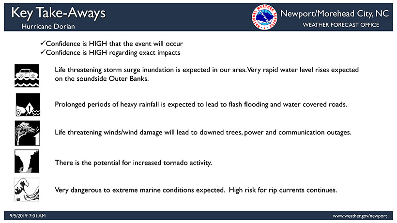
Hurricane Dorian summary, as it pertains to Beaufort County, provided for your immediate benefit here on BCN.
Summary:
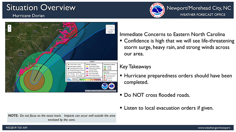
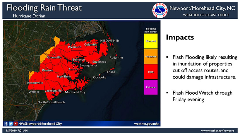
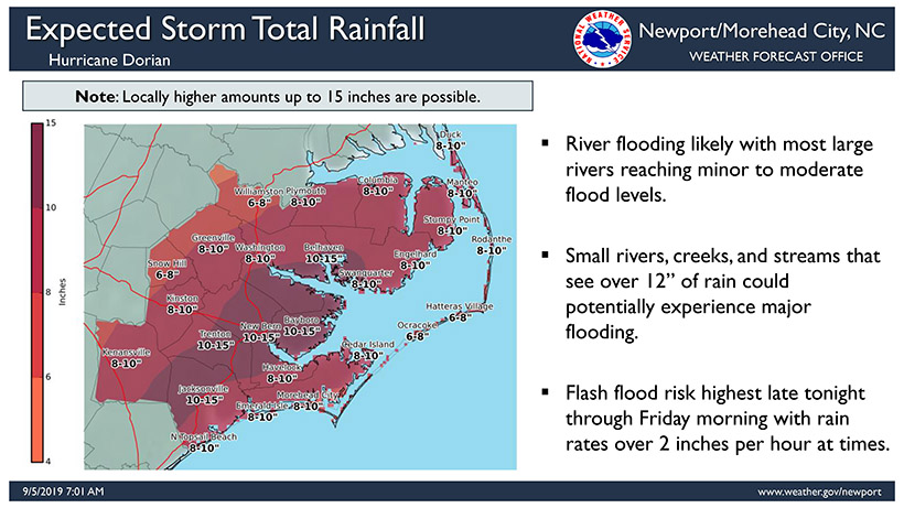
Generally speaking, we are expecting to receive 8" to 15" of rain. Areas east of Washington will mostly see 10"+.
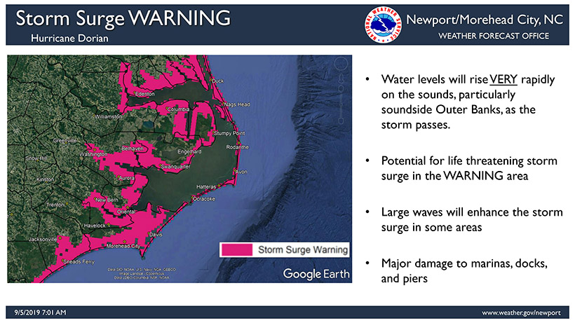
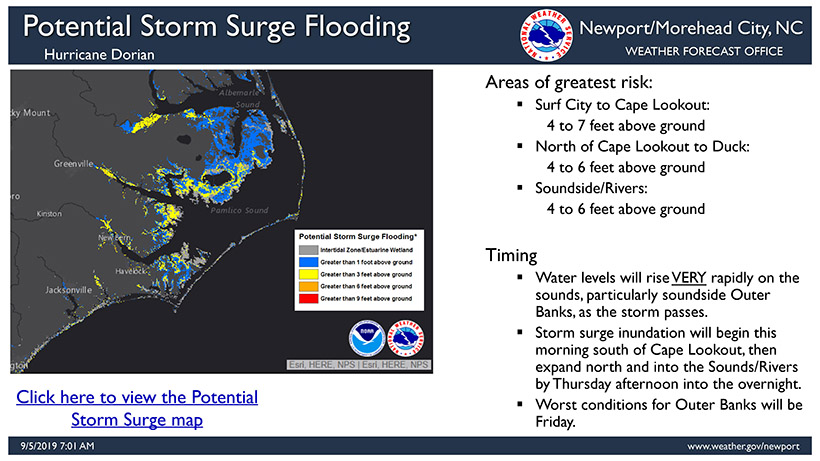
We are expecting 4' to 7' of storm surge along our coastlines. Areas west of Washington, as well as Whichards Beach and Aurora are expected to receive 6'+. This surge could inundate areas quickly as the storm passes to our east.
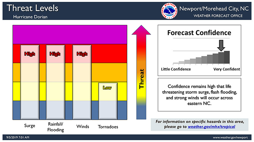
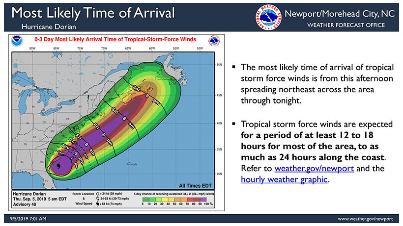
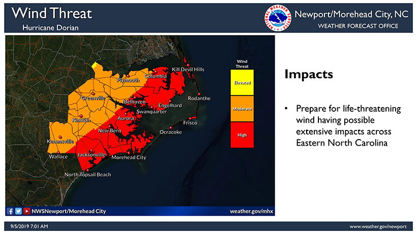
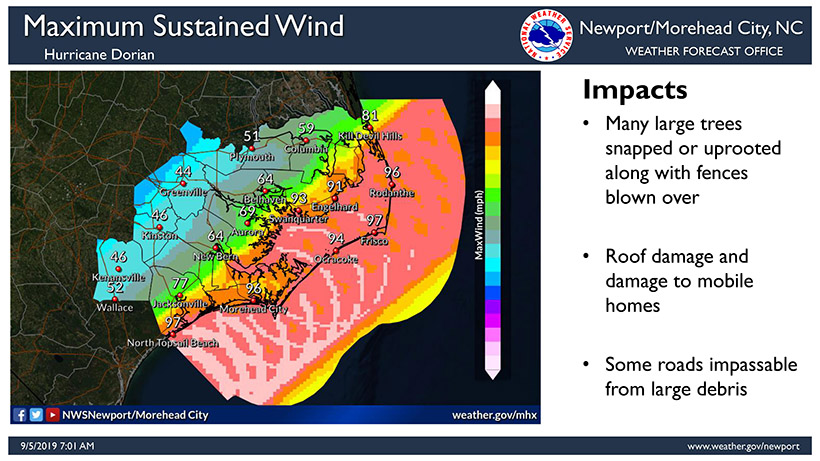
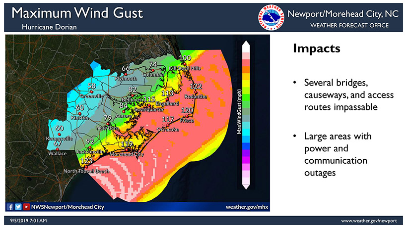
Winds will begin to increase for our area after 3pm, and are expected to be sustained at 40mph+ after 6pm. Our highest winds are expected to occur between 2am and 7am Friday. Most areas are expected to experience sustained wind of 50+ during this time, with gust of 75 mph. Areas east of Bayview and Blount's Creek will most likely experience Hurricane force wind during this same window.