News Release:
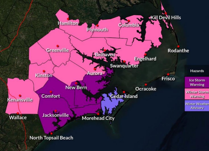 Click the Image above or here to access the Winter Storm Report
Good Morning Everyone,
The latest update from the National Weather Service (NWS) can be found in the email below and attached briefing. Notable changes to the forecast for Beaufort County included:
- A slight shift southeast in the snow / ice line, resulting in changes to the anticipated snow and ice accumulations for areas of Beaufort County.
- Minor time changes for the onset and departure of freezing rain, sleet and snow.
Details of how these changes impacted the forecast for Beaufort County have been highlighted below.
Current Forecast for Beaufort County
Precipitation
The first round of precipitation has now left our area, and the second wave is approaching. This change will continue to present as periods of light or no precipitation for most areas through 3pm today. However, any precipitation that does fall will most likely be sleet with a light mix of snow.
The second round of precipitation is expected to move into our area as sleet around 3pm, and continue through 8pm. A transition to snow is expected after 8pm, and will continue through 5am Saturday. Our heaviest period of snowfall is expected between 8pm and 1am Saturday.
Accumulations
Accumulation totals continue to be one of the more inconsistent items with forecast models so far, and could literally change by the mile. The current forecast suggest the following:
- Ice Accumulations: Generally speaking, the further north and west you are, the less ice you will receive, with areas northwest of Chocowinity Bay, Goose Creek, Terra Ceia and Pantego now out of the area of concern for significant amounts of additional ice. Areas southeast up to Edward, Bonnerton, Durham Creek and Pamlico Beach are forecasted to receive up to 1/10th of an inch of ice, with 1/4 to 1/2 of an inch possible for Aurora, South Creek and Cambell Creek. Again, this ice accumulation is primarily expected early Friday afternoon / evening, and these totals could fluctuate, varying drastically in matter of miles.
- Snow Accumulation: In terms of snow, the further north and west you are, the more snow you are likely to get. Areas north of Washington, Pinetown, Terra Ceia and Pantego could receive 4 to 6 inches of snow. Areas along the Chocowinity, Bunyan, Bath and Belhaven corridor could receive 3 to 4 inches. Areas along the Blounts Creek, Bayview, Sidney and Pamlico Beach communities could receive 2 inches, with areas further east receiving 1 to 2 inches. Again, snow accumulation is primarily expected late Friday night through 5am Saturday.
Winds
Northeast winds will remained sustained between 10 and 15 mph through 2pm on Saturday. Frequent gust between 15 and 20 mph are expected for areas west of Blounts Creek, Bunyan and Pinetown. Areas east of this point are forecasted to receive frequent gusts between 20 and 25 mph.
These winds along with below freezing temperatures will create windchills in the mid-teens, low twenties through sunrise Sunday.
Anticipated Hazards / Things To Prepare For
- Dangerous Road Conditions: We anticipate road conditions will deteriorate quickly Friday morning and remain treacherous through the weekend as temps are expected to remain at or below freezing through 10am Sunday. We encourage everyone to avoid any unnecessary travel during this time.
- Power Outages: While the forecasted ice accumulations have improved for parts of our county, power outages are still possible and expected. Please ensure that you, your family ,friends and neighbors are prepared to withstand cold temperatures and other winter elements in the event of a power outage.
- Cold Temperatures: Again, temperatures are expected to be at or below freezing from midnight Thursday through mid-morning Sunday. Please make the necessary arrangements to provide safety for outdoor pets / livestock, and protect any vulnerable infrastructure such as exposed water lines from freezing. We also encourage everyone to dress appropriately when going outdoors, and use caution when walking on frozen surfaces such as sidewalks, driveways, entry steps, etc.
This will be the last scheduled update for this storm. We encourage everyone to continue to monitor local media outlets for additional updates.
As always, thank you all for what you do to keep Beaufort County informed, prepared and safe. Feel free to contact us if we can help in any way.
Chris Newkirk
Deputy Director, Beaufort County Emergency Services
1420 Highland Dr
Washington, NC 27889
Office:
(252) 940-6511 • Cell:
(252) 378-5352
Good Morning,
Please find the latest weather briefing for the winter storm attached.
There are no significant changes from the last briefing.
Wintry precipitation will be patchy in coverage, especially for northern areas, for a better part of this morning into the early afternoon with minimal impacts expected. Please don't let down your guard. The heavy snow, sleet, and freezing rain is still on the way, and will become widespread later today and especially as we head through the evening hours tonight.
Another briefing will only be issued as needed, or if there are any significant changes. Otherwise, this will be the last briefing.
If you have any questions or concerns, please call us at the office at 252-223-5737 ext. 6
Regards,
NWS Morehead City
NOAA - National Weather Service
Newport/Morehead City, NC Weather Forecast Office
533 Roberts Rd
Newport, NC 28570
Phone: 252-223-5737


