Press Release:
Good Afternoon Everyone,
Today's weather updates have suggested slightly warmer temperatures for our area than was previously forecasted, which is shifting significant snow and freezing rain accumulations further west and north. Forecast changes for Beaufort County have been
underlined below.
Temperatures
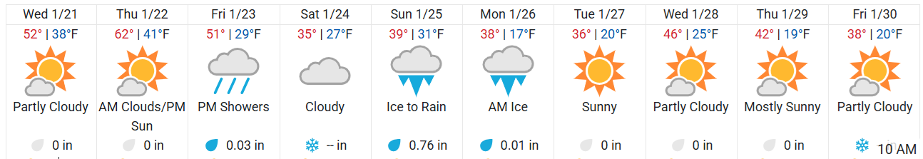
- While forecasted highs for Saturday, Sunday and Monday are several degrees higher than previously forecasted, we are still expected to experience wind chills between 15 and 20 degrees throughout the day on Saturday.
10-day Forecast - Temperature Graphic
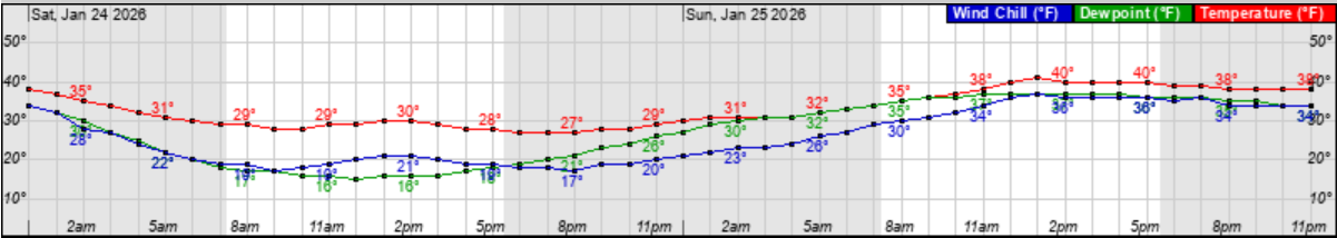
 Hourly wind chill (Blue Line) graphic for Saturday & Sunday
 Precipitation (Snow / Sleet / Freezing Rain)
Friday
Precipitation (Snow / Sleet / Freezing Rain)
Friday
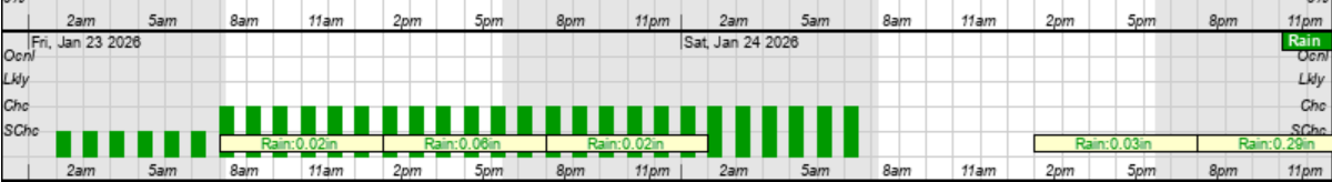
- While Friday's rainfall totals have been lowered slightly, light, scattered showers are still expected to move through our area after sunrise.
Friday Rain Graphic
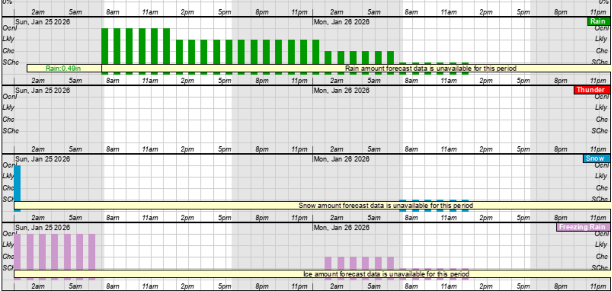
 Saturday
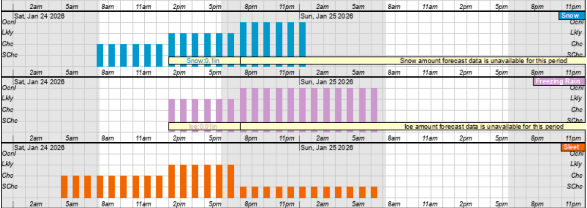
- A combination of snow, freezing rain and sleet are still expected throughout the day on Saturday.
- Our heaviest precipitation is expected to occur between 1 pm Saturday and sunrise Sunday.
Saturday Snow (blue), Freezing Rain (pink) and Sleet (orange) Hourly Graphic
 Sunday
- Sunday is currently forecasted to be primarily a cold rain event, with brief periods of a snow and freezing rain.
Sunday's Rain (green), Snow (blue) and Freezing Rain (pink) Hourly Graphic
 Accumulations
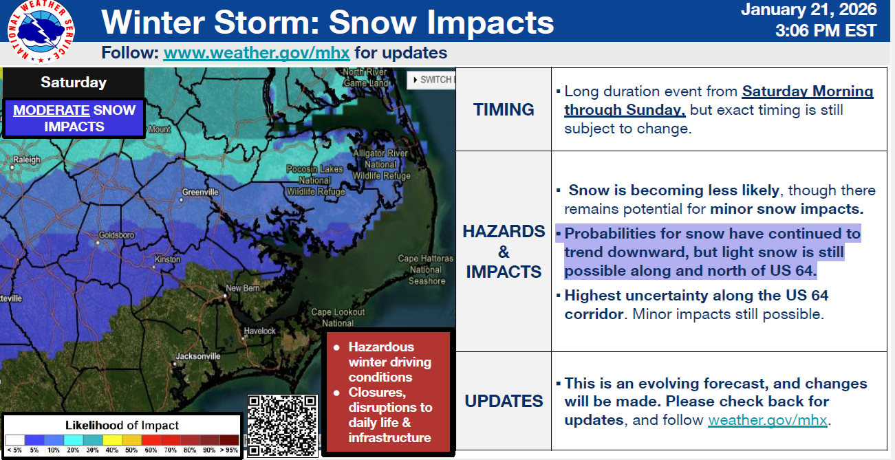
There continues to be a lot of uncertainty regarding the accumulations for snow, freezing rain, or a combination of the two.
Accumulations
There continues to be a lot of uncertainty regarding the accumulations for snow, freezing rain, or a combination of the two.
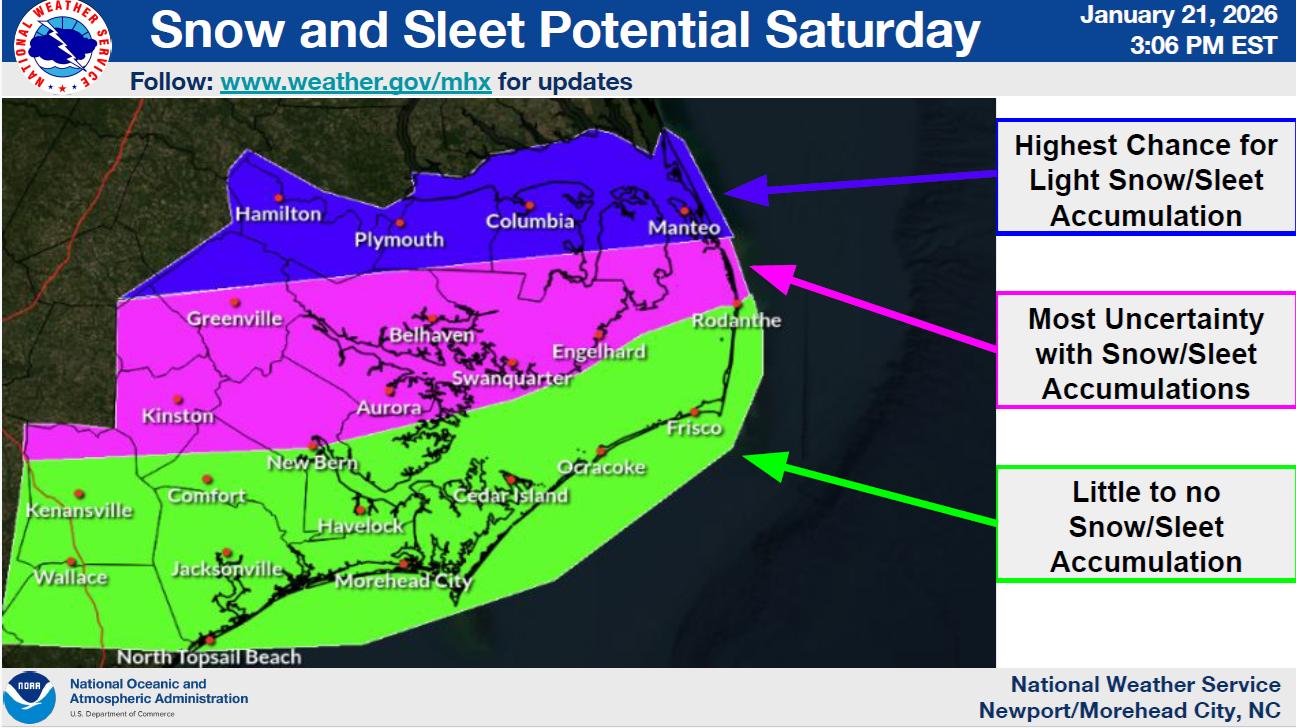 Snow
Snow
- Light snow accumulations remain possible for areas along and north of Hwy 64.
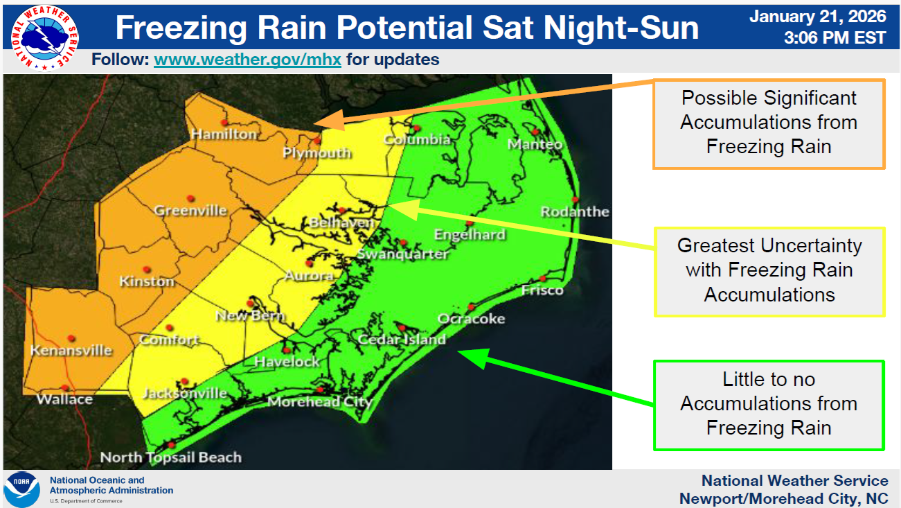
 Freezing Rain (Ice)
- Beaufort County is included within the area of greatest uncertainty for freezing rain accumulations.
While today's updated have indicated improving conditions for those that do not like snow, additional changes are likely as this forecast evolves. We anticipate receiving additional details related to potential accumulations with tomorrow's forecast and encourage everyone to continue to monitor and prepare for this weekend's potential for winter weather.
Please see the email below and attached briefing from the National Weather Service (NWS) for additional information.
As always, thank you all for what you do to keep Beaufort County informed, prepared and safe.
Chris Newkirk
Deputy Director
Beaufort County Emergency Services
1420 Highland Dr
Washington, NC 27889
Office: (252)940-6511
Cell: (252) 378-5352
Good afternoon all,
We have continued to see a warmer trend in the guidance over the last day or so. As a result, snowfall probabilities continue to decrease, though some light snow can't be ruled out primarily north of US 64.
There remains a threat for ice and freezing rain impacts with the greatest threat being across the western Coastal Plain. Greatest uncertainty in freezing rain impacts has now shifted west to the Hwy 17 corridor with little to no freezing rain accumulation currently forecast along the coast.
NWS_Morehead_City_Briefing_5_Weekend_Winter_Storm.pdf
Regards,
NWS Newport/Morehead City
NOAA - National Weather Service
Newport/Morehead City, NC Weather Forecast Office
533 Roberts Rd
Newport, NC 28570


