Press Release:
Good Afternoon Everyone,
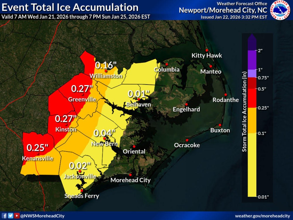
This afternoon's update continues to shift winter weather impacts further west and north, with Beaufort County now forecasted to receive less than 1/8 of an inch of accumulating ice from freezing rain, and little to no measurable snow. Changes from our previous briefing have been
underlined below.
Temperatures
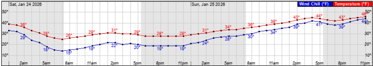
While forecasted highs for Saturday, Sunday and Monday are several degrees higher than previously forecasted, we are still expected to experience wind chills between 15 and 20 degrees throughout the day on Saturday
as we endure sustain North and Northeast winds between 10 and 15 mph, with frequent gust between 15 and 20 mph.
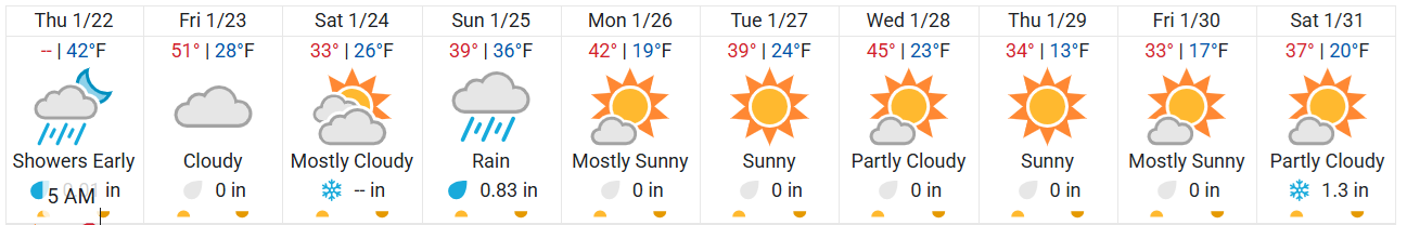
10-day Forecast - Temperature Graphic
 Hourly wind chill (Blue Line) graphic for Saturday & Sunday
 Precipitation (Snow / Sleet / Freezing Rain)
Friday
Precipitation (Snow / Sleet / Freezing Rain)
Friday
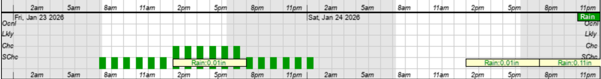
- Friday will be cloudy, with little to no measurable rain.
Friday Rain Graphic
 Saturday & Sunday
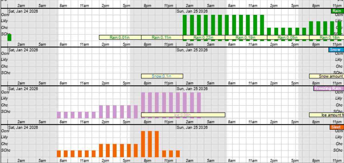
- Precipitation is forecasted to move into our area around 2pm as sleet and freezing rain. This mixture is expected to continue through 2 am Sunday morning, before transition to rain. A cold rain is expected to continue through sunrise Monday morning, with most areas of our county receiving between 1/2 and 3/4 of a inch.
- Our heaviest precipitation is expected to occur between 8 pm Saturday and noon on Sunday.
Saturday & Sunday - Freezing Rain (pink), Sleet (orange) and Rain (green) Hourly Graphic
 Accumulations
Beaufort County is currently forecasted to receive less than 1/8 of an inch of accumulating ice, with areas along and west of Hwy 17 being most vulnerable to these higher accumulations.
Accumulations
Beaufort County is currently forecasted to receive less than 1/8 of an inch of accumulating ice, with areas along and west of Hwy 17 being most vulnerable to these higher accumulations.
As always, thank you all for what you do to keep Beaufort County informed, prepared and safe.
Chris Newkirk
Deputy Director
Beaufort County Emergency Services
1420 Highland Dr
Washington, NC 27889
Office: (252)940-6511
Cell: (252) 378-5352


