News Release:
Good Afternoon Everyone,
Please see the email below and
attached briefing for this morning's update from the NWS.
Our office continues to monitor the progression of Tropical Storm Isaias. This afternoon’s forecast indicates the following for Beaufort County.
- Winds
- A general southernly wind between 5 and 10mph is expected through the day on Monday. Winds are expected to increase around 2am Tuesday morning, and remain sustained at 40 – 50 mph through 8am Tuesday morning. Gust of 50 – 70 mph are possible during this time. Winds should diminish drastically between 10am and noon Tuesday, and become sustained at 5 – 10 (SSW) for the remainder of the day.
- Rain
- Rain will begin to move into our area around 8am tomorrow morning, and continue through 3pm Tuesday. Our heaviest rains are expected Monday afternoon and Tuesday morning as the center of Isaias tracks across eastern NC. Areas west of Bath and Blounts Creek are forecasted to receive 2” – 3” of rain during this time, with areas east receiving 1” – 1 ½”. Showers could be heavy at times, with local amounts exceeding these totals as bands move through our area.
- Storm Surge
- Isaias is forecasted to produce minimal surge along our waterways, with most areas receiving 1’ above ground levels. However, areas susceptible to southern winds could see as much as 3’ before Isaias exits our area Tuesday morning.
The biggest threat that Isaias poses to our area will be the possibility of tornados. This threat will be present from Monday morning through noon Tuesday. Please ensure that you, your families, friends and neighbors have a way of receiving notifications fot the outbreak of these tornados and / or severe thunderstorms. This will be especially important during the overnight hours. Notifications can be received through weather radios, or by using various phone apps. (ie. Tornado - American Red Cross, local media outlets, etc.) Please help us spread this spread this message by ensuring that everyone in your communities have a way to receive notifications regarding tornado / severe thunderstorm warnings.
Please see the email below and attached briefing from the NWS for additional details pertaining to Tropical Storm Isaias.
As always, thank you all for what you do to keep Beaufort County prepared and safe.
As always,
Chris Newkirk
Deputy Director, Beaufort County Emergency Services
1420 Highland Dr
Washington, NC 27889
Office:
(252) 940-6511 • Cell:
(252) 378-5352
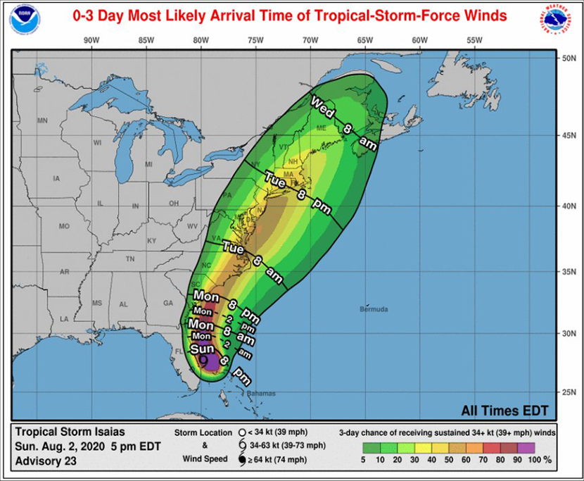
Click the image, which will expand when clicked, to reach the updated information, in PDF form, to access the progress of Hurricane Isaias: Below.
All,
Confidence has increased for the storm track, timing and intensity of Isaias. As a result this briefing has a lot more details. Although the storm intensity is not expected to be as strong over our area as previously thought, PLEASE help us continue to message both the risk for Rip Currents AND Tornadoes. The tornado threat may occur when people are asleep so everybody should have multiple ways to receive warnings.
Don't forget we will be doing daily webinars through Monday at 830 AM and 630 PM. We will continue to try to post these to our YouTube Channel afterwards.
To register for ALL of the webinars, please use this link: https://attendee.gotowebinar.com/register/6387513154615601168
We will be using the audio through the computer for these webinars. This has greatly helped us in our ability to keep the audio lines muted and controlled. To ask a question at the end you can either ask the question through the webinar panel or if you have a microphone, you can raise your hand and we will unmute your mic and call on you. If you have any questions you can always call the office at 252 223 5737 EXT 6.
NOAA - National Weather Service
Newport/Morehead City, NC Weather Forecast Office
533 Roberts Rd
Newport, NC 28570