Across North Carolina: Volume VIII | Eastern NC Now
This is the seventh of a new series of images from across North Carolina from my travels, and from the long intervals that I have spent with my camera making a record of where I have been.
Where do you stand on the Transgender Issue now that the issue has gotten to the overt point of the open celebration of this lifestyle choice, dictated by certain direct and explicit actions.
91.07% I do not approve of behavior that has within its expressed tenants policies that harm children.
8.04% I do support the Trans Community in all its many facets because diversity is at a premium in today's society.
0.89% What is a "Children's Drag Queen Story Hour?"
Publisher's note: Please be aware that we have created a new fixture at the foot of this post, describing the location of some of North Carolina's most memorable scenic points of interest, is our interactive map that we developed to do exactly what we want it to do ... for now.
Why am I going back and installing these interactive maps? Simply, folks like to use them because our newer posts are getting more views faster than the older posts did. Providing yet another 'leading edge' product that works is a good enough reason for me.
This is the eighth of a new series of images from across North Carolina from my travels, and from the long intervals that I have spent with my camera making a record of where I have been. Upon examination of these random images, I concluded that best format would be the one page arrangement, where I cut the images to 1280 pixels wide, arrayed in a wide viewed 'fancybox' series, where there is a title of explanation, and maybe a bit more, but mainly, the photo should speak rather than my words. In fact, I plan to put my words on hold for a bit here, which will be to the fine relief of a great many.
Each series will be random and varied; however, most will center from here in eastern North Carolina, which is closer to my home in northeastern North Carolina, in the county of Beaufort, and the county seat of Washington, my home. From this perspective, we will reach out beyond the myriad waters: fresh and calm, brackish and moving, salty with powerful waves, and get to see North Carolina, where we may know it a little better, if only through images.
This random display of images of North Carolina, made by the Tar Heel traveler, may have been revealed earlier in BCN, and when I can remember a relative series, I shall link to it; however know that this series of ongoing themes will remain that there is no theme. In this random projection of unrelated images, the series will seek its relevance, its beauty and its strength of purpose.
The Eighth Pictorial Trek from Here to There and Back Again
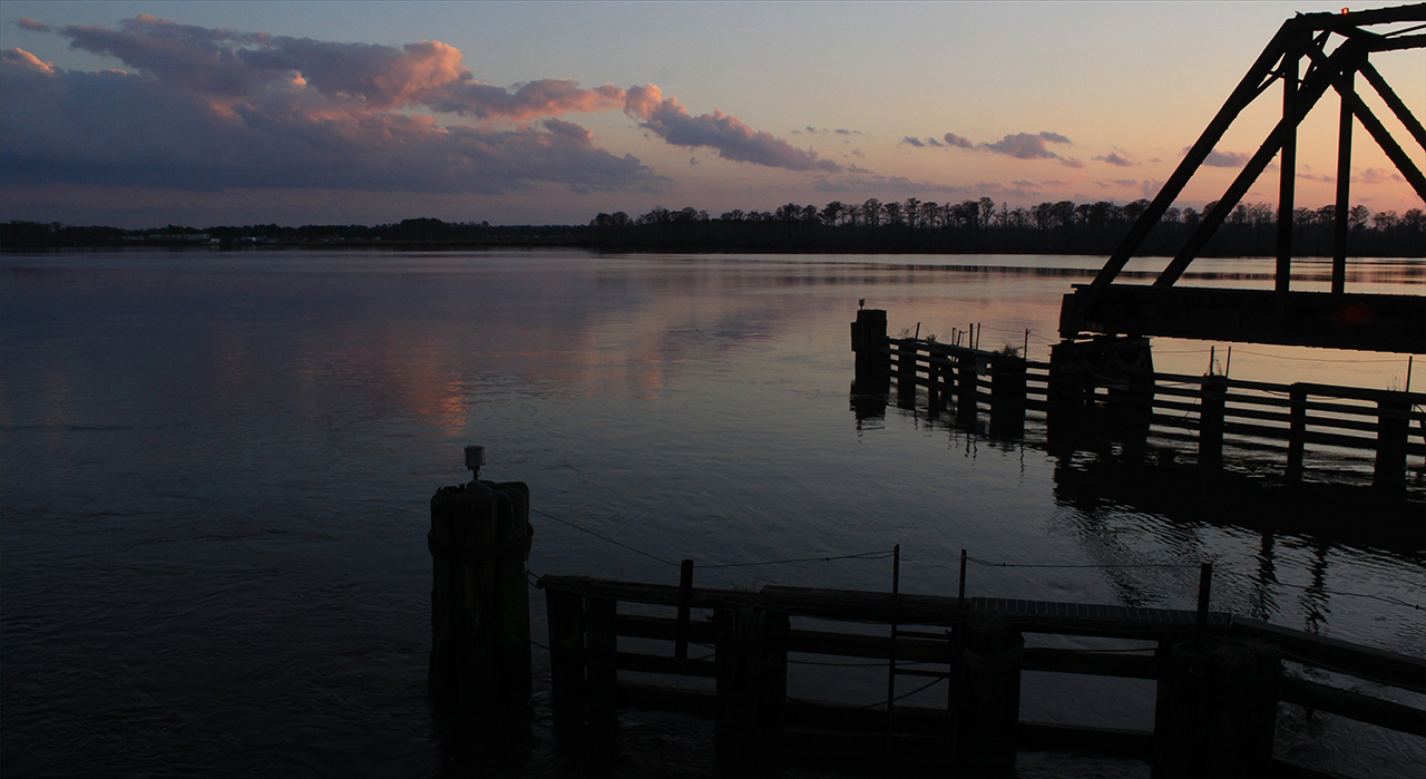
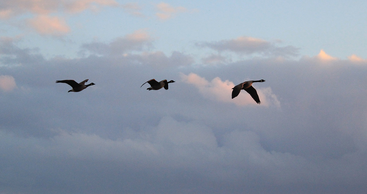
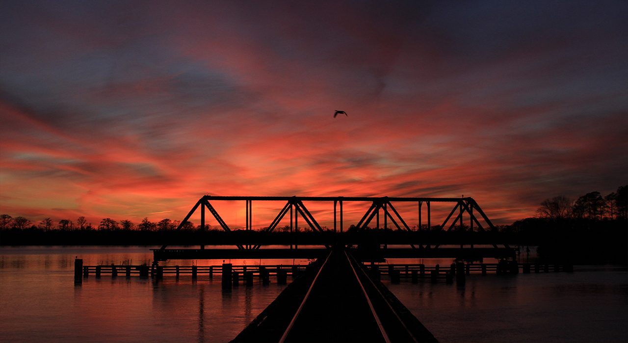
We begin in Beaufort County, where the trestle that spans the Pamlico River often provides an interesting muse: Above. Especially when the geese are flying over in winter at sunset: Below.photos by Stan DeatherageClick images to expand.
And further south, way south where the Cape Fear River ends as well as the Onslow Bay, North Carolina is just one county away from South Carolina.
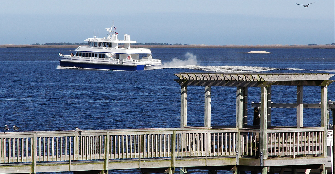
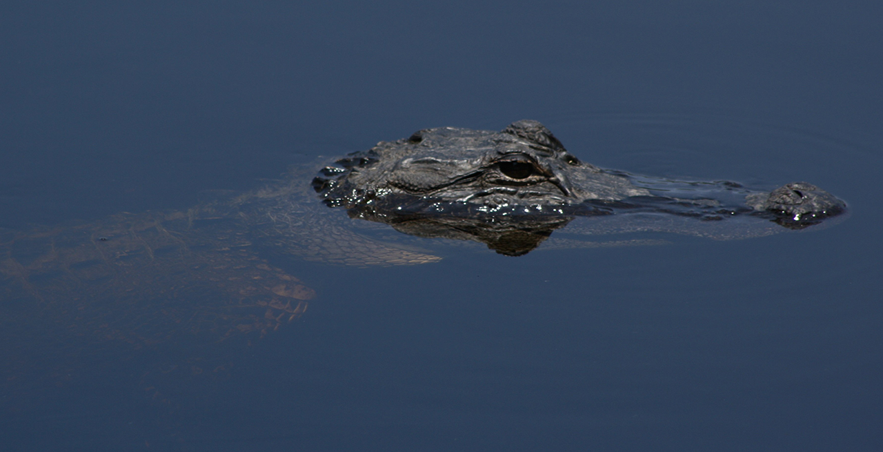
At Southport, where the lower Cape Fear River meets the Atlantic Ocean, we see the Bald Head Island foot ferry heading back to port: Above. At Orton Pond in Brunswick County, the Alligator resides far atop of the food chain: Below.photos by Stan DeatherageClick images to expand.
Leaving Brunswick in the east, we head far west to the farthest southern foothills and the beginning of the steep Blue Ridge Mountains.
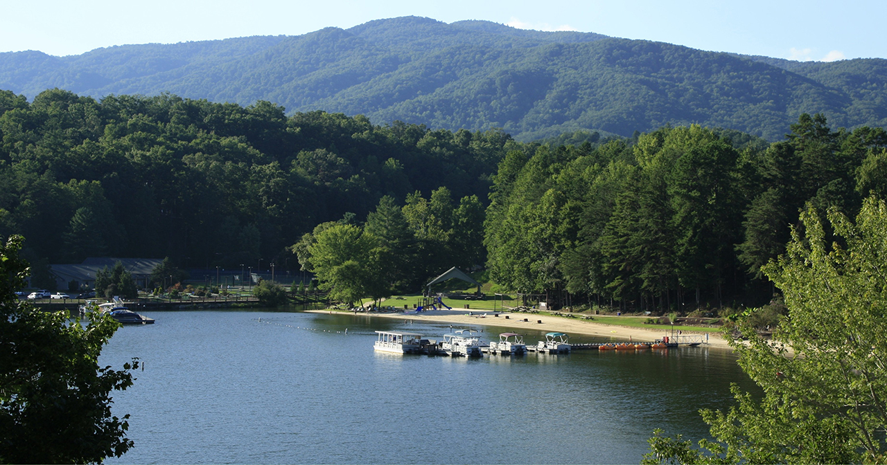
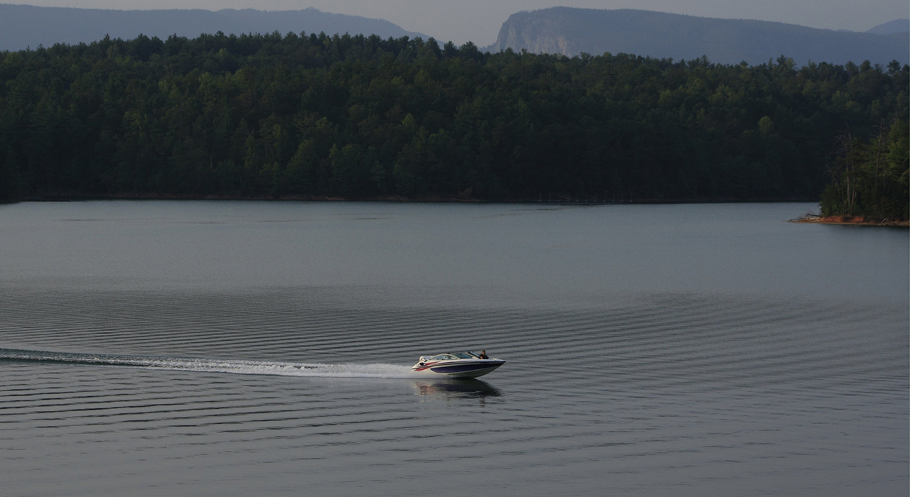
Lake Lure, in Rutherford County, is at the bottom of the Appalachian foothills, just as they begin to grow, like Chimney Rock, just a few miles southwest of this mountain in the background: Above. And further north, also in the foothills, where Lake James provides a fine bit of recreational boating in Burke County. In the distance, the most southeastern cliffs of Linville Gorge can be seen above the tree line: Below. photos by Stan DeatherageClick images to expand.
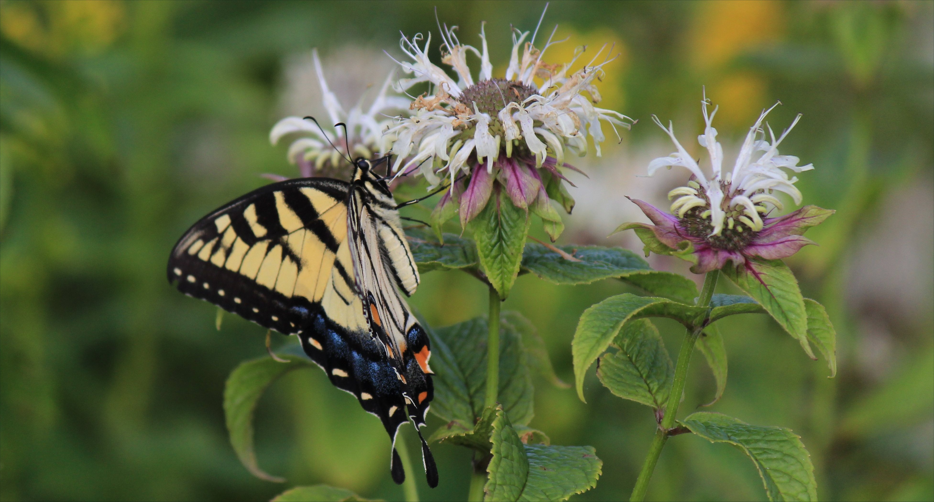
Along the Blue Ridge Parkway, there are small things in large places, and none are larger geologically than the mountains northeast of Asheville, North Carolina.
A butterfly finding nectar: Above. The bold peaks of the Black Mountains that stand shoulder to shoulder with Mount Mitchell: Below.photos by Stan DeatherageClick images to expand.
The zig zag from west to east and back again is much easier to accomplish in the scheduling of images than as an occupant in a vehicle on North Carolina's east to west roads.
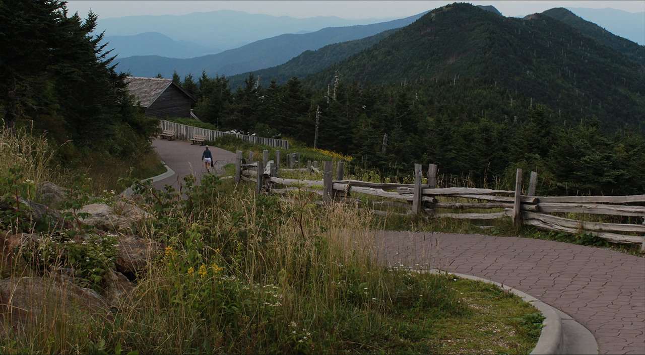
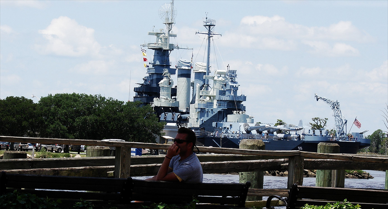
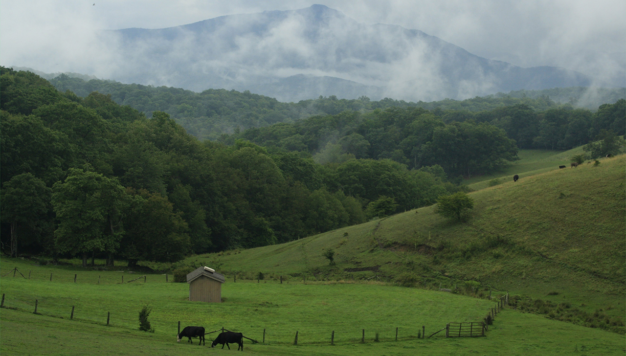
Here, along the eastern banks of the Cape Fear River in Wilmington, we see the USS North Carolina docked for perpetuity as a standing monument to our great navy in World War II: Above. An then back far west in Watauga County, at the Moses Cone Memorial, where Grandfather mountain is shrouded by clouds: Below. photos by Stan DeatherageClick images to expand.
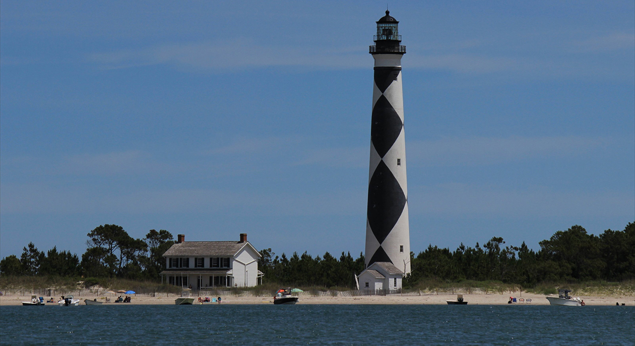
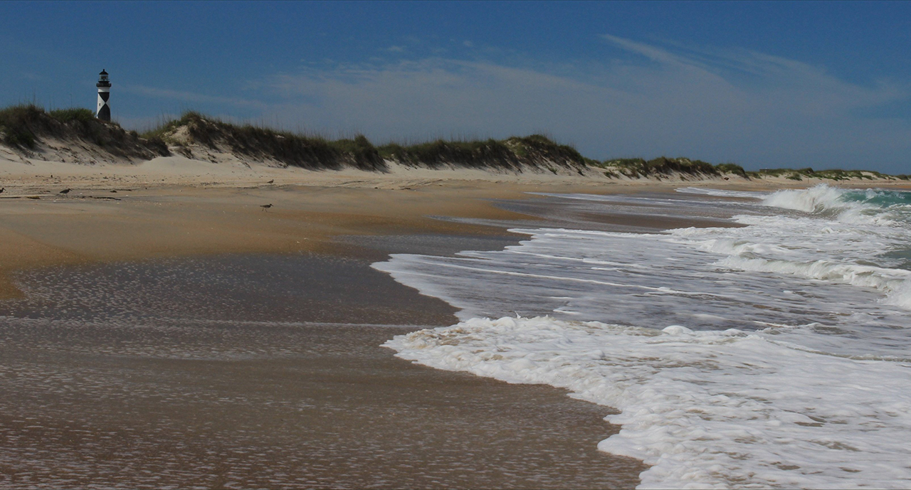
Way back east, about as far east as one can go in North Carolina is Core Banks along North Carolina's southern Outer Banks.
The iconic Cape Lookout Light Station stands tall about the Back Sound: Above. And then the iconic lighthouse again from the breaking surf of the Atlantic Ocean: Below.photos by Stan DeatherageClick images to expand.
And then back home ...
Where I always finish with a sunset image over the Pamlico River in Washington, NC: Above. photo by Stan DeatherageClick image to expand.
We'll do another one of these as the time becomes ready and appropriate. At your leisure, please follow this link to the growing list of this pictorial series - "Across North Carolina".
Below is our new interactive map that will show where all the pictures were made, and if you wish, you can get the distances and directions to these vistas. Also, you can interact with the map by placing your address in the "Enter an Address or Place & Click Find" field, and then click find to get best directions and mileage between your address and the chosen subject site. More features to follow.
Where I am right now is about 28 feet above sea level, and this is considered high ground here Downeast. Plenty of snakes, which I don't mind. They have a purpose.
I love the mountains; not as much as the coast, but I do love the higher ground, and the better air of summer.
Photography takes us above the Snake Line. I heard Snake Line in a sermon. It is the height on a mountain that becomes too cold and the air too thin for snakes. I use it to mean where angry people seldom go.
I'm working on another group of pictures recently taken to infuse into this series. This stuff takes a lot of time, but they should have a good 'shelf life'.