Press Release:
Good Afternoon Everyone,
Our office is monitoring the likelihood of severe weather across Eastern NC for tomorrow. Forecast details for Beaufort County include:
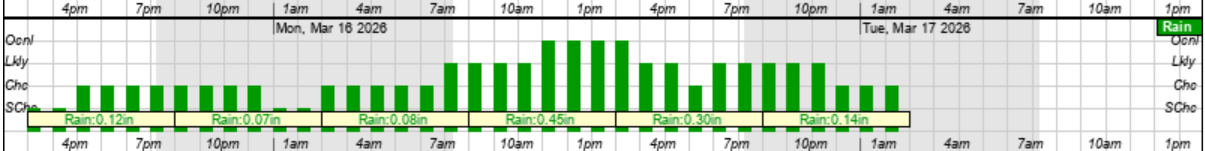
Rain
- Rain chance will increase after sunrise and continue through midnight, with most areas receiving about an inch of rain.
- Our heaviest rains are expected between 11am and 7pm.
Monday's Rain Graphic
 Winds
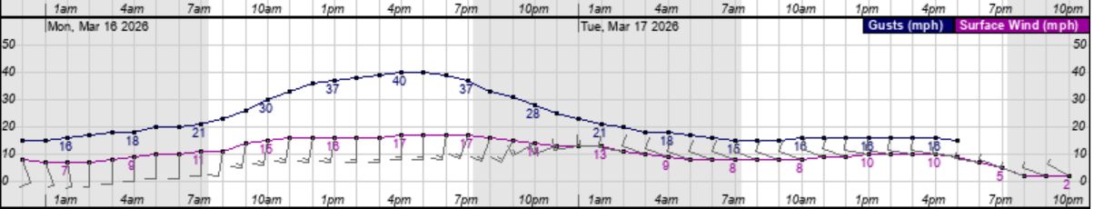
Winds
- South winds of 15 to 20 mph are expected between 10am and 10pm tomorrow, with frequent gust of 40 to 45 mph likely.
Monday's Wind Graphic
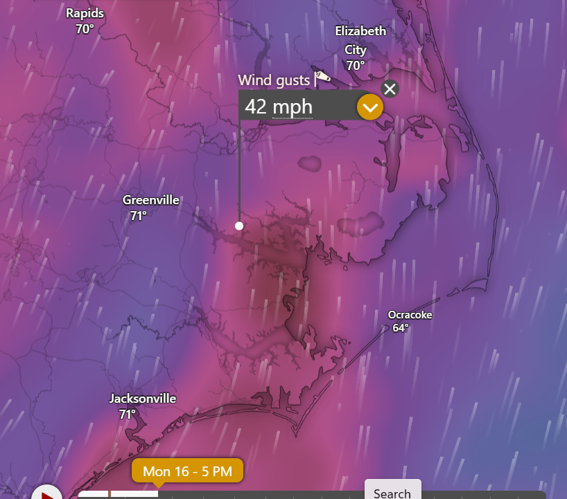
 Monday's 5pm Wind Graphic
 Severe Storm / Isolated Tornado(s)
- While thunderstorms are possible throughout the day, forecast models are suggesting that this threat will likely come in 2 different waves as follows.
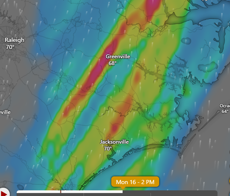
- Around 2pm
- Isolated strong to severe storms will likely begin to "pop-up" across Eastern NC around 2pm tomorrow. The possibility of isolated tornados is the primary concern for these storms, as they will have the potential to intensify quickly, and may, in some cases, offer very little time for advanced warnings.
2pm Thunderstorm Forecast Graphic
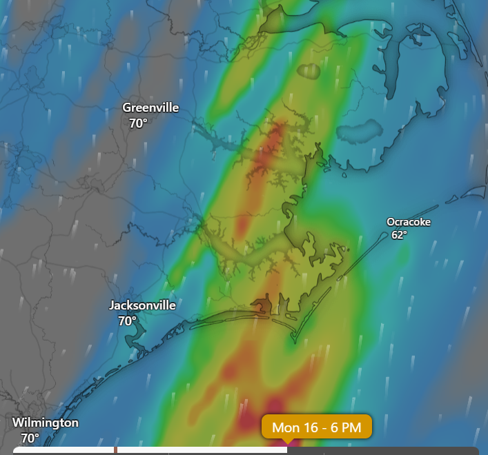
- 5pm - 8pm
- These storms will accompany the primary frontal system and will likely appear on the radar as the traditional line of storms stretching north to south along our state. This line will likely move through our area (west to east) after 5pm, with the primary threat of high wind gusts. (In some cases, exceeding 70 mph)
6pm Thunderstorm Forecast Graphic
Please see the email below and attached briefing from the National Weather Service for additional information. We will continue to pass along updates as we received them.
As always, thank you all for what you do to keep Beaufort County informed, prepared, and safe.
Chris Newkirk
Deputy Director
Beaufort County Emergency Services
1420 Highland Dr
Washington, NC 27889
Office: (252)940-6511
Cell: (252) 378-5352
Good morning partners,
The threat for severe thunderstorms continues to increase for Monday, March 16. This has the potential to be a significant severe weather event. In addition to tomorrow, there is a marginal risk of severe thunderstorms today and tonight. Attached is the latest briefing for this event.
Key Messages
- There is an Enhanced to Moderate (Level 3/4 of 5) risk of severe thunderstorms tomorrow, with the risk increasing to the west.
- All hazards are expected tomorrow, but damaging winds and tornadoes will be the most prominent. Gusts in excess of 70+ mph, and a few strong tornadoes (EF2+) are possible.
- Threat timing will be focused on tomorrow afternoon and evening. The tornado threat will be highest at the beginning of the event, with the wind risk peaking later in the day.
- There is a Marginal (Level 1 of 5) risk of a few isolated severe thunderstorms tonight and tonight with all hazards possible.
If you have questions or concerns, please let us know.
LatestBriefing_1_.pdf
Regards,
NWS Newport/Morehead City
NOAA - National Weather Service
Newport/Morehead City, NC Weather Forecast Office
533 Roberts Rd
Newport, NC 28570


