This is a continued series of posts explaining in detail the known whereabouts of Hurricane Florence, its presumed direction, and an accounting of its probable impact. This is the last post of this series since NOAA (National Oceanic and Atmospheric Administration) has ended its tracking of this devastating story that has so far claimed 17 lives, mostly in North Carolina.
Hurricane Florence made landfall between Wrightsville Beach and Carolina Beach as a Category 1 hurricane, in the Cape Fear region of North Carolina, and plowed through Brunswick County, NC and then into Horry County, SC, eventually downgraded to a strong tropical Storm. The initial landfall was about 4 miles south of where the storm was initially projected to hit, shown in this first report on Hurricane Florence on BCN.
Hurricane Florence once a devastating Category 4 storm, and a Category 2 storm as it raked much of the coast of entire eastern North Carolina just a few hours earlier is now a tropical storm making its way through northeastern to central South Carolina. Florence, now a weakening tropical storm, is projected to head west at 5 to 8 miles per hour, and then north up through the southern Blue Ridge Mountains and Smoky Mountains. The long true path of this well discussed storm, somewhat of a meteorological history, can be found as
posts archived here for current and future reference.
Please use these resources: 1)
Current updates from NOAA (National Oceanic and Atmospheric Administration); 2)
current digital map and projected path of storm(s) - in addition to the mapped information below to know Hurricane Florence's most current course, it's possible impact, and to plan for what become a life changing event - a powerful Atlantic Ocean hurricane.
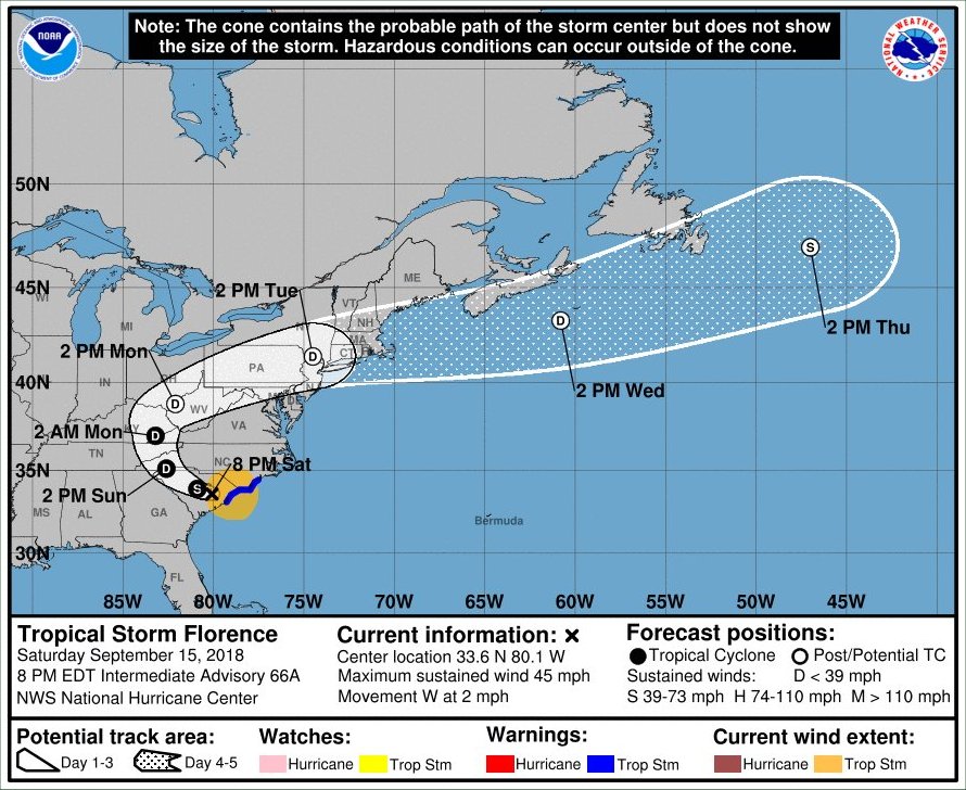
Below: This map of Tropical Storm Florence suggests the direction, as of Saturday, 091518 at 9:00 pm.
 Below: This map of Hurricane Florence suggests the direction, and estimated time of the arrival of the tropical storm force winds within the impacted area, as of Sunday, 091618 at 5:00 am.


