Publisher's note: We believe the subject of history makes people (i.e., American people) smarter, so in our quest to educate others, we will provide excerpts from the North Carolina History Project, an online publication of the John Locke Foundation. This seventeenth installment, by Jonathan Martin, is provided courtesy of the North Carolina History Project.
The Outer Banks are a series of barrier islands that stretch nearly 200 miles along the North Carolina coast. Beginning at the Virginia border, the Outer Banks pass through Currituck, Hyde, Dare, and Carteret counties. The large Albemarle Sound and Pamlico Sound separate the outer islands - Bodie, Roanoke, Hatteras, and Ocracoke - from mainland North Carolina.
The Outer Banks islands are named after the original inhabitants; Kinnakeet, Chicamacomico, Ocracoke, Hatteras, Manteo are five examples. Most Native Americans befriended the incoming settlers during the 1500s, and the Croatan Manteo even helped colonists settle the Roanoke area. By the 17th century, most tribes, however, had disappeared from the Outer Banks; continual fighting with settlers and disease decimated the coastal Native American population.
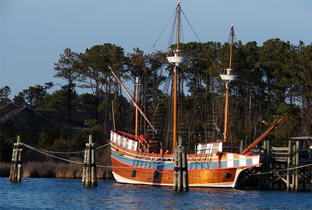
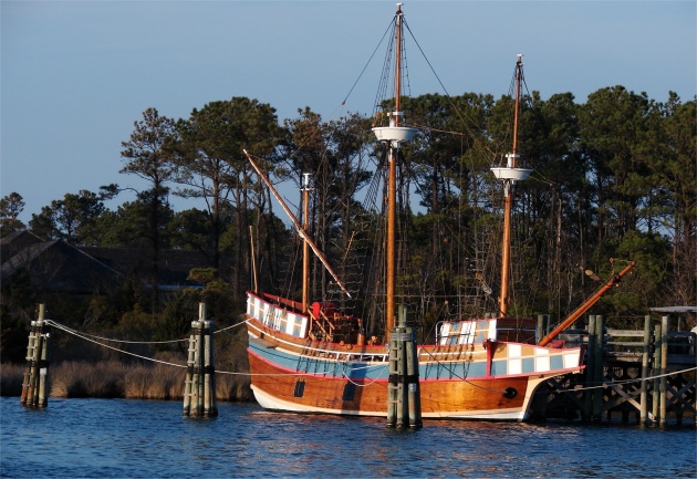 The Queen Elizabeth replica has a permanent mooring across from the Lighthouse and the village of Manteo: Above. photo by Stan Deatherage Click the picture to expand to as much as 1000 pixels wide within most expanded images, and then push the arrows embedded in the center edge of the play-box to access the gallery, and slide new images into viewing within the center of the screen.
John White and 116 English colonists were the first English to settle the Outer Banks. On June 22, 1587, the colonists touched down on Hatteras Island, but later considered the dry area unsuitable to establish a colony. Instead of sailing back to England, the settlers sailed the Pamlico Sound searching for a more hospitable place. They settled at Roanoke Island. John White meanwhile sailed back to England to gather supplies, but the Anglo-Spanish War prevented a timely return. Three years later, a supply team returned to Roanoke to learn that the settlement had vanished. Thus, the mystery of the "Lost Colony" began and remains unsolved to this day.
English settlers exhibited little enthusiasm for the Outer Banks after the failure of the Lost Colony, and for a century, Europeans avoided the islands. The inlets and coves, combined with the outlying islands' remoteness, attracted pirates and smugglers, however. Throughout the late 1600s and early 1700s, pirates used the Outer Banks as a central base of operations. They intercepted Spanish and British ships carrying gold, silver, and other New World riches, and they used the barrier islands as cover and to store plunder. One of the most famous and feared pirates was Blackbeard (Edward Teach) who made Ocracoke his home. When the British Royal Navy finally captured Blackbeard, it thereby ended the Golden Age of Pirates in the Outer Banks.
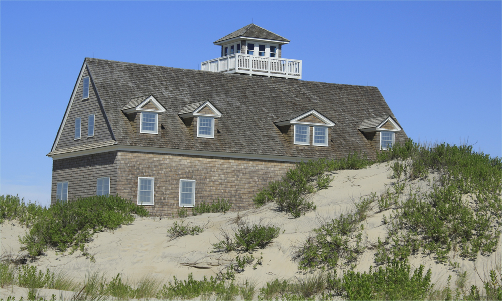
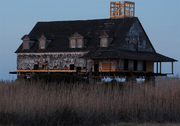 The Oregon inlet Lifesaving Station saved from being buried in a hill of sand, raised, moved and then reconstructed for future generations to know where brave men lived, and saved lives more than a century ago: Above and then below. photos by Stan Deatherage Click the picture to expand to as much as 1000 pixels wide within most expanded images, and then push the arrows embedded in the center edge of the play-box to access the gallery, and slide new images into viewing within the center of the screen.

As piracy dissipated, more settlers moved to the Outer Banks. Although still isolated from the rest of North Carolina, the local "Bankers" lived simple lifestyles that centered on salvaging shipwrecks, fishing the inlets and ocean, and steering ships through the seaways of the Outer Banks. Also, as more shipwrecks continued along the coast, the state constructed several lighthouses and lifesaving stations on the islands in the late 18th century. Today, the lighthouses at Cape Hatteras, Bodie Island, and Ocracoke remain an integral part to the Outer Bank landscape and culture.
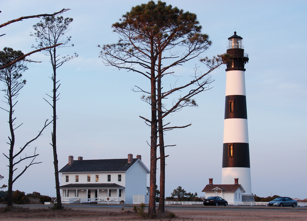
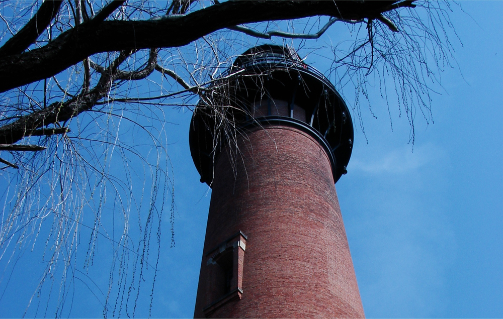
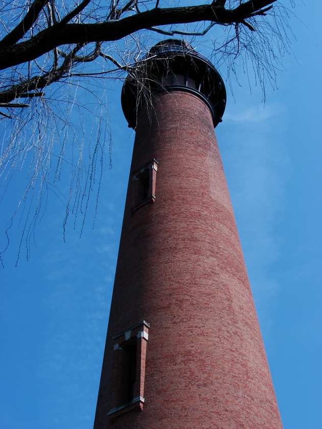
 From the Bodie Island light station to the the fare norther reaches of the outer Banks in Corolla, where the Currituck lighthouse stands tall, sailors and ships were saved by these beacons that positioned coordinates: Above and then below (relative). photos by Stan Deatherage Click the picture to expand to as much as 1000 pixels wide within most expanded images, and then push the arrows embedded in the center edge of the play-box to access the gallery, and slide new images into viewing within the center of the screen.
By the late 19th century the Outer Banks underwent several changes. For one, the same islands and inlets that were used as forts by the Union in the Civil War became summer retreats for northerners and southerners. Hunters and fishermen targeted the Outer Banks as recreational destinations. Two, the link between the Albemarle and Chesapeake Canal was finally finished in 1859 and connected the Outer Banks to the economies of the north. The barrier islands started to shift away from subsistence fishing to more commercialized forms.
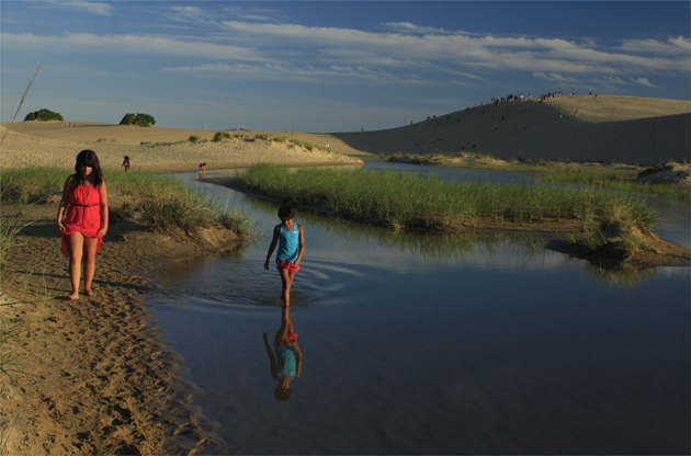 In between these two inspiring masonry edifices, the lighthouses, is the remarkable geographical oddity Jockey's Ridge: Above. photo by Stan Deatherage Click the picture to expand to as much as 1000 pixels wide within most expanded images, and then push the arrows embedded in the center edge of the play-box to access the gallery, and slide new images into viewing within the center of the screen.
With the advent of the airplane and some of the first successful radio transmissions, the Outer Banks grew in American popularity. From 1901 to 1902, Reginald A. Fessenden successfully played wireless messages from Roanoke Island to Cape Hatteras and Cape Henry, Virginia. In 1903, Wilbur and Orville Wright flew the first heavier-than-air plane for 12 seconds at Kitty Hawk. Both of these inventions changed transportation and radio transmissions forever.
For most of its history, the Outer Banks has been separated from the rest of North Carolina. The constant shift in the area's topography due to the weather and rough waves of the Atlantic prevented settlers from populating the outlying islands. However, the New Deal highway provisions and the creation of the Herbert Bonner Bridge in the 1960s led to drastic transportation improvements. Today, there are two bridges that connect the Outer Banks to North Carolina and a ferry system that links Ocracoke Island to the mainland.
Sources:
Jim Kerr, "North Carolina's Outer Banks" Travel America Jul/Aug2000, Vol. 16, Issue 1. EBSCOhost search engine, (accessed July 5, 2011).William S. Powell, ed. Encyclopedia of North Carolina (Chapel Hill, NC 2006); "Outer Banks History." Outer Beaches Reality, Hatteras Island, NC, website. http://www.outerbeaches.com/OuterBanks/AllAboutOBX/History/. (accessed July 5. 2011).